25th Annual Black Diamond Fall Fundraising Party
Thursday, September 13; 6:00-10:00 PM; Black Diamond Parking Lot
25th Annual Black Diamond Fall Fundraising Party
Thursday, September 13; 6:00-10:00 PM; Black Diamond Parking Lot
| Advisory: Uintas Area Mountains | Issued by Craig Gordon for Wednesday - December 14, 2016 - 3:41am |
|---|

|
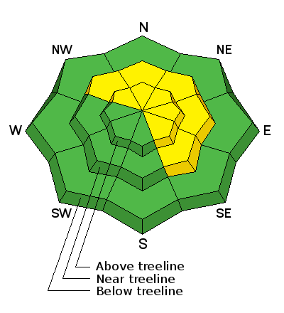
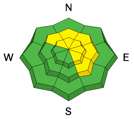
bottom line At upper elevations, especially above treeline in the wind zone, the avalanche danger is MODERATE today. Human triggered avalanches are possible on steep, wind drifted slopes facing the north half of the compass and particularly in terrain with an easterly component to its aspect. Any slide triggered has the potential to be deep and dangerous. Low angle, wind sheltered slopes with nothing steep above or adjacent to where you're riding and most terrain facing the south half of the compass offers LOW avalanche danger.
|
 |
special announcement
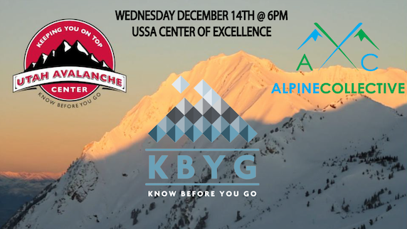
In partnership with The Alpine Collective, I'll be giving a Park City specific avalanche awareness and current state of our snowpack presentation tonight at 6:00 PM. This FREE Avalanche Awareness Event for ages 12 and older is at the USSA Center of Excellence located on 1 Victory Dr. Park City, Utah 84060. More details are found here. |
 |
current conditions Under mostly cloudy skies temperatures are in the teens and low 20's. West and southwest winds reached their crescendo yesterday right around dinner time with gusts in the 50's, but have since mellowed somewhat and are currently blowing 20-30 mph along the high ridges. No new snow overnight, but an active storm track delivered several feet of snow last week and average settled snow depths are right around 36". Real time wind, snow, and temperatures for the Uinta's are found here. Recent observations are found here.
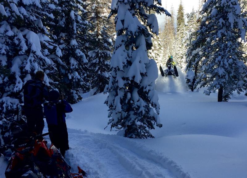
Recent winds have worked a lot of upper elevation terrain, but wind sheltered slopes still offer soft, settled snow. UAC Director Mark Staples was out with the pro athletes from the Boondockers crew Sunday and had a blast on low angle slopes. |
 |
recent activity No new avalanches reported from yesterday, but it's been super active during and after last weeks big storm. A full list of recent avalanche activity is found here. |
| type | aspect/elevation | characteristics |
|---|

|
|
LIKELIHOOD
 LIKELY
UNLIKELY
SIZE
 LARGE
SMALL
TREND
 INCREASING DANGER
SAME
DECREASING DANGER
|
|
description
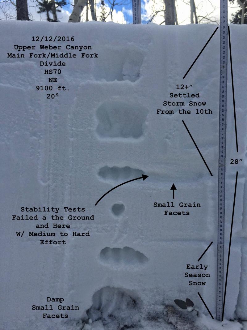
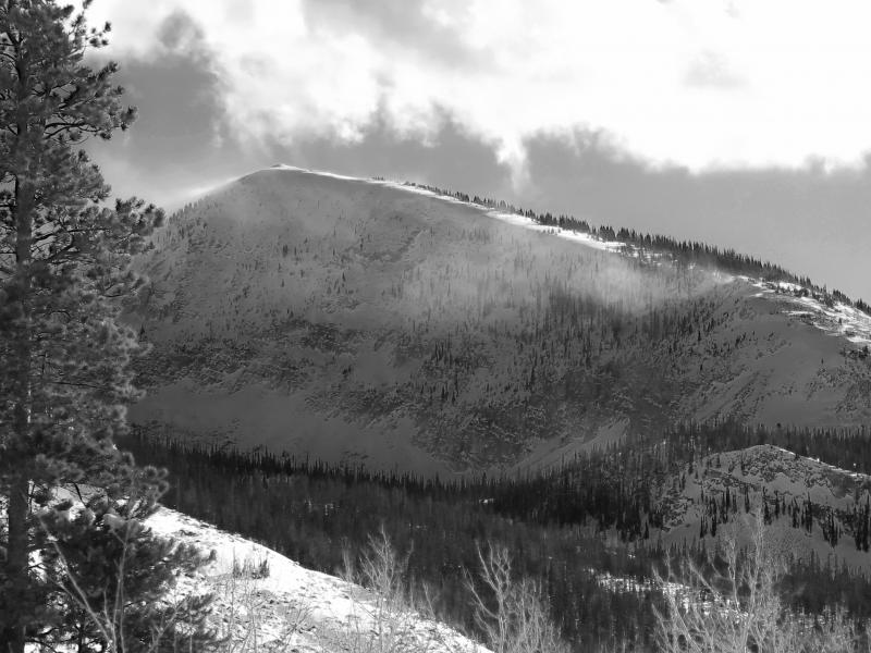
I think the snowpack is adjusting to last weeks big storm and it's getting comfortable in its own skin. While the chances of triggering a deep, dangerous avalanche diminish, the aftermath remains quite severe. Found mostly on steep, rocky, mid and upper elevation slopes facing the north half of the compass, todays slabs may be harder to trigger, but they'll break deeper and wider than you might expect. And remember- any slide triggered that breaks into older snow near the ground, will take you for a body bruising ride through stumps, rocks, or deadfall, instantly ruining your day. Let slope angle be your friend. There's lots of great low angle riding out there and you can have a blast boondocking in trees and still find deep, floaty snow.
You can clearly see distinct layering in our pack. Last weeks big storm nearly doubled our snowpack and in some terrain, it's still adjusting. (JG photo) |
| type | aspect/elevation | characteristics |
|---|

|
|
LIKELIHOOD
LIKELY
UNLIKELY
SIZE
 LARGE
SMALL
TREND
INCREASING DANGER
SAME
DECREASING DANGER
|
|
description
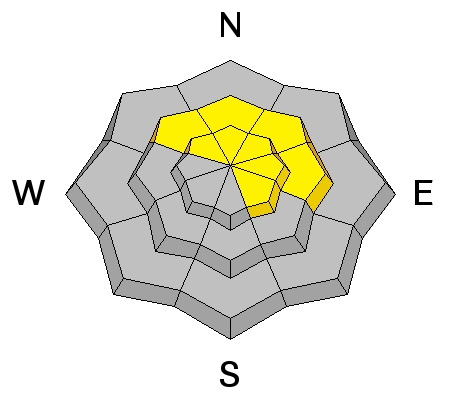
West and southwest winds have been howling for several days now, but they're kinda running out of loose snow to work with. Of course, the Uinta's are a big place and it always surprises me how winds can find just enough snow to blow around and form a slab or two sensitive to our additional weight. That said, I'd continue to steer clear of any fat, rounded piece of snow, especially if sounds or feels hollow like a drum. Found mostly on the leeward side of upper elevation ridges, due to the strength of recent winds, I bet there's a few rogue drift or two lurking in steep chutes and gullies at mid elevations as well.
In a new zone and unsure what the winds have been doing? Take a moment and check out the snow surface. In this image, winds have been blowing right (windward) to left (leeward). At upper elevations today we'll find both new and old drifts sensitive to our additional weight on the leeward side of ridges. (Scroggin photo)
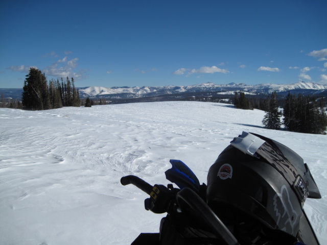
You can also observe wind loading patterns from a distance and make a game plan before even approaching a slope. (JG Photo) |
 |
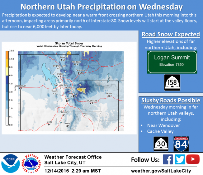
weather Mostly cloudy skies, warm temperatures, gusty winds, and a few inches of snow are on tap for us today as a warm front lifts through northern Utah. High temperatures climb into the low 30's with overnight lows right around freezing. West and southwest winds blow 30-40 mph along the ridges and increase into the 50's and 60's overnight. A break in the action is slated for Thursday and then a warm, wet, windy pattern sets it's sights on the region late Thursday through Saturday.
|
| general announcements Remember your information can save lives. If you see anything we should know about, please participate in the creation of our own community avalanche advisory by submitting snow and avalanche conditions. You can call me directly at 801-231-2170, email [email protected] The information in this advisory is from the US Forest Service which is solely responsible for its content. This advisory describes general avalanche conditions and local variations always occur. The information in this advisory expires 24 hours after the date and time posted, but will be updated by 7:00 AM on Thursday December 15th. |