25th Annual Black Diamond Fall Fundraising Party
Thursday, September 13; 6:00-10:00 PM; Black Diamond Parking Lot
25th Annual Black Diamond Fall Fundraising Party
Thursday, September 13; 6:00-10:00 PM; Black Diamond Parking Lot
| Advisory: Uintas Area Mountains | Issued by Craig Gordon for Sunday - December 4, 2016 - 5:05am |
|---|

|
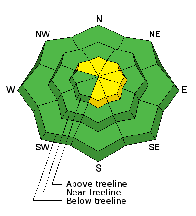
bottom line At upper elevations, in the wind zone, the avalanche danger is MODERATE today and human triggered avalanches are possible on steep, wind drifted slopes, especially shady slopes facing the north half of the compass and terrain with an easterly component to its aspect. Any avalanche breaking into old snow will be deep and dangerous. The avalanche danger in wind sheltered terrain and on low elevation slopes is generally LOW.
|
 |
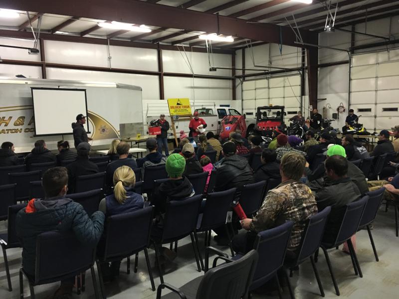
special announcement Huge thanks to Tyler St. Jeor and the amazing crew at Wasatch County Search and Rescue for organizing and hosting last night's Avy Awareness presentation. Turnout was solid and stoke was high. It was great to see the usual suspects, but even more awesome to see lot's of new faces looking to stay on top of the Greatest Snow on Earth... thanks for all the support. Click here for more info on our January sled specific avy class and here for the February class.
Heads up- Plowing operations have ceased for Mirror Lake Highway. Wolf Creek Pass is still mostly pavement and access to avalanche terrain is relatively easy. Remember... just cause you can see your rig from a ridgeline doesn't necessarily make the terrain any safer and triggering even a small slide this time of year will reveal stumps, rocks, and general nastiness, easily ruining your day or perhaps your season.
Ted Scroggin photo |
 |
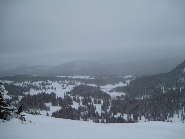
current conditions Skies remained clear overnight and it looks like most areas squeezed out about an inch of snow from yesterdays low cloud deck. Around 1:00 this morning west and northwest winds ramped up into the 30's and 40's along the high peaks and have been blowing steadily since. Temperatures are in the low teens and total snow depths have settled and are generally right around 24". Real time wind, snow, and temperatures for the Uinta's are found here. Recent observations are found here.
Not a lot of snow falling from those clouds, but just enough to help freshen things up. Excellent early season riding conditions are found on low angle, grassy slopes. Scroggin photo. |
 |
recent activity No recent avalanche activity to report. |
| type | aspect/elevation | characteristics |
|---|

|
|
LIKELIHOOD
 LIKELY
UNLIKELY
SIZE
 LARGE
SMALL
TREND
 INCREASING DANGER
SAME
DECREASING DANGER
|
|
description
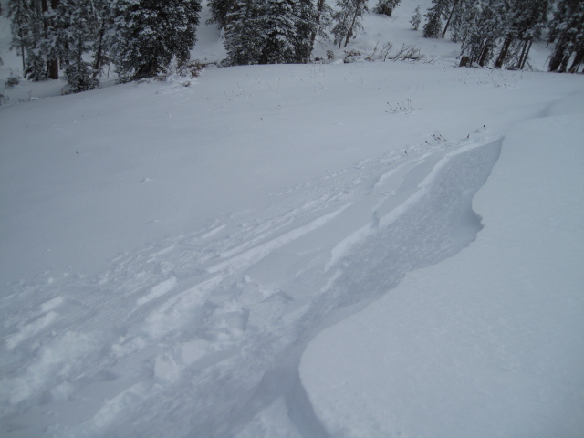
Cold temperatures have allowed the snow to remain light and fluffy and of course, that's proving quality riding and turning conditions. However, it doesn't take much wind to move this cold smoke around and form drifts sensitive to our additional weight. With winds already on the rise, today's main avalanche concern are fresh slabs and you'll find these mainly along the leeward side of upper elevation ridges and around terrain features like chutes and gullies. While manageably breaking at or below your skis, board, or sled, remember... snow cover remains thin and any slide triggered today has the possibility to uncover stumps, rocks, or deadfall, resulting in an unexpected and possibly traumatic ride.
Test slopes like these give you great information about the snowpack. Tweak a few and see how they're reacting before you get into big terrain. |
| type | aspect/elevation | characteristics |
|---|

|
|
LIKELIHOOD
 LIKELY
UNLIKELY
SIZE
 LARGE
SMALL
TREND
INCREASING DANGER
SAME
DECREASING DANGER
|
|
description
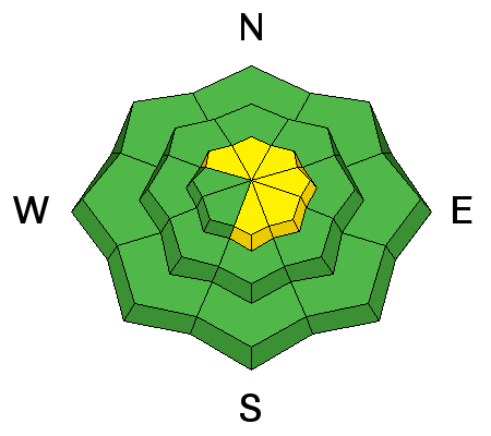
We're off to a good start in the Uinta's and our weak snow issues are isolated to a handful of upper elevation slopes facing the north half of the compass which retained snow from late September. While making up a small portion of the terrain available to ride in, if your travels take you into steep, upper elevation, north facing terrain, remember that any avalanche you trigger has the possibility of breaking into old snow, creating a deep, dangerous slide.
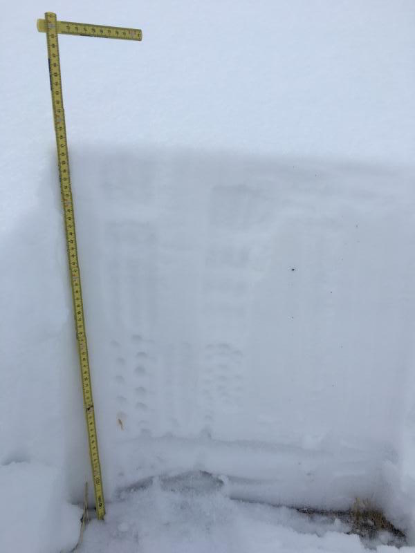
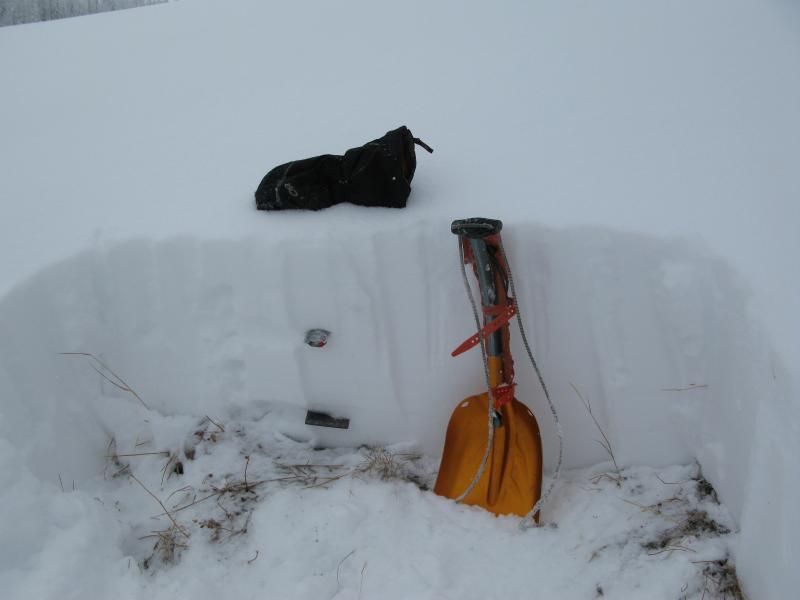
Here's a nice, deep pit from Weber Canyon. We haven't seen a solid homogenous snowpack like this for about 10 years. While things are looking good, there's still some weak snow near the ground we'll need to keep an eye on. Deutschlander photo.
My travels to the south half of the range this week revealed snow depths about half of the North Slope. However, most of the storm snow fell on bare, warm ground, creating a "right side up" snow structure. |
 |
weather A dry westerly flow this morning gives us partly cloudy skies with daytime highs in the low 30's. West and northwest winds are gonna be a nuisance, blowing in the 30's and 40's with gusts to 60 mph along the high peaks. Clouds increase as the day progresses and a weak storm system slides through the region tonight through Monday morning. We'll probably just see a couple of inches of snow out of this first wave, before a colder system swings through the state later Monday, ushering in light snow along with very cold temperatures through about midweek.
|
| general announcements Remember your information can save lives. If you see anything we should know about, please participate in the creation of our own community avalanche advisory by submitting snow and avalanche conditions. You can call me directly at 801-231-2170, email [email protected] The information in this advisory is from the US Forest Service which is solely responsible for its content. This advisory describes general avalanche conditions and local variations always occur. The information in this advisory expires 24 hours after the date and time posted, but will be updated on Monday December 5th. |