25th Annual Black Diamond Fall Fundraising Party
Thursday, September 13; 6:00-10:00 PM; Black Diamond Parking Lot
25th Annual Black Diamond Fall Fundraising Party
Thursday, September 13; 6:00-10:00 PM; Black Diamond Parking Lot
| Advisory: Uintas Area Mountains | Issued by Craig Gordon for Thursday - December 1, 2016 - 4:19am |
|---|

|
bottom line At mid and upper elevations, the avalanche danger is MODERATE today and human triggered avalanches are possible on steep, wind drifted slopes, especially shady slopes facing the north half of the compass. Any avalanche breaking into old snow will be deep and dangerous. The avalanche danger on low elevation slopes is generally LOW.
|
 |
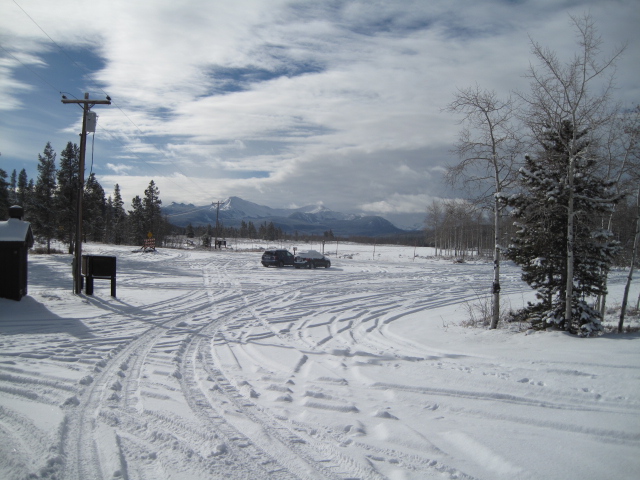
special announcement Heads up- Plowing operations have ceased for Mirror Lake Highway. Wolf Creek Pass is snowpacked and access to avalanche terrain is relatively easy. Remember... just cause you can see your rig from a ridgeline doesn't necessarily make the terrain any safer and triggering even a small slide this time of year will reveal stumps, rocks, and general nastiness, easily ruining your day or perhaps your season.
Ted Scroggin photo |
 |
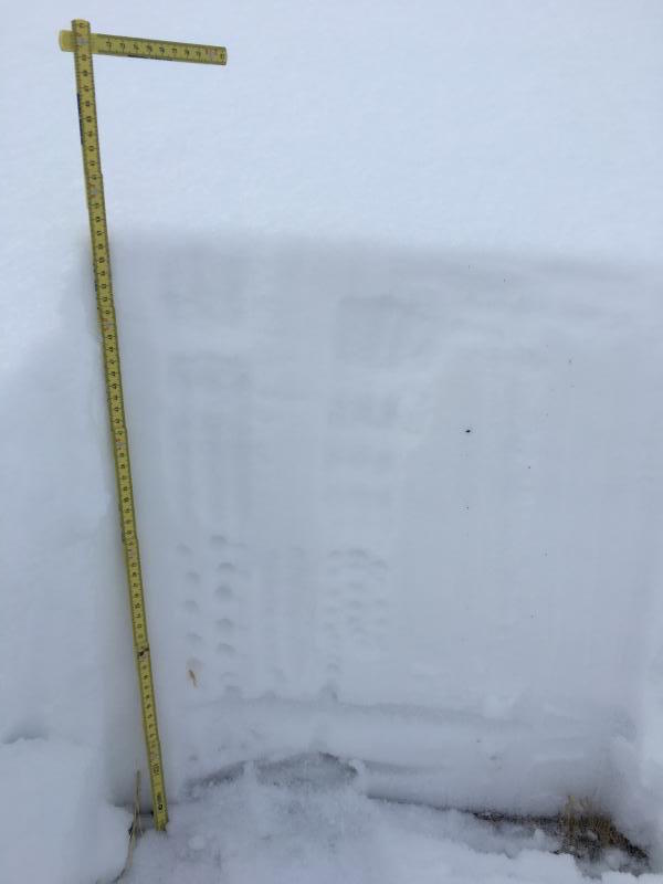
current conditions A weak system sliding into the state is producing overcast skies and a light snow flurry or two. West and northwest winds are blowing 15-25 mph along the high ridges and temperatures have warmed in the low teens. Total snow depths are in the 24"-36" range and it's starting to look like winter out there! Real time wind, snow, and temperatures for the Uinta's are found here.
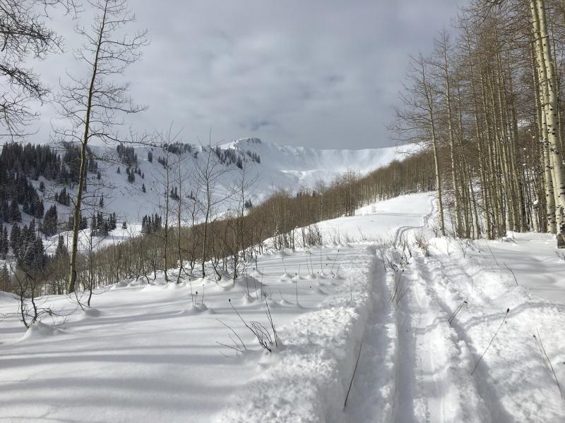
The Bear River Trailhead looking white yesterday. Ted was in Whitney Basin. His trip report is found here.
Weston and Shaun were in Upper Weber Canyon and their field day info is found here. |
 |
recent activity
Yesterday, Ted spotted a few fresh wind drifts along the leeward side of Double Hill. |
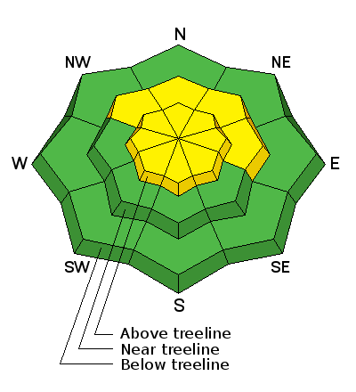
| type | aspect/elevation | characteristics |
|---|

|

|
LIKELIHOOD
 LIKELY
UNLIKELY
SIZE
 LARGE
SMALL
TREND
 INCREASING DANGER
SAME
DECREASING DANGER
|
|
description
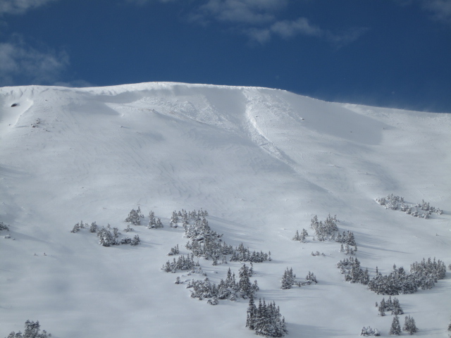
The multi-day storm formed fresh wind drifts all over the place, especially along the leeward side of upper elevation ridges and around terrain features like chutes and gullies. Fat and rounded in their appearance, today's wind drifts might not be quite as reactive as the past few days, but still have the possibility to break deeper and wider than you expect. Remember... snow cover remains thin and any slide triggered today has the possibility to uncover stumps, rocks, or deadfall, resulting in an unexpected and traumatic ride.
Test slopes like these give you great information about the snowpack. Tweak a few and see how they're reacting before you get into big terrain. |
| type | aspect/elevation | characteristics |
|---|

|

|
LIKELIHOOD
LIKELY
UNLIKELY
SIZE
 LARGE
SMALL
TREND
INCREASING DANGER
SAME
DECREASING DANGER
|
|
description
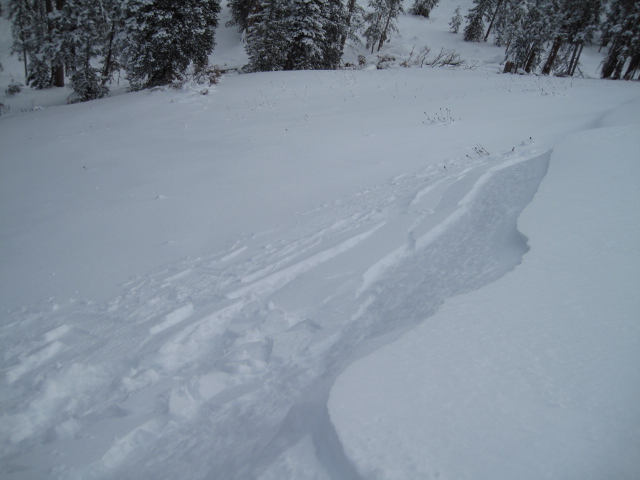
In general, we're off to a good start in the Uinta's and our weak snow issues are isolated to a handful of upper elevation slopes facing the north half of the compass... think of places like Murdock Bowl which retained snow from late September. While making up a small portion of the terrain available to ride in, if your travels take you into steep, upper elevation, north facing terrain, remember that any avalanche you trigger has the possibility of breaking into old snow, creating a deep, dangerous slide.
We haven't seen a solid homogenous snowpack like this for about 10 years. While things are looking good, there's still some weak snow near the ground we'll need to keep an eye on. Deutschlander photo. |
 |
weather A weak storm system gradually moves through the region, bringing mostly cloudy skies and light snow showers with accumulations in the 1"-3" range. Temperatures climb into the low 20's and northwest winds remain light, blowing 15-20 mph along the ridges. A break is slated for Friday and Saturday and then a colder storm brings the potential for snow Sunday night through early next week. |
| general announcements Remember your information can save lives. If you see anything we should know about, please participate in the creation of our own community avalanche advisory by submitting snow and avalanche conditions. You can call me directly at 801-231-2170, email [email protected] The information in this advisory is from the US Forest Service which is solely responsible for its content. This advisory describes general avalanche conditions and local variations always occur. The information in this advisory expires 24 hours after the date and time posted, but will be updated on Friday December 2nd. |