| Please join us at the 23rd annual Black Diamond Fall Fundraiser Party Thursday Sept 15. Tickets are on sale now here, at the Black Diamond store & at REI. Special bonus raffle for online ticket purchasers! |
| Please join us at the 23rd annual Black Diamond Fall Fundraiser Party Thursday Sept 15. Tickets are on sale now here, at the Black Diamond store & at REI. Special bonus raffle for online ticket purchasers! |
| Advisory: Uintas Area Mountains | Issued by Craig Gordon for Thursday - March 31, 2016 - 4:07am |
|---|

|
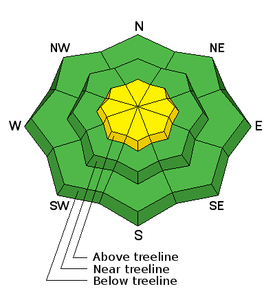
bottom line While not widespread and making up a small portion of the terrain available to ride in today, a MODERATE avalanche danger exists and human triggered avalanches are possible on all steep wind drifted slopes at and above treeline in the wind zone. Out of the wind the avalanche danger is generally LOW.
|
 |
special announcement Check out the Adventure and Gear Expo on April 8 & 9 at the Southtowne Expo Center. Use the code GOUAC to get a $2 discount on entrance tickets and the Adventure and Gear Expo will donate $2 to the UAC. http://www.adventuregearfest.com/ Spring powder special! We have reduced the price of donated Snowbasin lift tickets to $50 and Sundance tickets to $35, about half of window price. Take advantage of fresh powder on a fat snowpack and benefit the Utah Avalanche Center at the same time. Every penny spent on these donated tickets benefits the Utah Avalanche Center. |
 |
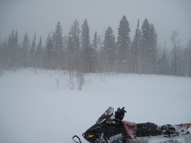
current conditions A weak wave of moisture slid through the region overnight, delivering just an inch of snow across the range. Skies are mostly cloudy, light snow showers continue, and temperatures are in the low to mid 20's. North and northeast winds did bump into the 20's and 30's around 1:00 this morning and continue as I type the advisory. Low elevation terrain took on some heat yesterday, but gain a little elevation, swing over to north facing, wind sheltered terrain, and you'll be rewarded with cold, dry snow.
Ted found deep, cold snow in the Whitney Basin Wednesday. More on his travels here. (Scroggin photo) Uinta weather station network info is found here. Trip reports and observations are found here.
|
 |
recent activity
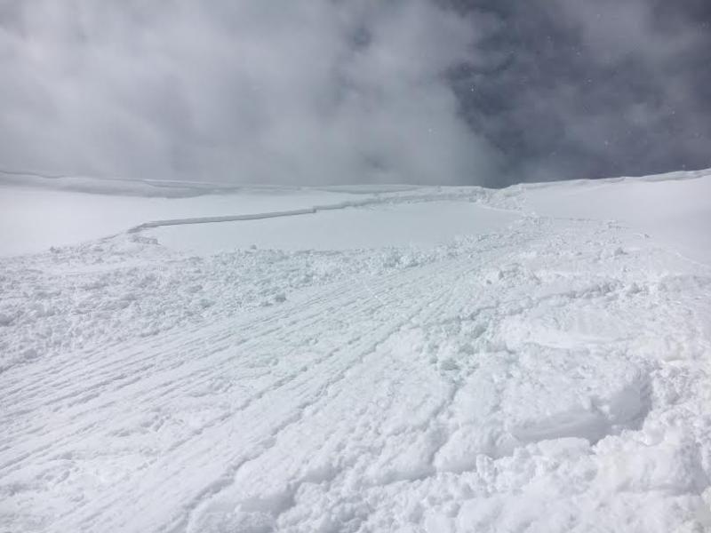
Breaking about a foot deep, within the new snow/old snow interface, I was able to intentionally trigger this pocket on a steep, wind loaded northeast facing slope in upper Weber Canyon yesterday.
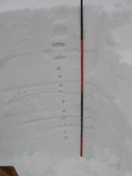
Michael J was near Castle Peak and found good stability though slightly inverted storm snow. His pit profile clearly illustrates the current setup. More on his travels here. Recent avalanche observations are found here See or trigger an avalanche? Shooting cracks? Hear a collapse? It's simple. Go here to fill out an observation.
|
| type | aspect/elevation | characteristics |
|---|

|
|
LIKELIHOOD
 LIKELY
UNLIKELY
SIZE
 LARGE
SMALL
TREND
 INCREASING DANGER
SAME
DECREASING DANGER
|
|
description
Other than a few pockety wind drifts left over from the past storm cycle, I think most of our instabilities are rather well behaved and in general the snowpack is predictable. That's not to say you couldn't find a rogue slab or two sensitive to your additional weight. As a matter of fact, if you went avalanche hunting I bet you can still trigger a drift that has the potential to catch you off guard and maybe even boss you around a bit. While more the exception than the rule, the most likely terrain to encounter these conditions are steep, upper elevation, leeward slopes, especially those in the wind zone above treeline.
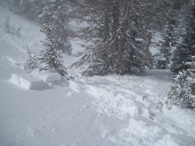
Triggering even a small slide and getting slammed into a group of trees can definitely put a damper on the day. (Scroggin photo)
|
 |
weather A weak system dropping out of the north brings considerable cloudiness and occasional snow showers to the region today. Northeast winds pickup during the day and should gust in the 40's along the high peaks. Temperatures rise into the low 30's and dip into the mid 20's overnight. Snow showers end this evening and high pressure builds into Utah over the weekend bringing dry weather and a warming trend.
|
| general announcements Remember your information can save lives. If you see anything we should know about, please participate in the creation of our own community avalanche advisory by submitting snow and avalanche conditions. You can call me directly at 801-231-2170, email [email protected], or email by clicking HERE If Craig is unavailable you can reach his partner Trent at 801-455-7239, email [email protected] This is a great time of year to schedule a free avalanche awareness presentation for your group or club. You can contact me at 801-231-2170 or email [email protected]. To register for the first in our series of on-the-snow sled specific classes you can register here. The information in this advisory is from the US Forest Service which is solely responsible for its content. This advisory describes general avalanche conditions and local variations always occur. The information in this advisory expires 24 hours after the date and time posted, but will be updated by 7:00 AM on Friday, April 1st.
|