| Please join us at the 23rd annual Black Diamond Fall Fundraiser Party Thursday Sept 15. Tickets are on sale now here, at the Black Diamond store & at REI. Special bonus raffle for online ticket purchasers! |
| Please join us at the 23rd annual Black Diamond Fall Fundraiser Party Thursday Sept 15. Tickets are on sale now here, at the Black Diamond store & at REI. Special bonus raffle for online ticket purchasers! |
| Advisory: Uintas Area Mountains | Issued by Craig Gordon for Thursday - March 24, 2016 - 5:21am |
|---|


|
bottom line In the wind zone, at and above treeline, pockets of MODERATE avalanche danger exist and human triggered avalanches are possible on all steep, wind drifted slopes. Any slide that breaks to old snow near the ground has the potential to break deeper and wider than you might expect and can quickly ruin your day. Out of the wind the avalanche danger is generally LOW.
|
 |
special announcement Please help guide our discussions of website maintenance, upgrades or possible changes in coming years. Take this brief survey. As a way of saying thanks we'll be raffling a free avalanche class and other free stuff like hats, beanies, water bottles, etc. |
 |
current conditions Under partly cloudy skies, temperatures are in the upper teens and low 20's. Northwest winds finally relaxed late yesterday and are currently blowing 15-25 mph along the high ridges. The big open bowls and upper elevation terrain experienced some wind damage yesterday, but lose a little elevation, head to protected slopes and you'll be treated to deep, cold, creamy riding.
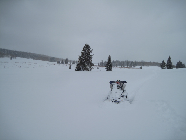
Yep... over-the-hood and over-the-head. It's deep out there as Ted found in his travels through Gold Hill Basin yesterday. (Scroggin photo) Uinta weather station network info is found here. Trip reports and observations are found here.
|
 |
recent activity
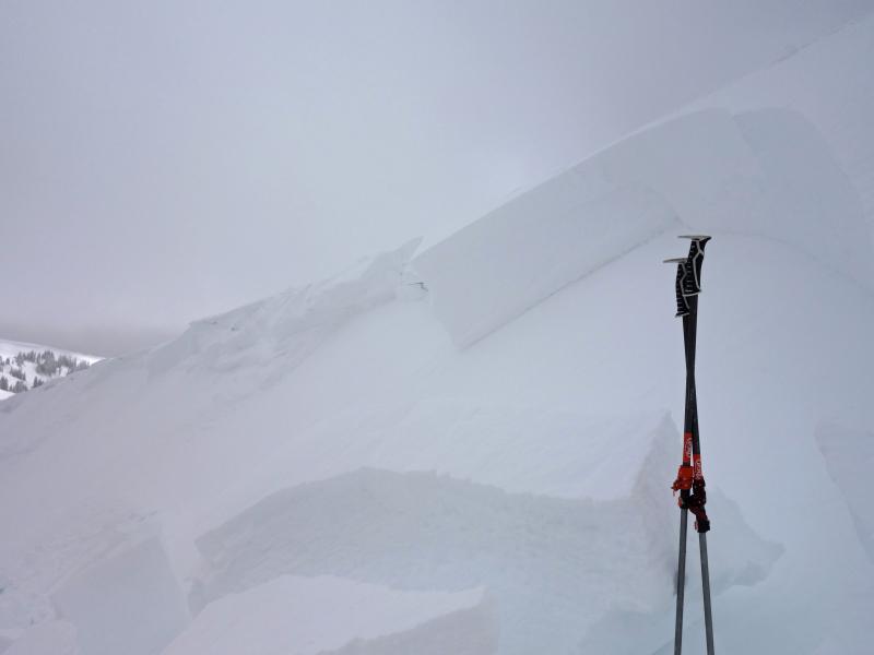
Yesterday's wind drifts weren't quite as widespread as I would've suspected, but in the right wind loaded terrain they were quite reactive to the additional weight of a rider, breaking about 12"-18" deep. (Kikkert photo) Recent avalanche observations are found here See or trigger an avalanche? Shooting cracks? Hear a collapse? It's simple. Go here to fill out an observation.
|
| type | aspect/elevation | characteristics |
|---|

|
|
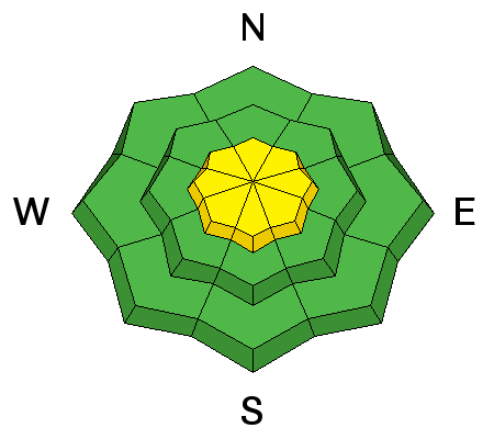
LIKELIHOOD
 LIKELY
UNLIKELY
SIZE
 LARGE
SMALL
TREND
 INCREASING DANGER
SAME
DECREASING DANGER
|
|
description
I think yesterday's drifts settled out overnight and won't be nearly as reactive today. However, it's not full-on green light conditions and I bet with a little coaxing you can still pop out a drift, especially on steep, upper elevation, leeward slopes. Generally manageble in depth and width, remember... even a small slide can take you for a fast, body-bruising ride, especially in steep, committing terrain. Here's an option... lose a little elevation, you lose the problem and get some incredible riding to boot. Not a bad payoff! Don't forget- shallow snowpack areas exist and there is still a chance of triggering an avalanche that breaks to old, weak snow. Steep, upper elevation, north facing slopes, especially those with a thin, weak snowpack need to be carefully evaluated or better yet, simply avoid terrain with these characteristics.
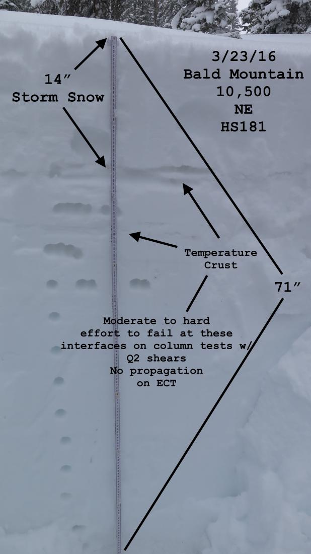
Welcome back JG.... we've missed your detailed pit profiles! More on JG's travels are found here.
|
 |
weather A few snow showers linger along the high peaks, but in general we should start to see some breaks in the clouds, and sunny skies by about mid morning. High temperatures rise into the low 30's with overnight lows dipping into the low 20's. Westerly wind start ramping up late this afternoon and clouds thicken, all ahead of the next impulse slated to move through the region late Friday producing a quick round of snow and colder temperatures. A break is on tap for late Saturday and Sunday and then another shot of snow settles in over the region Monday.
|
| general announcements Remember your information can save lives. If you see anything we should know about, please participate in the creation of our own community avalanche advisory by submitting snow and avalanche conditions. You can call me directly at 801-231-2170, email [email protected], or email by clicking HERE If Craig is unavailable you can reach his partner Trent at 801-455-7239, email [email protected] This is a great time of year to schedule a free avalanche awareness presentation for your group or club. You can contact me at 801-231-2170 or email [email protected]. To register for the first in our series of on-the-snow sled specific classes you can register here. The information in this advisory is from the US Forest Service which is solely responsible for its content. This advisory describes general avalanche conditions and local variations always occur. The information in this advisory expires 24 hours after the date and time posted, but will be updated by 7:00 AM on Friday, March 25th.
|