| Please join us at the 23rd annual Black Diamond Fall Fundraiser Party Thursday Sept 15. Tickets are on sale now here, at the Black Diamond store & at REI. Special bonus raffle for online ticket purchasers! |
| Please join us at the 23rd annual Black Diamond Fall Fundraiser Party Thursday Sept 15. Tickets are on sale now here, at the Black Diamond store & at REI. Special bonus raffle for online ticket purchasers! |
| Advisory: Uintas Area Mountains | Issued by Craig Gordon for Thursday - March 10, 2016 - 4:08am |
|---|


|
bottom line While the avalanche danger is generally LOW, pockets of MODERATE avalanche danger exist, especially on steep, wind drifted slopes and particularly in terrain with a thin, weak snowpack. While it's becoming more the exception than the rule, any avalanche that fails on weak, sugary snow near the ground, has the potential to break deeper and wider than you might expect.
|
 |
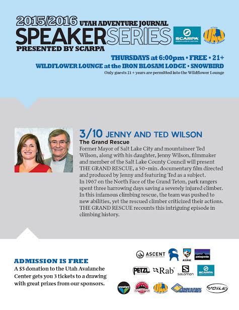
special announcement
Thursday 6pm: Utah Adventure Journals final installment of the speaker series at Snowbird presented by Scarpa. Raffle held to benefit UAC. Must be 21 or older to attend. |
 |
current conditions Wow.... yesterday's little storm blossomed into a full-on, winter-like snow producer. In short order, 4"-6" of new snow quickly stacked up, westerly winds raged into the 50's along the high peaks, and there were reports of lightning as the cold front marched through the region. Of course, I underestimated the storm and basically blew the forecast, but that was so yesterday. I think I got it right this morning though. Looking around the range, skies are clear, temperatures in the mid to upper 20's, and southwest winds are blowing 15-25 mph along the high ridges. On a go-anywhere kinda base, excellent riding and turning conditions exist, especially in wind sheltered terrain facing the north half of the compass.
Mark Staples was in the Whitney Basin yesterday and reports soft, surfy snow in wind sheltered terrain. More on his travels here. Uinta weather station network info is found here. Trip reports and observations are found here.
|
 |
recent activity
Yesterday's winds cranked in the morning, producing sensitive, yet pockety soft slabs in the wind zone. Mark spotted this fresh wind slab on Double Hill yesterday. Click here to view a short viddy. Recent avalanche observations are found here See or trigger an avalanche? Shooting cracks? Hear a collapse? It's simple. Go here to fill out an observation.
|
| type | aspect/elevation | characteristics |
|---|

|

|
LIKELIHOOD
 LIKELY
UNLIKELY
SIZE
 LARGE
SMALL
TREND
 INCREASING DANGER
SAME
DECREASING DANGER
|
|
description
Yesterday's drifts were quite sensitive during the height of the storm, but settled out around midday. While generally well-behaved and predictable, today you'll find a few lingering drifts on steep, leeward, upper elevation slopes. In general these are manageable, easy to detect, and easier to avoid. Lose a little elevation and you lose the problem. However, if you're getting after it and your travels take you into the wind zone, look for and avoid any fat, rounded piece of snow, especially if it feels or sounds hollow like a drum. In addition to fresh drifts, a rogue slab breaking into weak snow near the ground isn't out of the question and our usual suspects come to mind... steep, rocky terrain with a shallow, weak snowpack. Any slide that breaks to weak snow near the ground has the potential to quickly ruin your day.
|
 |
weather A warm southwest flow develops today and we get our first taste of March madness with sunny skies and temperatures soaring into the 50's. Southwest winds increase into the mid 30's by days end. Overnight lows remain warm, in the low 30's. Windy and warm conditions continue Friday. A weak cold front crosses northern Utah late Saturday producing an inch or two of snow. The chance of snow increases Sunday through Monday as a broad Pacific trough begins to move into the western states. This system brings a period of colder snowy weather through mid week.
|
| general announcements Remember your information can save lives. If you see anything we should know about, please participate in the creation of our own community avalanche advisory by submitting snow and avalanche conditions. You can call me directly at 801-231-2170, email [email protected], or email by clicking HERE If Craig is unavailable you can reach his partner Trent at 801-455-7239, email [email protected] This is a great time of year to schedule a free avalanche awareness presentation for your group or club. You can contact me at 801-231-2170 or email [email protected]. To register for the first in our series of on-the-snow sled specific classes you can register here. The information in this advisory is from the US Forest Service which is solely responsible for its content. This advisory describes general avalanche conditions and local variations always occur. The information in this advisory expires 24 hours after the date and time posted, but will be updated by 7:00 AM on Friday, March 11th.
|