| Please join us at the 23rd annual Black Diamond Fall Fundraiser Party Thursday Sept 15. Tickets are on sale now here, at the Black Diamond store & at REI. Special bonus raffle for online ticket purchasers! |
| Please join us at the 23rd annual Black Diamond Fall Fundraiser Party Thursday Sept 15. Tickets are on sale now here, at the Black Diamond store & at REI. Special bonus raffle for online ticket purchasers! |
| Advisory: Uintas Area Mountains | Issued by Craig Gordon for Saturday - February 27, 2016 - 4:54am |
|---|


|
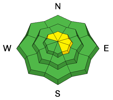
bottom line While the avalanche danger is generally LOW, pockets of MODERATE avalanche danger exist on steep, upper elevation, leeward slopes, especially those facing the north half of the compass. Yes... it's becoming more the exception than the rule, but any avalanche that fails on weak, sugary snow near the ground, has the potential to break deeper and wider than you might expect.
|
 |
special announcement The Utah Avalanche Center greatly values in longtime partnership with our world-class resorts and is blowing out the remaining donated lift tickets from Alta, Snowbird, Snowbasin, Sundance, and Nordic Valley with reduced prices. Every penny you spend and turn you make benefits the Utah Avalanche Center. Check out our Garage Sale! Chock full of sweet backcountry gear - you can find the goods on our Facebook page here. |
 |
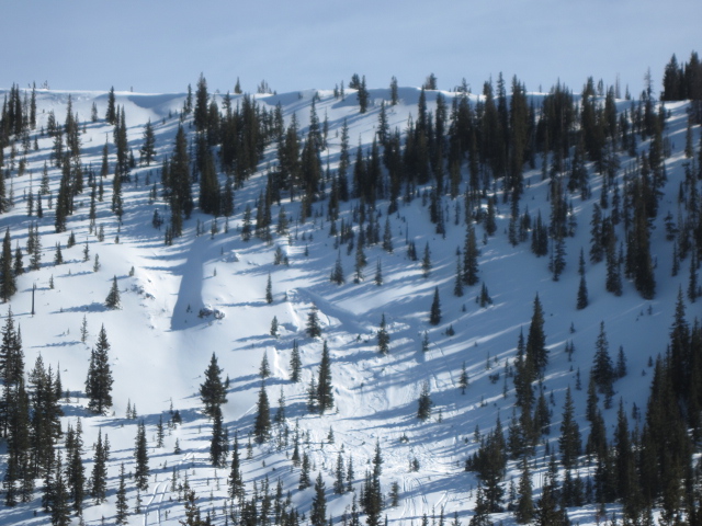
current conditions High, thin clouds are streaming into the region, ahead of a weak storm that passes well to our north today. In the meantime, temperatures are in the upper 20's, and southwest winds started increasing around 8:00 last night and are currently blowing 20-30 mph along the high peaks. Riding and turning conditions remain stellar and it's a tale of two snow surfaces. On the south half of the compass, supportable corn softens around 10:00 and is best harvested at low and mid elevations. On the other side of the compass, mid and upper elevation, north facing terrain still offers soft settled powder on a go-anywhere base.
The sleeping maiden... yep, the view of Timp is pretty spectacular from the eastern front perspective. Uinta weather station network info is found here. Trip reports and observations are found here.
|
 |
recent activity
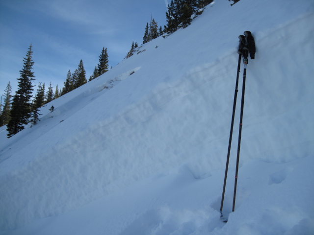
Wind drifts like this one we spotted in Upper Chalk Creek yesterday, are isolated to steep, leeward terrain in the wind zone.
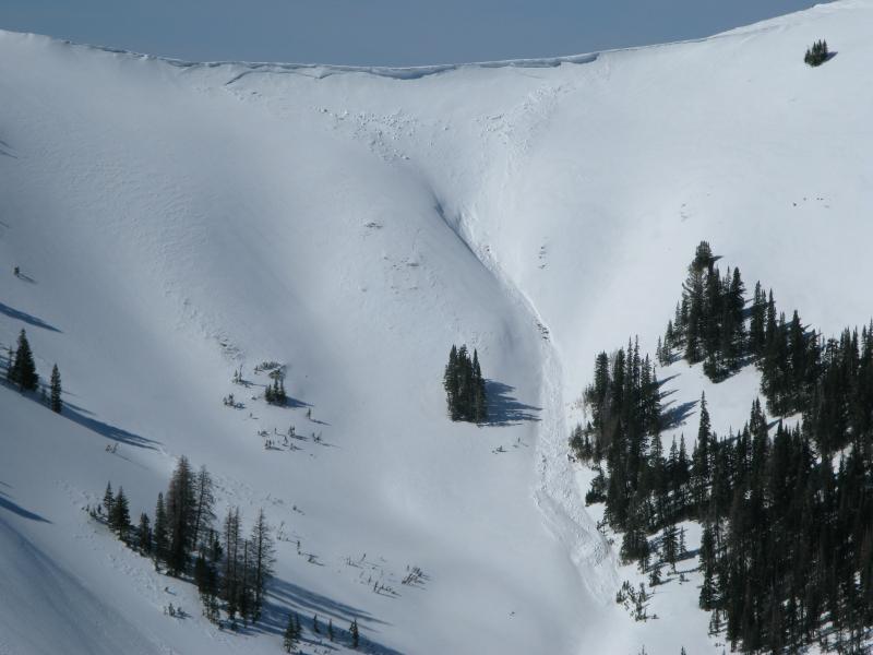
Less predictable is a persistent slab like this sled triggered avalanche in Gold Hill Basin, that Ted discovered from last Saturday. Breaking 150' wide and failing on weak snow near the ground, check out Ted's great write-up and very informative video here. Recent avalanche observations are found here See or trigger an avalanche? Shooting cracks? Hear a collapse? It's simple. Go here to fill out an observation.
|
| type | aspect/elevation | characteristics |
|---|

|
|
LIKELIHOOD
 LIKELY
UNLIKELY
SIZE
 LARGE
SMALL
TREND
 INCREASING DANGER
SAME
DECREASING DANGER
|
|
description
A few old wind drifts are found on steep leeward slopes in the wind zone, but these are generally manageable and predictably break at or below your feet. Less predictable, is any slide that fails on weak, sugary snow near the ground, or what we call persitent slabs. Remember- persistent slabs have the potential to break deeper and wider than you might expect. Steep, rocky terrain facing the north half of the compass and particularly slopes that avalanched near the ground earlier this season should be considered suspect.
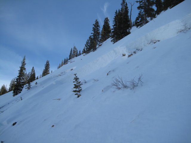
Breaking to weak snow in steep, rocky terrain... here's another pic Ted snapped from Gold Hill Wednesday. (Scroggin photo)
|
 |
weather Snow showers develop over the region late this morning, but accumulations are negligible, perhaps a trace to a couple of traces. Temperatures remain rather mild, topping out in the upper 30's and low 40's. Westerly winds are gonna be annoying along the high ridges, gusting into the 30's and 40's. Today's little brush-by moves out of the region tonight and skies clear allowing overnight temperatures to drop into the low 20's. Weak storms slide to the north of us on Monday, Wednesday, and Friday.
|
| general announcements Remember your information can save lives. If you see anything we should know about, please participate in the creation of our own community avalanche advisory by submitting snow and avalanche conditions. You can call me directly at 801-231-2170, email [email protected], or email by clicking HERE If Craig is unavailable you can reach his partner Trent at 801-455-7239, email [email protected] This is a great time of year to schedule a free avalanche awareness presentation for your group or club. You can contact me at 801-231-2170 or email [email protected]. To register for the first in our series of on-the-snow sled specific classes you can register here. The information in this advisory is from the US Forest Service which is solely responsible for its content. This advisory describes general avalanche conditions and local variations always occur. The information in this advisory expires 24 hours after the date and time posted, but will be updated by 7:00 AM on Sunday, February 28th.
|