| Please join us at the 23rd annual Black Diamond Fall Fundraiser Party Thursday Sept 15. Tickets are on sale now here, at the Black Diamond store & at REI. Special bonus raffle for online ticket purchasers! |
| Please join us at the 23rd annual Black Diamond Fall Fundraiser Party Thursday Sept 15. Tickets are on sale now here, at the Black Diamond store & at REI. Special bonus raffle for online ticket purchasers! |
| Advisory: Uintas Area Mountains | Issued by Craig Gordon for Thursday - January 28, 2016 - 4:25am |
|---|


|
bottom line At and above treeline, a MODERATE avalanche danger exists. Human triggered avalanches are possible on steep, wind drifted slopes. Any avalanche that breaks to weak, sugary snow near the ground has the potential to be deep and dangerous. Looking for LOW avalanche danger? Simply avoid being on or under steep wind drifted slopes. You can have a blast carving deep trenches in big, open meadows or seek out turns in wind sheltered terrain.
|
 |
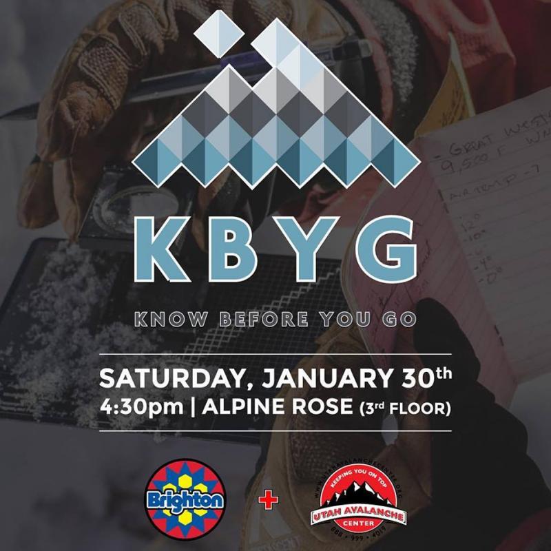
special announcement Saturday 4:30pm - Brighton Resort hosts UAC Forecaster Craig Gordon for a special Know Before You Go awareness talk focused on the current backcountry conditions. Presentation will be held on 3rd floor of Alpine Rose Lodge and as always is free to attend.
|
 |
current conditions Skies remained clear overnight and temperatures are inverted, in the teens and low 20's... just about the same as Salt Lake this morning. North and northeast winds are blowing 15-25 mph along the high peaks. Strong sunshine and warm temperatures are having their way with the sunny slopes and this morning they'll be crusted. However, flip around to the shady side of the compass and you'll be treated to soft, settled, creamy snow.
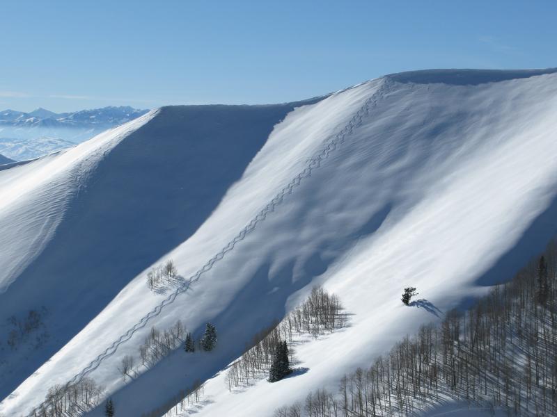
The Uinta's are white and phat and experienced locals are taking advantage of good stability in the big terrain of Upper Weber Canyon. (Most_OG photo)
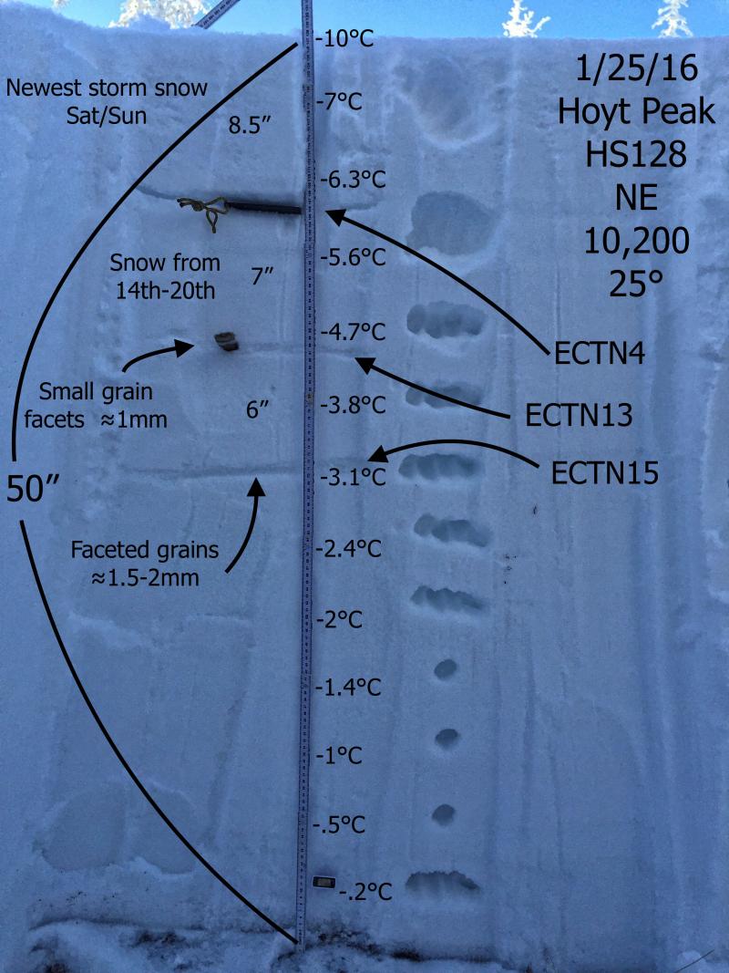
JG's most excellent snowpit, accurately depicts our current snowpack structure. More on his travels around Hoyt Peak found here. Additional rip reports and observations are found here.
|
 |
recent activity
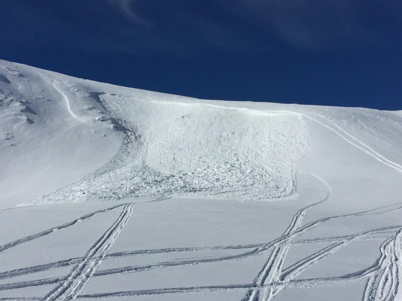
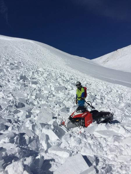
This slide in Race Track Bowl was triggered Tuesday by two local riders. Breaking up to 7' deep and failing on weak snow near the ground, here's a great example of the tricky nature of our persistent slab avalanche problem right now. More details found here. Recent avalanche observations are found here. See or trigger an avalanche? Shooting cracks? Hear a collapse? It's simple. Go here to fill out an observation.
|
| type | aspect/elevation | characteristics |
|---|

|
|
LIKELIHOOD
 LIKELY
UNLIKELY
SIZE
 LARGE
SMALL
TREND
 INCREASING DANGER
SAME
DECREASING DANGER
|
|
description
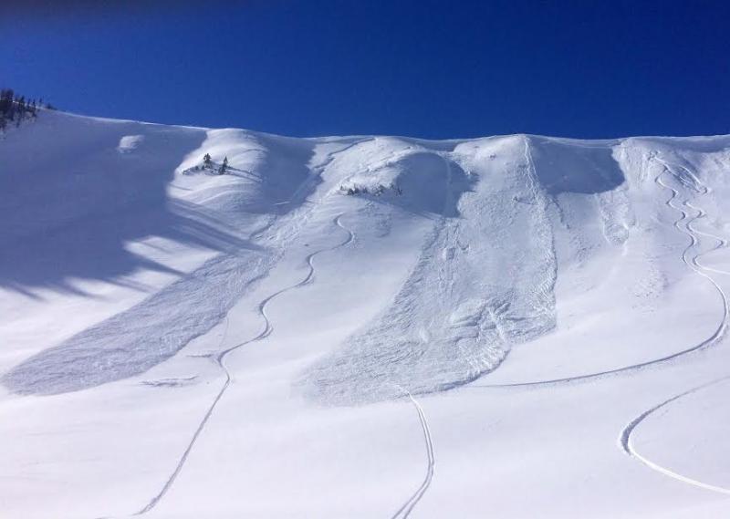
Recent wind drifts are today's most obvious avalanche problem. Predictably breaking at or below your skis, board, or sled, fresh drifts are found on all quadrants of the compass, especially on the leeward side of upper elevation ridges. While generally manageable in size, a rogue slab on a steep, leeward slope in the wind zone, could take you for a ride and let you know who's boss. Best bet is not to pull on the dogs tail and simply avoid fat, rounded pieces of snow, especially if they sound hollow like a drum.
Pretty straight-forward, but big enough to put the hurt on ya, fresh drifts sensitive to the additional weight of a rider are found along the leeward side of upper elevation ridges. (Kikkert photo)
|
| type | aspect/elevation | characteristics |
|---|

|

|
LIKELIHOOD
LIKELY
UNLIKELY
SIZE
 LARGE
SMALL
TREND
 INCREASING DANGER
SAME
DECREASING DANGER
|
|
description
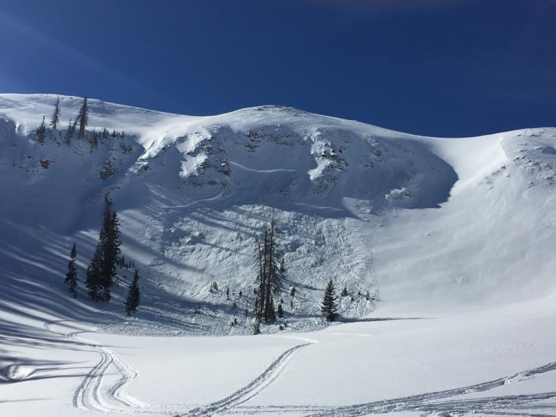
Not so manageable, less predictable, and certainly more dangerous is any avalanche that breaks to old snow near the ground. Steep slopes facing the north half of the compass, particularly those that avalanched during the Solstice Storm remain guilty until proven otherwise. Unless you have a solid history of a slope or you're doing your homework and digging down to investigate the layering, you're simply rolling the dice.
Not so manageable, unpredictable, and definitely day ruining, is a persistent slab breaking to old snow near the ground like this one triggered Tuesday in Race Track Bowl on the southern half of the range. (Dickerson photo) |
 |
weather High pressure remains in place for one more day, giving us partly cloudy skies and temperatures warming into the upper 30's. Northwest winds remain well behaved, blowing in the 20's along the high peaks. Thin clouds stream into the region late in the day and overnight lows dip into the mid 20's. The graphic below pretty much sums up the next couple of days... increasing moisture combined with a cold front crossing the area leads to a good shot of snow mainly late Friday and Saturday.
|
| general announcements Remember your information can save lives. If you see anything we should know about, please participate in the creation of our own community avalanche advisory by submitting snow and avalanche conditions. You can call me directly at 801-231-2170, email [email protected], or email by clicking HERE This is a great time of year to schedule a free avalanche awareness presentation for your group or club. You can contact me at 801-231-2170 or email [email protected]. To register for the first in our series of on-the-snow sled specific classes you can register here. The information in this advisory is from the US Forest Service which is solely responsible for its content. This advisory describes general avalanche conditions and local variations always occur. The information in this advisory expires 24 hours after the date and time posted, but be will be updated by 7:00 AM on Friday, January 29th.
|