| Please join us at the 23rd annual Black Diamond Fall Fundraiser Party Thursday Sept 15. Tickets are on sale now here, at the Black Diamond store & at REI. Special bonus raffle for online ticket purchasers! |
| Please join us at the 23rd annual Black Diamond Fall Fundraiser Party Thursday Sept 15. Tickets are on sale now here, at the Black Diamond store & at REI. Special bonus raffle for online ticket purchasers! |
| Advisory: Uintas Area Mountains | Issued by Craig Gordon for Saturday - January 23, 2016 - 4:25am |
|---|

|
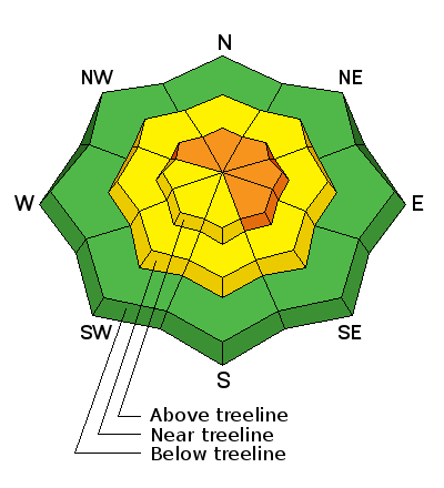
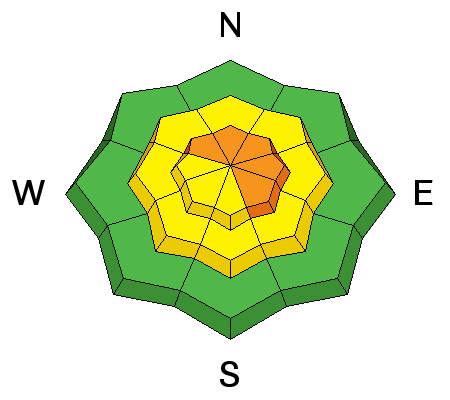
bottom line In the wind zone, at and above treeline, a CONSIDERABLE avalanche danger exists. Human triggered avalanches are probable on steep, wind drifted slopes, particularly on slopes with an easterly component to their aspect. Any avalanche that breaks to weak, sugary snow near the ground has the potential to be deep and dangerous. In steep, mid elevation terrain, a MODERATE avalanche danger is found and human triggered avalanches are possible on steep slopes with recent deposits of wind drifted snow. Looking for LOW avalanche danger? Simply avoid being on or under steep wind drifted slopes. You can have a blast carving deep trenches in big, open meadows or go for turns in wind sheltered, low angle terrain.
|
 |
special announcement Our collective thoughts, prayers, and energy go out to friends and family of Douglas Green who was tragically killed in an avalanche accident Thursday while skiing Gobbler's Knob in Big Cottonwood Canyon. An accident report is found here. |
 |
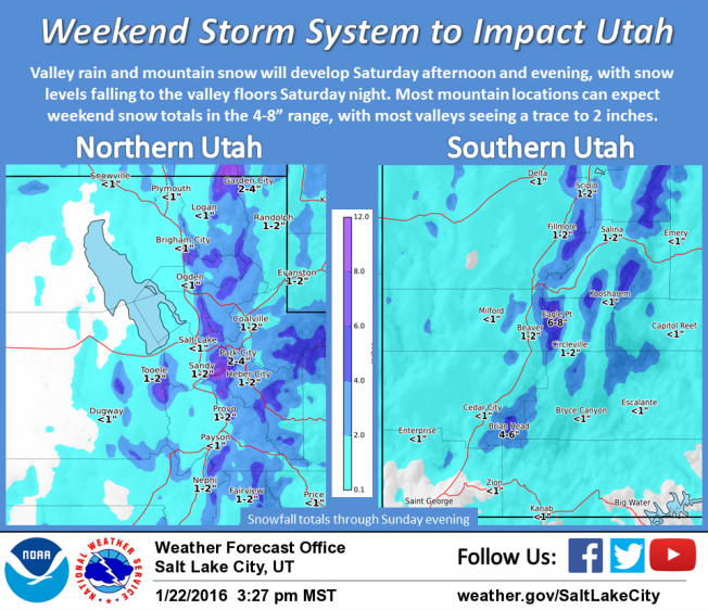
current conditions Clouds are streaming into the area ahead of a storm system slated to impact the region late today and tonight. In the meantime, southwest winds ramped up Friday and started cranking 30-50 mph around 6:00 last night. The surface snow took a bit of a hit yesterday and there's some wind and sun damage. But wind sheltered, mid and upper elevation shady slopes still offer soft, creamy snow. Trip reports and observations are found here.
|
 |
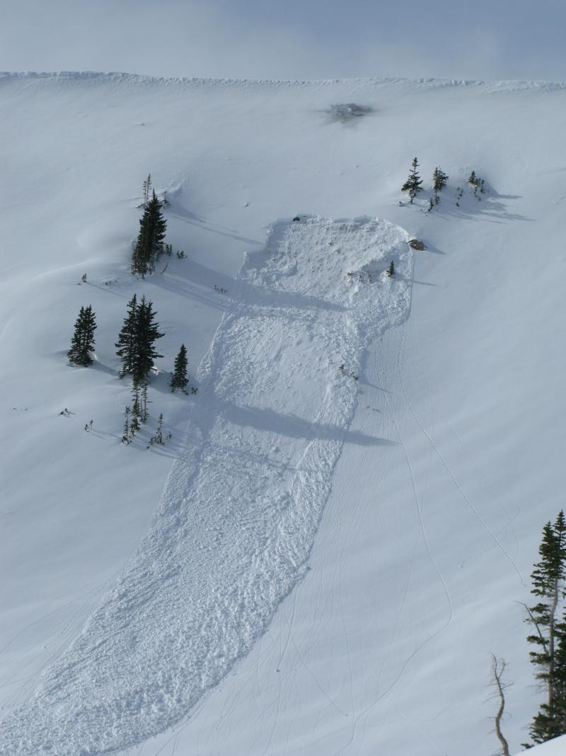
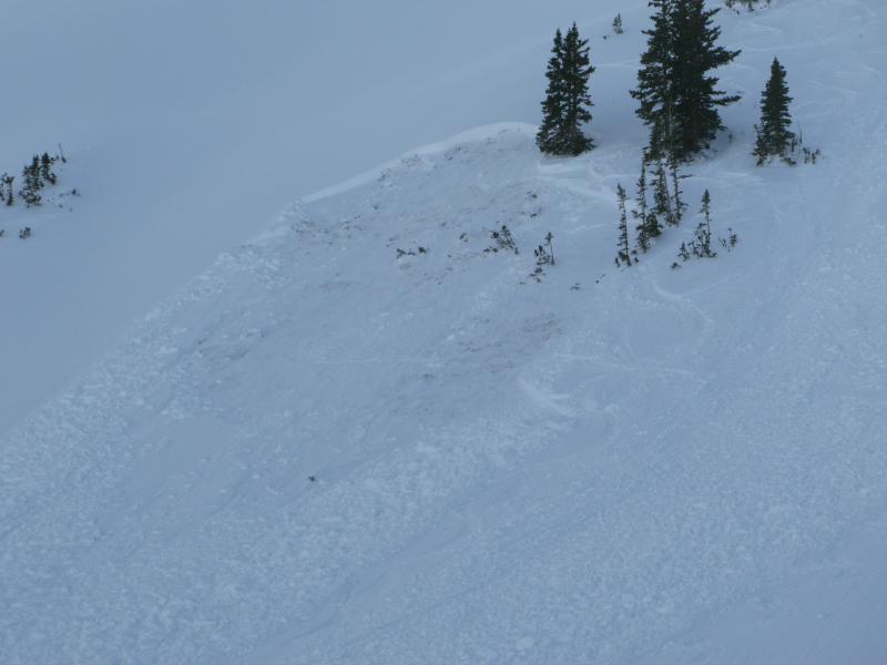
recent activity
This pocket was triggered by collapsing the slope from above.
This pocket was triggered low on the slope... same characteristics. Common theme is steep, north facing terrain that slid to the ground during the Solstice Storm. Recent avalanche observations are found here. See or trigger an avalanche? Shooting cracks? Hear a collapse? It's simple. Go here to fill out an observation.
|
| type | aspect/elevation | characteristics |
|---|

|
|
LIKELIHOOD
 LIKELY
UNLIKELY
SIZE
 LARGE
SMALL
TREND
 INCREASING DANGER
SAME
DECREASING DANGER
|
|
description
The snowpack is in its teenage years and testosterone is running rampantly. Where the pack is deep and comfortable in its own skin its pretty predictable, mostly well behaved, and avalanches are generally manageable, breaking about a foot deep. But that same teenage snowpack needs to be carefully evaluated so you know which personality your dealing with. In steep, wind drifted terrain facing the north half of the compass, the snowpack can easily come unglued and often with hardly any provoking. At a moments notice you can collapse the slope and now you're staring down an umanageable slide that's breaking several feet deep. The most likely terrain to encounter our unruly problem child are slopes that avalanched to ground during the Solstice Storm. Big differance is snowpack depth, strength, and stability.
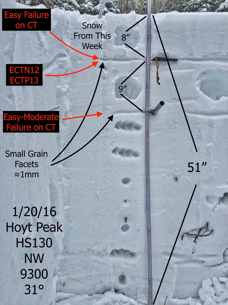
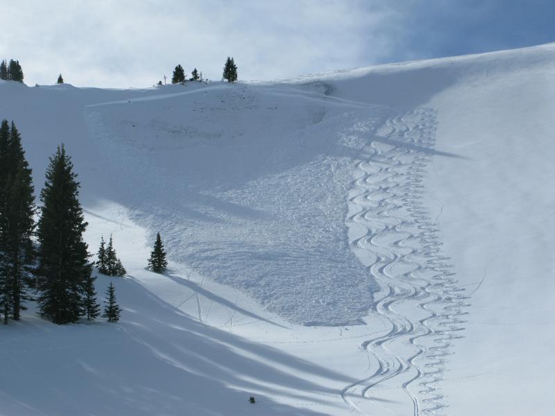
Where the snowpack is deep, shears breaking to weak snow near the ground are getting ragged and lack energy, suggesting a turn towards stronger snow. JG's pit from Wednesday clearly illustrates our current setup. More on his travels found here. Where the snowpack broke to the ground earlier this season it's a differant story. This is an example of good route finding and an intimate relationship with slope and snowpack history. This slide triggered yesterday on a steep, wind drifted, north facing slope is a repeater. It avalanched early in January, breaking to the ground, leaving behind a weak, shallow snowpack. We were able to safely navigate our way down the slope by reducing our slope angle and decending terrain where we know the snowpack is deep. If you don't have a good history of the snowpack or the terrain your riding in... you're rolling the dice.
|
 |
weather Increasing clouds and wind today as a storm enters the region this afternoon. Southwest winds are gonna be a nuisance, blowing 30-50 mph along the high ridges. Temperatures climb into the mid 30's and then dip into the mid teens overnight. As the storm develops, the south half of the range should do alright initially, then winds turn northwest early Sunday morning, cold air filters into the area and the North Slope gets in on the act. Showers will likely linger through the day Sunday before slowly tapering off Sunday night and Monday. Not a huge storm, but I'm thinking 6"-8", maybe 10" storm totals appear realistic. High pressure builds for the rest of the week.
|
| general announcements Remember your information can save lives. If you see anything we should know about, please participate in the creation of our own community avalanche advisory by submitting snow and avalanche conditions. You can call me directly at 801-231-2170, email [email protected], or email by clicking HERE This is a great time of year to schedule a free avalanche awareness presentation for your group or club. You can contact me at 801-231-2170 or email [email protected]. To register for the first in our series of on-the-snow sled specific classes you can register here. The information in this advisory is from the US Forest Service which is solely responsible for its content. This advisory describes general avalanche conditions and local variations always occur. The information in this advisory expires 24 hours after the date and time posted, but be will be updated by 7:00 AM on Sunday, January 24th.
|