| Please join us at the 23rd annual Black Diamond Fall Fundraiser Party Thursday Sept 15. Tickets are on sale now here, at the Black Diamond store & at REI. Special bonus raffle for online ticket purchasers! |
| Please join us at the 23rd annual Black Diamond Fall Fundraiser Party Thursday Sept 15. Tickets are on sale now here, at the Black Diamond store & at REI. Special bonus raffle for online ticket purchasers! |
| Advisory: Uintas Area Mountains | Issued by Craig Gordon for Monday - January 18, 2016 - 4:29am |
|---|


|
bottom line In the wind zone, at and above treeline, a CONSIDERABLE avalanche danger exists. Human triggered avalanches are likely on steep, wind drifted slopes, especially those that face the north half of the compass, and particularly on slopes with an easterly component to their aspect. Any avalanche that breaks to weak, sugary snow near the ground will be deep and dangerous. At treeline, in steep, mid elevation terrain, a MODERATE avalanche danger is found and human triggered avalanches are possible on steep slopes with recent deposits of wind drifted snow. Lose the wind and you'll lose the problem. A LOW avalanche danger exists at lower elevations, particularly in wind sheltered terrain.
|
 |
special announcement
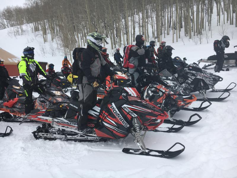
Huge thanks and a big shout out to Park City Powder Cats for hosting Saturday's sled specific Avy 101. I couldn't pull off such a successful class without the help from a truly talented posse of instructors. Thanks to Dan, Phatty, Nick, and Zak from the Boondockers for sharing their riding skills with the group. And Trent, Andy, Tyler, Cody, Jason, and Mark for helping spread the avalanche gospel.... amen! |
 |
current conditions Clouds are increasing as the next storm is on our doorstep. Southwest winds peaked around 11:00 last night, with gusts in the 30's and 40's, but mellowed somewhat and are currently blowing in the 20's and 30's. Temperatures are relatively mild and hovering in the low to mid 20's. There's quite a bit of wind damge in our big, open terrain, but lose some elevation or head to the wind sheltered trees and you'll be treated to deep, cold snow. Trip reports and observations are found here.
|
 |
recent activity
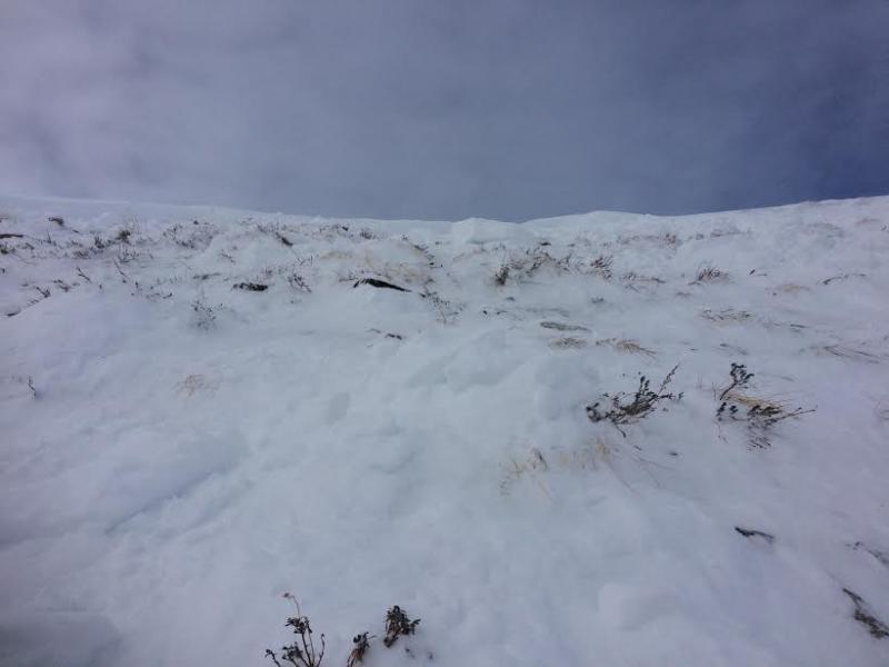
3'-5' deep and 200' wide, this slide was intentionally triggered on a steep, upper elevation, east facing slope by a very experienced backcountry rider. However, due to the tricky nature of the snowpack, the slide got a little out of hand as it broke wider and deeper than first anticipated. This slope avalanched to the ground during the Solstice storm and the snowpack structure prior to last weeks series of storms was weak and sugary. This is what we call a repeater. Recent avalanche observations are found here. See or trigger an avalanche? Shooting cracks? Hear a collapse? It's simple. Go here to fill out an observation. |
| type | aspect/elevation | characteristics |
|---|

|

|
LIKELIHOOD
 LIKELY
UNLIKELY
SIZE
 LARGE
SMALL
TREND
 INCREASING DANGER
SAME
DECREASING DANGER
|
|
description
Last weeks light, fluffy storm snow is now capped with a strong, cohesive slab. Problem is... this will feel relatively stable and good to go under our skis, board, or sled. But as we know, strong snow on weaker snow is a scary combination in our mountains. We're dealing with what we call a peristent slab and it often tricks even very experienced people. As a matter of fact, several people were caught off guard yesterday as avalanches broke above them while they were well out on the slope. While I think today's avalanche conditions won't be quite as reactive, I know we've got a tricky setup and the best way to avoid the unknown is to avoid the problem. Today, you'll simply want to steer clear of steep wind drifted slopes, especially terrain with an easterly component to its aspect. Slopes that avalanched to the ground during the Solstice Storm are thin and weak and remain guilty until proven otherwise.
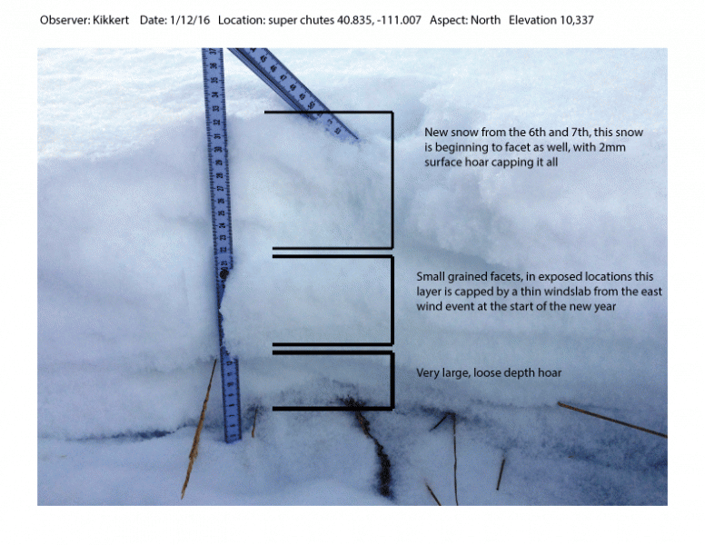
Big differance is snowpack depth and strength- Where the snowpack is deep, shears breaking to weak snow near the ground are getting ragged and lack energy, suggesting a turn towards stronger snow.
|
 |
weather Increasing clouds with snow developing later this morning. Westerly winds blow in the 30's along the high peaks, with a bump in wind speeds late this afternoon. Temperatures rise into the low 30's and dip into the 20's overnight. We might squeak out 2"-4" of snow by Tuesday morning, then see a break, with another system slated for late Tuesday and Wednesday.
|
| general announcements Remember your information can save lives. If you see anything we should know about, please participate in the creation of our own community avalanche advisory by submitting snow and avalanche conditions. You can call me directly at 801-231-2170, email [email protected], or email by clicking HERE This is a great time of year to schedule a free avalanche awareness presentation for your group or club. You can contact me at 801-231-2170 or email [email protected]. To register for the first in our series of on-the-snow sled specific classes you can register here. The information in this advisory is from the US Forest Service which is solely responsible for its content. This advisory describes general avalanche conditions and local variations always occur. The information in this advisory expires 24 hours after the date and time posted, but be will be updated by 7:00 AM on Tuesday, January 19th.
|


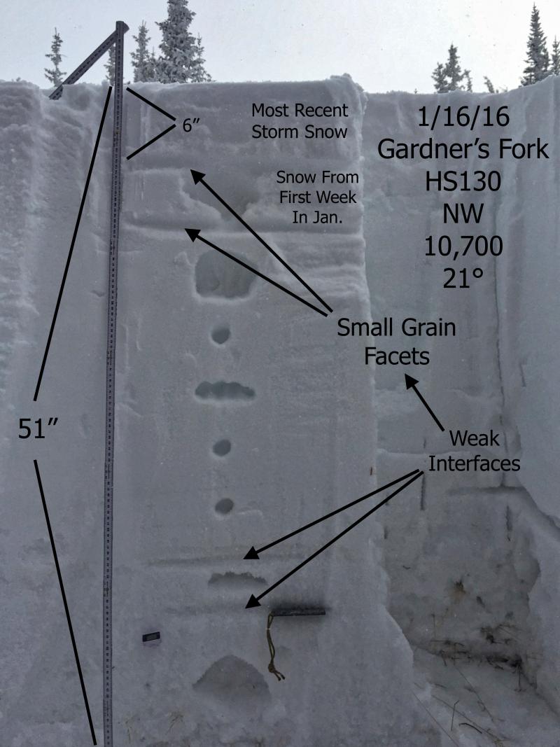

 Where the snowpack is shallow, it's a weak sugary mess. This snowpit is from a slope that avalanched during the Solstice Storm. Now a strong slab rests on top of this gong show, adding a layer of complexity to our current snowpack setup.