| Please join us at the 23rd annual Black Diamond Fall Fundraiser Party Thursday Sept 15. Tickets are on sale now here, at the Black Diamond store & at REI. Special bonus raffle for online ticket purchasers! |
| Please join us at the 23rd annual Black Diamond Fall Fundraiser Party Thursday Sept 15. Tickets are on sale now here, at the Black Diamond store & at REI. Special bonus raffle for online ticket purchasers! |
| Advisory: Uintas Area Mountains | Issued by Craig Gordon for Friday - December 25, 2015 - 4:40am |
|---|


|
bottom line At mid and upper elevations at and above treeline, a HIGH avalanche danger exists, especially on steep, wind drifted terrain facing the north half of the compass. Human triggered avalanches are very likely, particularly on slopes with an easterly component to their aspect. Any slide triggered today will be deep, dangerous, and quite possibly, unsurvivable. The south half of the compass offers CONSIDERABLE avalanche danger and human triggered slides are likely on steep slopes, especially those that had old snow prior to the big Solstice storm. Looking for a place to ride today and avoid avalanches? Simply stick to low angle terrain with no steep slopes above or adjacent to where you're riding or choose big, wide open meadows where you can practice carving deep trenches.
|
 |
special announcement
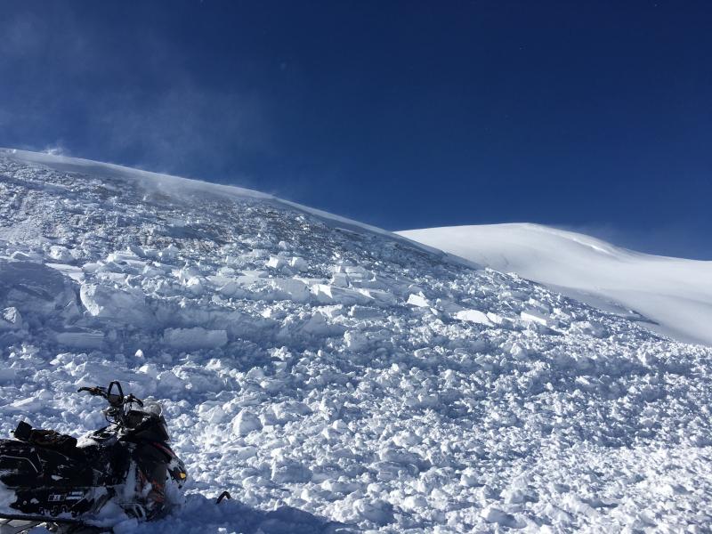
The Uinta's are going off... and not in a good way! Trent grabbed this image of me on the debris of large natural slide that was triggered when winds ramped up Thursday morning. Very dangerous avalanche conditions continue on the eastern front and slides can be triggered not only on steep wind drifted slopes, but also low on the slope and from adjacent terrain. Once triggered, today's avalanches will break deep and wide, taking out the entire seasons snowpack. This is the exact type of setup that leads to avalanche accidents that always have a sad, devastating ending. |
 |
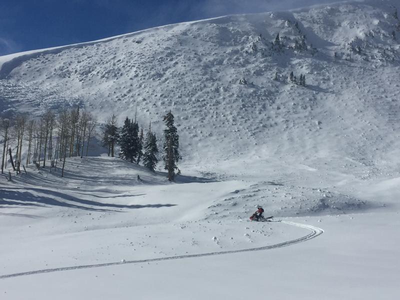
current conditions Bruce and I wanna wish you all a Merry Christmas... baby! Wow... what a great holiday week it's been. The Solstice storm cycle measured in feet, edging in on just about four of them since Tuesday, with a couple inches of light, chin tickling fluff overnight. Winds are light and northerly, blowing 10-15 mph along the high peaks. It's cold this morning with temperatures in the single digits and low teens. Riding and turning conditions are all-time. Yep... it's over-the-head and over-the hood! Trip reports and observations are found here.
|
 |
recent activity
A close call occurred yesterday in between Tower Mountain and Currant Creek Peak. Here is a great firsthand account. Clearly breaking wide and to the ground, avalanche conditions remain quite dangerous. Above, top notch Uinta observer, avalanche professional, and of course, all around great guy, Tyler St. Jeor investigates this recently triggered slide which broke nearly as deep as he is tall! Recent avalanche observations are found here. See or trigger an avalanche? Shooting cracks? Hear a collapse? It's simple. Go here to fill out an observation. |
| type | aspect/elevation | characteristics |
|---|

|

|
LIKELIHOOD
 LIKELY
UNLIKELY
SIZE
 LARGE
SMALL
TREND
 INCREASING DANGER
SAME
DECREASING DANGER
|
|
description
I think we've turned the corner on natural avalanche activity as the snowpack becomes a little more comfortable in its own skin, adjusting to this weeks big storm. Sure much of the range slid naturally and there's reports of avalanches everywhere. Unfortunately, many slopes still hang in the balance waiting for a trigger to come along and tip the scales. Now comes the tricky part. It's pretty much been snowing and blowing all week and it's gonna be hard to tell what slopes are intact and which have already avalanched. Unless you've got a keen eye or you've been carefully tracking a certain zone, your safest bet is to simply avoid steep slopes altogether.
It's pretty straight-forward. All you need to do is add the additional weight of a rider to the slope and the whole mountain shatters like a pane of glass, similar to this slide in Upper Weber Canyon yesterday. If you're caught in one of these monsters the best case scenario is you're buried under feet of bone crushing snow and now the race is on for your partners to find you. Worst case scenario is you're beatened to death by trauma. In either case, I think both options suck. Fact is... conditions remain very scary throughout the range.
|
 |
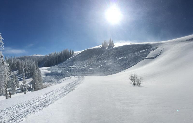
weather Today's storm system delivers another couple of inches of snow before exiting the region later today as high pressure builds. In the mean-time, northerly winds increase throughout the day, blowing into the 30's along the high peaks, and temperatures struggle to climb into the teens. Skies clear tonight and overnight lows crash into negative territory. The weekend looks beautiful with clear skies and slowly warming temperatures.
|
| general announcements Remember your information can save lives. If you see anything we should know about, please participate in the creation of our own community avalanche advisory by submitting snow and avalanche conditions. You can call me directly at 801-231-2170, email [email protected], or email by clicking HERE This is a great time of year to schedule a free avalanche awareness presentation for your group or club. You can contact me at 801-231-2170 or email [email protected]. To register for the first in our series of on-the-snow sled specific classes you can register here. The information in this advisory is from the US Forest Service which is solely responsible for its content. This advisory describes general avalanche conditions and local variations always occur. The information in this advisory expires 24 hours after the date and time posted, but be will be updated by 7:00 AM on Saturday, December 26th by Craig Gordon.
|