| During the month of April, Mark Miller will donate $75 to the charity of your choice (5 to chose from, including the Utah Avalanche Center!) Mark Miller Subaru has raised over $300k in the previous 6 Do Good Feel Good events. More Info here |  |
| During the month of April, Mark Miller will donate $75 to the charity of your choice (5 to chose from, including the Utah Avalanche Center!) Mark Miller Subaru has raised over $300k in the previous 6 Do Good Feel Good events. More Info here | |
| Advisory: Uintas Area Mountains | Issued by Craig Gordon for Saturday - February 14, 2015 - 5:26am |
|---|


|
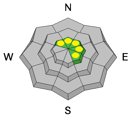
bottom line Most terrain offers a LOW avalanche danger. However, in the wind zone at and above treeline, pockets of MODERATE avalanche danger exist and human triggered slides are possible, especially on wind drifted slopes facing the north half of the compass. Once triggered, avalanches have the potential to break deeper and wider than you might expect, particularly in steep, rocky terrain.
|
 |
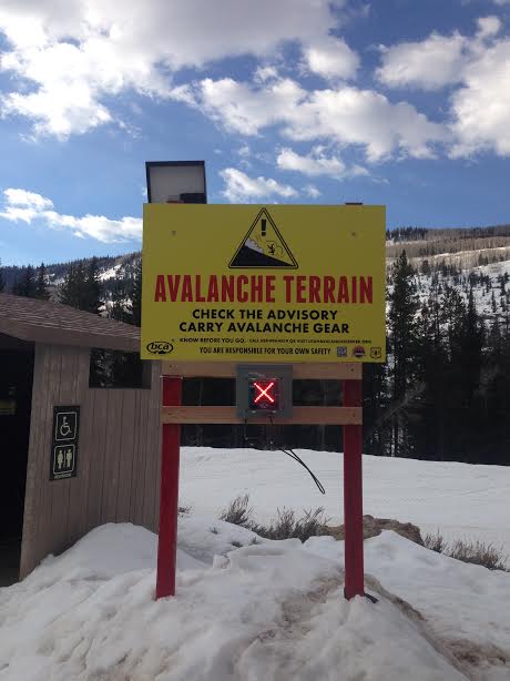
special announcement
We installed an upgraded beacon checker at the Soapstone trailhead. As you might've guessed.... it's right by the restrooms. RESEARCH PROJECT ON UNDERSTANDING TRAVEL BEHAVIOR IN AVALANCHE TERRAIN NEEDS YOU! Scientists from the Snow and Avalanche Lab at Montana State University are seeking more participants for their project examining decision making and travel in avalanche terrain. Their project aims to collect GPS location information (from your smartphone) and survey responses from backcountry skiers and riders to better understand what types of terrain are used and how decisions are made. Their focus is on backcountry skiers and riders of all abilities and experience. For more information: www.montana.edu/snowscience/tracks For snowmobilers: www.montana.edu/snowscience/sleds We just released an exciting, new avy safety video designed specifically for snowmobilers - Knowledge is Powder. https://vimeo.com/113677686 NEW THIS YEAR: You can now receive advisories by email for each region in the state. Go here for details. |
 |
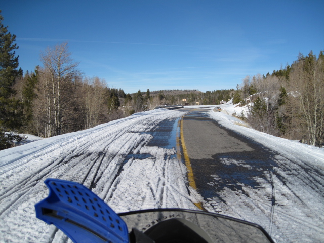
current conditions Not exactly a bluebird out there this morning.... but not a fifty shades of gray bird either. A few high clouds are drifting into the region as a weak cool front slides through the area. Winds are light and westerly, blowing just 5-10 mph even along the highest peaks. What's remarkable are the temperatures.... mid 30's at most locations, near 40 degrees along the ridges. It's a mixed bag out there this morning, but between all the old tracks, sun crusts, and wind funk, high elevation north facing terrain still offers soft, shallow powder. Click here for real-time temperatures, snowfall, and winds.
Trailheads have taken a big hit this week. Pretty amazing for mid February.
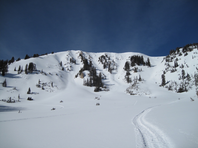
It's worth the struggle to get up high where you'll be rewarded with spectacular views and soft snow.
|
 |
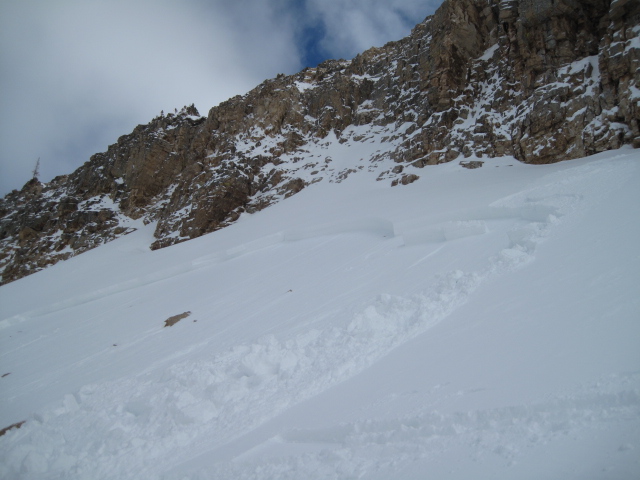
recent activity
This slide was triggered Wednesday. Click here for more details.
This slide was triggered on Tuesday. Click here for more details.
|
| type | aspect/elevation | characteristics |
|---|

|

|
LIKELIHOOD
 LIKELY
UNLIKELY
SIZE
 LARGE
SMALL
TREND
 INCREASING DANGER
SAME
DECREASING DANGER
|
|
description
It's been generally quiet the past few days, however, our string of mid week human triggered avalanches surely can't be ignored. Unusually, by this time of year our snowpack is deep and avalanche conditions are mostly predictable, but several wind events this winter stripped upper elevation east and northeast facing terrain, leaving behind a shallow snowpack that is now weak and sugary, especially in steep, rocky terrain. While avalanches breaking to old snow are an outlier for sure, if you're travels take you to steep, committing terrain, take a moment, think about the consequences of triggering a slide, and have an exit strategy planned.
|
| type | aspect/elevation | characteristics |
|---|

|
|
LIKELIHOOD
LIKELY
UNLIKELY
SIZE
LARGE
SMALL
TREND
INCREASING DANGER
SAME
DECREASING DANGER
|
|
description
Cornices have the potential to break back a bit further than you might expect. In addition, there's a chance that once initiated, a large block of corni can trigger a slab as it crashes down on the slope below.
|
 |
weather Warm, dry high pressure for today with a few high clouds drifting in and out of the area. Winds remain light and westerly and temperatures climb into the mid 40's. Overnight lows dip into the 20's as another cool, dry system affects the region for Sunday. Much colder weather and a few flakes are expected for late Sunday and Monday... we might be able to squeak a few inches out of this system before we go high and dry for the rest of the week.
|
| general announcements Remember your information can save lives. If you see anything we should know about, please participate in the creation of our own community avalanche advisory by submitting snow and avalanche conditions. You can call me directly at 801-231-2170, email [email protected], or email by clicking HERE This is a great time of year to schedule a free avalanche awareness presentation for your group or club. You can contact me at 801-231-2170 or email [email protected] Donate to your favorite non-profit –The Utah Avalanche Center. The UAC depends on contributions from users like you to support our work. Benefit the Utah Avalanche Center when you buy or sell on ebay - set the Utah Avalanche Center as a favorite non-profit in your ebay account here and click on ebay gives when you buy or sell. You can choose to have your seller fees donated to the UAC, which doesn't cost you a penny. Utah Avalanche Center mobile app - Get your advisory on your iPhone along with great navigation and rescue tools. The information in this advisory is from the US Forest Service which is solely responsible for its content. This advisory describes general avalanche conditions and local variations always occur. I will update this advisory by 7:00 AM Sunday Feb. 15, 2015. |


_0.jpg)