| During the month of April, Mark Miller will donate $75 to the charity of your choice (5 to chose from, including the Utah Avalanche Center!) Mark Miller Subaru has raised over $300k in the previous 6 Do Good Feel Good events. More Info here |  |
| During the month of April, Mark Miller will donate $75 to the charity of your choice (5 to chose from, including the Utah Avalanche Center!) Mark Miller Subaru has raised over $300k in the previous 6 Do Good Feel Good events. More Info here | |
| Advisory: Uintas Area Mountains | Issued by Craig Gordon for Wednesday - January 7, 2015 - 6:29am |
|---|

|
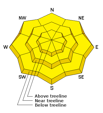
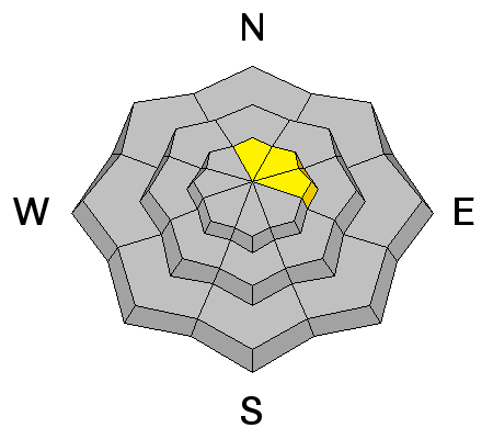
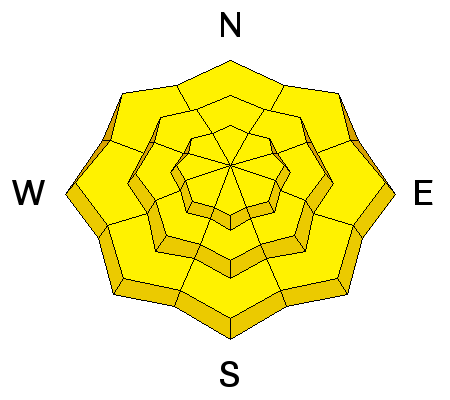
bottom line Today you'll find a MODERATE avalanche danger on steep, rocky, upper elevation slopes facing the north half of the compass and human triggered avalanches are possible. While not widespread and making up a small portion of the terrain available to ride in, once triggered, avalanches still have potential to break to the ground, especially on slopes facing North, Northeast, and East. The danger for wet avalanches rises to MODERATE and human triggered avalanches are possible on all steep, sun exposed slopes as the day heats up.
|
 |
special announcement
Tough crowd out there on the eastern front. You probably wouldn't want to meet these guys in a dark alley, but they were a huge help yesterday assisting me in getting the Uinta weather network back on line. Many thanks to Tyler St. Jeor (Canyons Ski Patrol, Wasatch SAR, and shredding sledder) and a cameo from visiting LaSal UAC forecaster Eric Trenbeth for taking time out of their busy lives and lending a hand. Factoid- Eric helped me get the sled specific avalanche programs off the ground in 1999 and has surely saved many lives through his amazing efforts in outreach and education. Click here for real-time temperatures, snowfall, and winds. We just released an exciting, new avy safety video designed specifically for snowmobilers - Knowledge is Powder. https://vimeo.com/113677686 NEW THIS YEAR: You can now receive advisories by email for each region in the state. Go here for details. |
 |
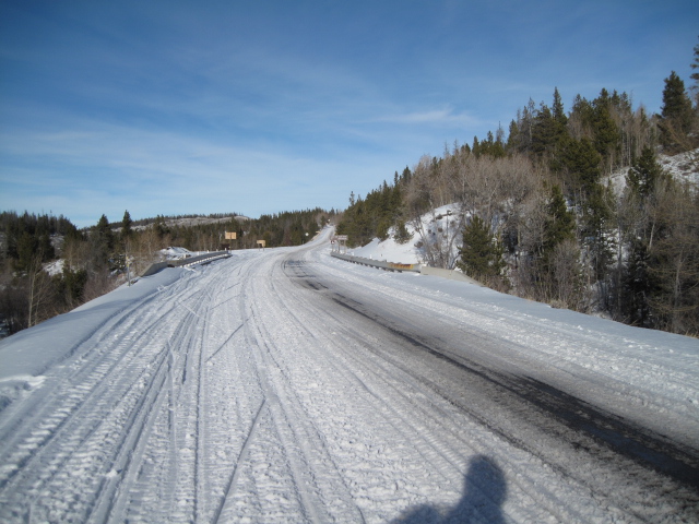
current conditions High pressure over the the region has ushered in very warm temperatures and light easterly winds. Currently, it's a Caribbean-esque, take your shirt off, 30 degrees at most locations, even a few degrees warmer along the high ridges. East-northeast winds are blowing 10-20 mph along the high peaks. Last weeks east winds and this weeks warm temperatures turned the surface snow from hero to zero and all but the highest, shady slopes offer dry snow. Of course, any day in the mountains is better than a day in the valley gunk... the higher you are the better the air. Not a bad proposition.
The heat is on and trailheads are taking a hard hit from the spring-like temperatures.
|
 |
recent activity
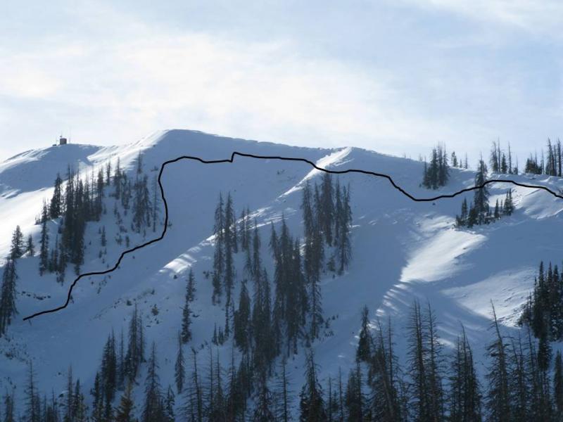
Whilst working on the Currant Creek weather station network we discovered this very large sled triggered slide on Currant Creek Peak. Approximately 1200 ft wide, 4-5 ft deep and breaking to the December midpack facets, the slide ran 600 ft vertically... someone started the New Year off with a bang and a very close call. |
| type | aspect/elevation | characteristics |
|---|

|
|
LIKELIHOOD
 LIKELY
UNLIKELY
SIZE
 LARGE
SMALL
TREND
 INCREASING DANGER
SAME
DECREASING DANGER
|
|
description
While the chances of triggering an avalanche that breaks to deeper buried weak layers in the snowpack are becoming less likely overtime, the consequences remain quite dangerous. The way we deal with low probability/high consequence situations in the mountains is to simply avoid them. It doesn't mean you can't ride steep terrain. Most avy savvy riders are climbing big terrain they know already avalanched to the ground earlier in the season... good call, or just boondocking in wind sheltered terrain where the snow quality is much better. Here's a great video illustrating the kind of avalanche dragon we're dealing with.
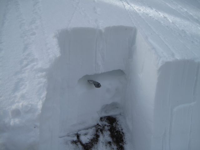
Ted's pit from Gold Hill yesterday reveals the midpack weakness where you can still initiate avalanches which then break to weaker snow near the ground. More on his travels are found here.
|
| type | aspect/elevation | characteristics |
|---|

|
|
LIKELIHOOD
 LIKELY
UNLIKELY
SIZE
 LARGE
SMALL
TREND
INCREASING DANGER
SAME
DECREASING DANGER
|
|
description
Blame it on global weirding... wet avalanches in January are kinda unusual for us, but warm temperatures will lead to damp slides on all steep, sun exposed slopes. Easy to manage by getting off steep slopes when they get damp and manky, you definitely don't want to be in terrain traps like gullies or road cuts where heavy, cement-like debris can pile up very deeply, especially during the heat of the day..
|
 |
weather Not much new in this department. Sunny and warm the next few days with daytime highs soaring into the mid 40's and overnight lows hovering near freezing. A slight cool down is expected for late Friday and Saturday as a weak storm slides to our south. Perhaps a better chance for snow early next week, but the computer jury is still deliberating. |
| general announcements Remember your information can save lives. If you see anything we should know about, please participate in the creation of our own community avalanche advisory by submitting snow and avalanche conditions. You can call me directly at 801-231-2170, email [email protected], or email by clicking HERE This is a great time of year to schedule a free avalanche awareness presentation for your group or club. You can contact me at 801-231-2170 or email [email protected] Donate to your favorite non-profit –The Utah Avalanche Center. The UAC depends on contributions from users like you to support our work. Benefit the Utah Avalanche Center when you buy or sell on ebay - set the Utah Avalanche Center as a favorite non-profit in your ebay account here and click on ebay gives when you buy or sell. You can choose to have your seller fees donated to the UAC, which doesn't cost you a penny. Utah Avalanche Center mobile app - Get your advisory on your iPhone along with great navigation and rescue tools. The information in this advisory is from the US Forest Service which is solely responsible for its content. This advisory describes general avalanche conditions and local variations always occur. I will update this advisory by 7:00 AM Saturday Jan. 10, 2015. |


_0.jpg)