| During the month of April, Mark Miller will donate $75 to the charity of your choice (5 to chose from, including the Utah Avalanche Center!) Mark Miller Subaru has raised over $300k in the previous 6 Do Good Feel Good events. More Info here |  |
| During the month of April, Mark Miller will donate $75 to the charity of your choice (5 to chose from, including the Utah Avalanche Center!) Mark Miller Subaru has raised over $300k in the previous 6 Do Good Feel Good events. More Info here | |
| Advisory: Uintas Area Mountains | Issued by Craig Gordon for Saturday - November 22, 2014 - 5:59am |
|---|

|
bottom line It'll be a tricky day with the avalanche danger rising to CONSIDERABLE by days end, especially on upper elevation, leeward slopes, facing the north half of the compass. Human triggered avalanches are probable in terrain with these characteristics. Triggering even a small slide will expose a myriad of hidden obstacles, resulting in a trauma inducing injury.
|
 |
avalanche warning An Avalanche Warning has been issued for all the mountains of northern Utah. Dangerous avalanche conditions will develop by this afternoon as strong winds and heavy snow overload the preexisting weak snow. This Avalanche Warning is from 3 pm this afternoon through 5 pm Monday. |
 |
special announcement Join us tonight, Nov. 22nd as the Alpine Assassins AA5 Utah film premiere rolls out at the Egyptian Theater in Ogden Utah. Doors open at 6:00 and Movies will start at 7:00. Lots of door prizes, raffles, and giveaways.
|
 |
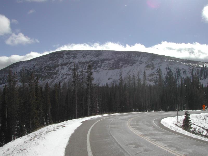
current conditions South and southwest winds are already nuking into the 60's along the high ridges in advance of a powerful winter storm, slated to clobber the region later today. This morning, skies are mostly cloudy and temperatures are in the upper 20's and low 30's. Riding and turning options are very limited to a few patches of high north facing terrain surrounding the region. We're at an awkward stage of the snowpacks existence... white from far, but far from white. Give it a few days and it should be pretty wintry in the high country.
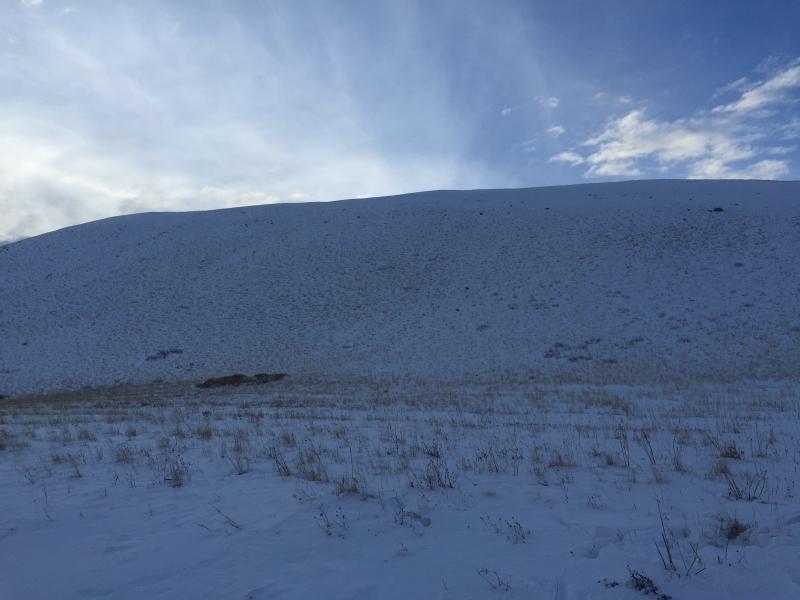
Still quite grassy on the south end of the range by Tower Mountain.
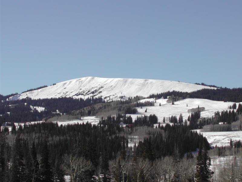
And not much differant in the Whitney Basin near Double Hill. Thanks to Ted Scroggin and Tyler St. Jeor for their great info this week. Their trip reports can be found here. |
 |
recent activity No recent avalanche activity to report.
|
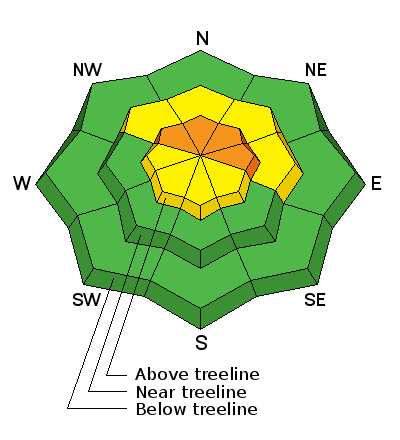
| type | aspect/elevation | characteristics |
|---|

|

|
LIKELIHOOD
 LIKELY
UNLIKELY
SIZE
 LARGE
SMALL
TREND
 INCREASING DANGER
SAME
DECREASING DANGER
|
|
description
Both Mirror Lake Highway and Wolf Creek Pass are open. However, just cause you can see it from the road doesn't necessarily mean it's safe. Your choices for riding or turning are limited to a few patches of high elevation snow facing the north half of the compass... and that's exactly the type of terrain where you could trigger an avalanche today. Underneath this white facade is early season snow that grew weak and sugary and today's ripping winds, along with fresh storm snow will create a supportable slab. Problem is, this supportable slab rests on top of a sugary junk show underneath. Unfortunately, a lot of avalanche accidents and close calls occur early in the season when we don't think there's enough snow to slide. As the storm develops it'll create a dangerous early season setup- strong snow on weak snow. Today, you'll want to look for and avoid any fat, rounded piece of snow, especially if it sounds hollow like a drum. Remember- clues like shooting cracks and booming collapses or whoomphing sounds are huge clues to unstable snow. There's not much snow and triggering a slide will immediately ruin your day, taking you for a nasty ride through rocks and stumps barely hidden underneath the shallow snowpack, resulting in a season ending injury. |
 |
weather A good looking, potent system is headed our way and it looks like a nice shot of snow for the range. Southwest winds are gonna be nuking into the 70's and 80's along the high ridges and temperatures climb into the mid 30's. We should see a few inches of snow during the day, but the main event gets here late this afternoon as the cold front arrives. Cold, moist air slams into northern Utah late in the day, winds switch to the west and then northwest and it should start stomping. A foot of snow is a good bet for Sunday morning and it'll feel like winter with temperatures in the low teens. Looks like a brief break Sunday afternoon then another wave slides through the region late in the day into Monday. |
| general announcements Remember your information can save lives. If you see anything we should know about, please participate in the creation of our own community avalanche advisory by submitting snow and avalanche conditions. You can call me directly at 801-231-2170, email [email protected], or email by clicking HERE This is a great time of year to schedule a free avalanche awareness presentation for your group or club. You can contact me at 801-231-2170 or email [email protected] Donate to your favorite non-profit –The Utah Avalanche Center. The UAC depends on contributions from users like you to support our work. Benefit the Utah Avalanche Center when you buy or sell on ebay - set the Utah Avalanche Center as a favorite non-profit in your ebay account here and click on ebay gives when you buy or sell. You can choose to have your seller fees donated to the UAC, which doesn't cost you a penny. Utah Avalanche Center mobile app - Get your advisory on your iPhone along with great navigation and rescue tools. The information in this advisory is from the US Forest Service which is solely responsible for its content. This advisory describes general avalanche conditions and local variations always occur. I will update this advisory by 7:00 AM Sunday Nov. 23, 2014. |


_0.jpg)