| During the month of April, Mark Miller will donate $75 to the charity of your choice (5 to chose from, including the Utah Avalanche Center!) Mark Miller Subaru has raised over $300k in the previous 6 Do Good Feel Good events. More Info here |  |
| During the month of April, Mark Miller will donate $75 to the charity of your choice (5 to chose from, including the Utah Avalanche Center!) Mark Miller Subaru has raised over $300k in the previous 6 Do Good Feel Good events. More Info here | |
| Advisory: Uintas Area Mountains | Issued by Craig Gordon for Wednesday - March 26, 2014 - 5:40am |
|---|


|
bottom line In the wind zone, a MODERATE avalanche danger exists on leeward slopes and human triggered avalanches are possible in steep, wind drifted terrain. While not widespread, once initiated, today's avalanches can break deep and wide, creating a very dangerous slide. Mid and low elevation wind sheltered terrain offers a generally LOW avalanche danger.
.
|
 |
current conditions Just like Dylan's, Man in a Long Black Coat, a veil of clouds rolled into the region late last night, keeping overnight temperatures to right around freezing. Southwest winds began ramping up around midnight and are currently blowing 25-50 mph along the high ridges. Snow surface conditions are a mixed bag and It's sort of an in-between day. There will probably be enough fresh snow late in the day for an early evening ride and a dusk patrol might be the ticket.
Upper elevation north facing terrain is a bit wind jacked, but wind sheltered, shady terrain still offers soft, settled snow. Click here for current winds, temperatures, and snowfall throughout the range. Click here for trip reports.
|
 |
recent activity
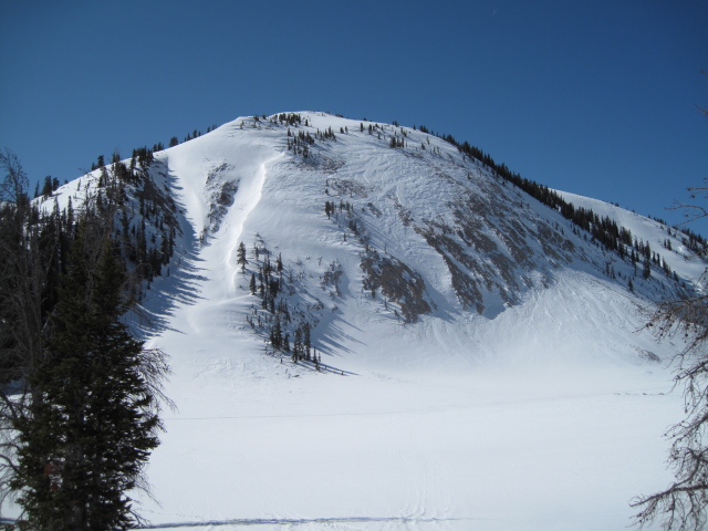
Ted found these recent slides breaking to the ground in steep, rocky terrain on the east side of the range in Millcreek Canyon. More of his trip report from yesterday can be found here. Archived avalanche activity is found here.
|
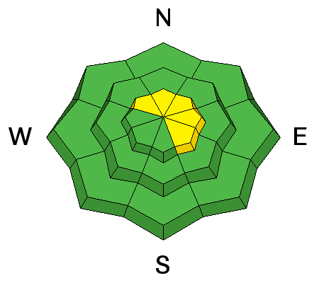
| type | aspect/elevation | characteristics |
|---|

|
|
LIKELIHOOD
 LIKELY
UNLIKELY
SIZE
 LARGE
SMALL
TREND
 INCREASING DANGER
SAME
DECREASING DANGER
|
|
description
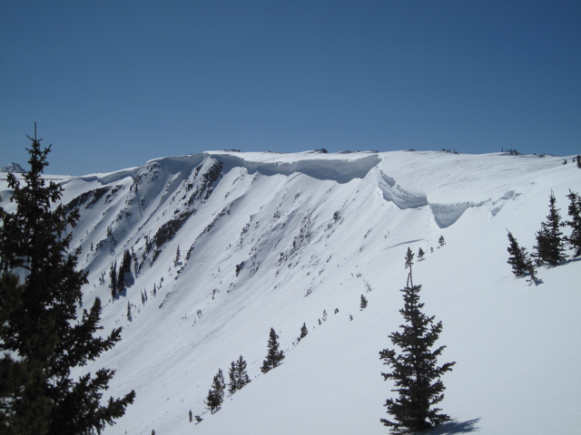
As the storm develops today, strong winds combined with fresh snow will conspire to create drifting along the leeward side of upper elevation ridges. I think today's fresh slabs are gonna be predictable in size and depth. While generally manageable, if you're in a location where winds are cranking you'll definitely want to avoid any fat looking, rounded pillow of snow, especially if they sound hollow like a drum.
.
|
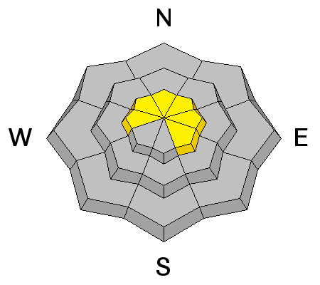
| type | aspect/elevation | characteristics |
|---|

|
|
LIKELIHOOD
LIKELY
UNLIKELY
SIZE
 LARGE
SMALL
TREND
 INCREASING DANGER
SAME
DECREASING DANGER
|
|
description
Each time the wind blows, we see avalanches breaking to weak snow near the ground, particularly in steep, rocky terrain with a thin, shallow snowpack. Strong ridgetop winds are forecast the next few days and this may be enough to again tip the scales. While there's plenty of slopes offering green light conditions, steep, rocky terrain, facing the north half of the compass remains suspect. Unless you have a detailed history of the slope you plan to ride and know it's avalanched to the ground at some point this season, given the consequences, it's best to avoid terrain with these characteristics. |
 |
weather A decent looking shot of snow is at the doorstep and there are two distinct pieces for the next storm. A cold front crosses the region later this morning ushering in a round of snow by about mid morning. A couple inches of snow stacks up during the day before a break in the action later tonight. West and southwest winds blow 20-30 mph with gusts in the 40's and 50's along the high ridges. Temperatures cool slightly throughout the day and overnight lows should dip into the teens. Round two moves into the region early tomorrow morning, bringing more persistent snowfall through early afternoon. High pressure builds for Friday and Saturday with another round of stormy weather for late Sunday.
|
| general announcements Remember your information can save lives. If you see anything we should know about, please participate in the creation of our own community avalanche advisory by submitting snow and avalanche conditions. You can call me directly at 801-231-2170, email [email protected], or email by clicking HERE This is a great time of year to schedule a free avalanche awareness presentation for your group or club. You can contact me at 801-231-2170 or email [email protected] Donate to your favorite non-profit –The Utah Avalanche Center. The UAC depends on contributions from users like you to support our work. Benefit the Utah Avalanche Center when you buy or sell on ebay - set the Utah Avalanche Center as a favorite non-profit in your ebay account here and click on ebay gives when you buy or sell. You can choose to have your seller fees donated to the UAC, which doesn't cost you a penny. Utah Avalanche Center mobile app - Get your advisory on your iPhone along with great navigation and rescue tools. The information in this advisory is from the US Forest Service which is solely responsible for its content. This advisory describes general avalanche conditions and local variations always occur. I will update this advisory by 7:00 AM on Saturday Mar. 29, 2014 or sooner if conditions warrant. |


_0.jpg)