| During the month of April, Mark Miller will donate $75 to the charity of your choice (5 to chose from, including the Utah Avalanche Center!) Mark Miller Subaru has raised over $300k in the previous 6 Do Good Feel Good events. More Info here |  |
| During the month of April, Mark Miller will donate $75 to the charity of your choice (5 to chose from, including the Utah Avalanche Center!) Mark Miller Subaru has raised over $300k in the previous 6 Do Good Feel Good events. More Info here | |
| Advisory: Uintas Area Mountains | Issued by Craig Gordon for Saturday - February 1, 2014 - 5:49am |
|---|

|
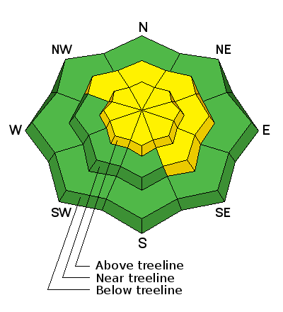
bottom line We have two distinctly different avalanche dragons today resulting in very different outcomes- Manageable- fresh wind drifts in the wind zone where a MODERATE avalanche danger exists and human triggered avalanches are possible on steep, wind drifted slopes.. Not manageable- any avalanche that breaks to old snow near the ground. A scary MODERATE avalanche danger is found on steep, rocky, upper elevation slopes, particularly those facing the north half of the compass. Once triggered, avalanches have the possibility to break deep and wide, creating a dangerous avalanche. Wind sheltered mid and low elevation terrain offers a LOW avalanche danger.
|
 |
special announcement
Join the Utah Avalanche Center and Boondockers on Feb 20 and 22 for another avalanche & riding skills class. Registration is open now. Note that we changed the date from the original class posting. |
 |
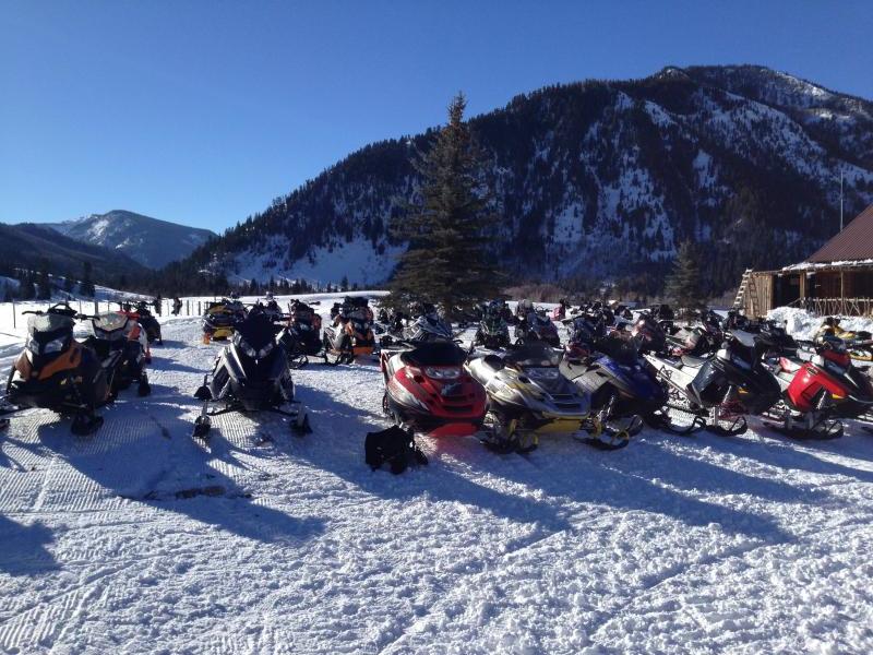
current conditions Skies are partly cloudy, northwesterly winds are blowing 10-15 mph with a few gusts in the mid 20's along the high peaks, and temperatures are just crawling out of negative territory. The midweek storm was good to us and most of the eastern front received a much needed foot of creamy, new snow. The riding and turning conditions are outstanding.... get out and get after it! Click here for current winds, temperatures, and snowfall throughout the range. Click here for trip reports and avalanche observations.
|
 |
recent activity
West and north westerly winds found enough light density storm snow to blow around and form sensitive soft slabs on leeward slopes.
Winds grabbed snow from the huge, open football field and loaded it onto the steep leeward slope to the right of the picture. While certainly manageable in size and depth, I was surprised to see how well connected this piece of snow was. Recent avalanche activity is found here.
|
| type | aspect/elevation | characteristics |
|---|

|
|
LIKELIHOOD
 LIKELY
UNLIKELY
SIZE
 LARGE
SMALL
TREND
 INCREASING DANGER
SAME
DECREASING DANGER
|
|
description
The midweek storm snow seems pretty well behaved. While I found a few shallow soft slabs on the leeward side of upper elevation ridges, there were no surprises as the drifts predictably broke and or below my skis and sled. I think you'll find the same conditions today, but the Uinta's are a big place and as always look for and avoid any fat, rounded, pillow of snow.
.
|
| type | aspect/elevation | characteristics |
|---|

|

|
LIKELIHOOD
 LIKELY
UNLIKELY
SIZE
 LARGE
SMALL
TREND
INCREASING DANGER
SAME
DECREASING DANGER
|
|
description
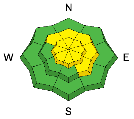
I'm psyched to see deeper snowpack zones show encouraging signs of strengthening and these regions were able to withstand the midweek storm with no issues. However, we don't trigger deep, dangerous avalanches where the pack is thick and strong. We trigger unmanageably scary avalanches where the pack is thin and weak. Steep, upper elevation, rocky slopes, especially those facing the north half of the compass remain suspect and need to be approached with caution. Gather as much information as possible by tweaking small test slopes with similar characteristics before center-punching big terrain. Above all- think about the consequences of triggering a slide that breaks to the ground.
|
 |
weather Look for a few passing snow showers as a weak system grazes the north half of the state. Winds remain northerly, blowing 15-25 along the high peaks. Temperatures climb into the mid teens before crashing into negative territory under clearing skies during the evening. Short-lived high pressure builds for Sunday with computer models suggesting an unsettled pattern for the upcoming week. The first in a series of storms slides through the region late Monday/early Tuesday.
|
| general announcements Remember your information can save lives. If you see anything we should know about, please participate in the creation of our own community avalanche advisory by submitting snow and avalanche conditions. You can call me directly at 801-231-2170, email [email protected], or email by clicking HERE This is a great time of year to schedule a free avalanche awareness presentation for your group or club. You can contact me at 801-231-2170 or email [email protected] Donate to your favorite non-profit –The Utah Avalanche Center. The UAC depends on contributions from users like you to support our work. Benefit the Utah Avalanche Center when you buy or sell on ebay - set the Utah Avalanche Center as a favorite non-profit in your ebay account here and click on ebay gives when you buy or sell. You can choose to have your seller fees donated to the UAC, which doesn't cost you a penny. Utah Avalanche Center mobile app - Get your advisory on your iPhone along with great navigation and rescue tools. The information in this advisory is from the US Forest Service which is solely responsible for its content. This advisory describes general avalanche conditions and local variations always occur. I will update this advisory by 7:00 AM on Sunday Feb. 2, 2014 |


_0.jpg)