
| During the month of April, Mark Miller will donate $75 to the charity of your choice (5 to chose from, including the Utah Avalanche Center!) Mark Miller Subaru has raised over $300k in the previous 6 Do Good Feel Good events. More Info here |  |
| During the month of April, Mark Miller will donate $75 to the charity of your choice (5 to chose from, including the Utah Avalanche Center!) Mark Miller Subaru has raised over $300k in the previous 6 Do Good Feel Good events. More Info here | |
| Advisory: Uintas Area Mountains | Issued by Craig Gordon for Sunday - January 26, 2014 - 5:47am |
|---|

|
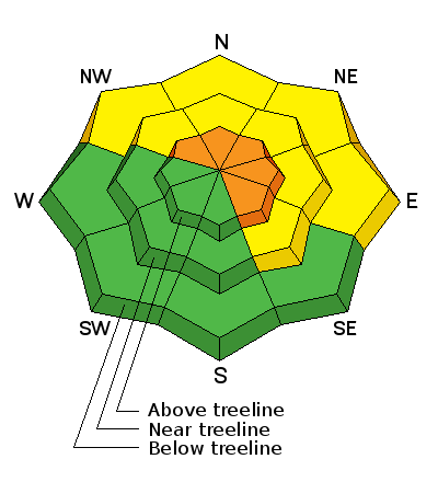
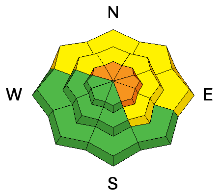
bottom line While not widespread, pockets of CONSIDERABLE danger exist on steep, rocky, leeward slopes in the wind zone.Terrain to avoid- upper elevation slopes facing the north half of the compass, especially those with an easterly component to their aspect. Human triggered avalanches are likely in terrain with these characteristics. Once triggered, today's avalanches have the possibility to break deep and wide, creating a very dangerous avalanche. A MODERATE avalanche danger is found on any steep wind drifted slope at mid elevations. Human triggered avalanches are possible. Go to terrain- If you're looking for LOW avalanche danger, head to wind sheltered terrain, especially where there are no steep slopes above or adjacent to where you're riding.
|
 |
special announcement
Last weekend was so much fun we are going to do it again. Join the Utah Avalanche Center and Boondockers on Feb 20 and 22 for another avalanche & riding skills class. Registration is open now. Note that we changed the date from the original class posting. |
 |
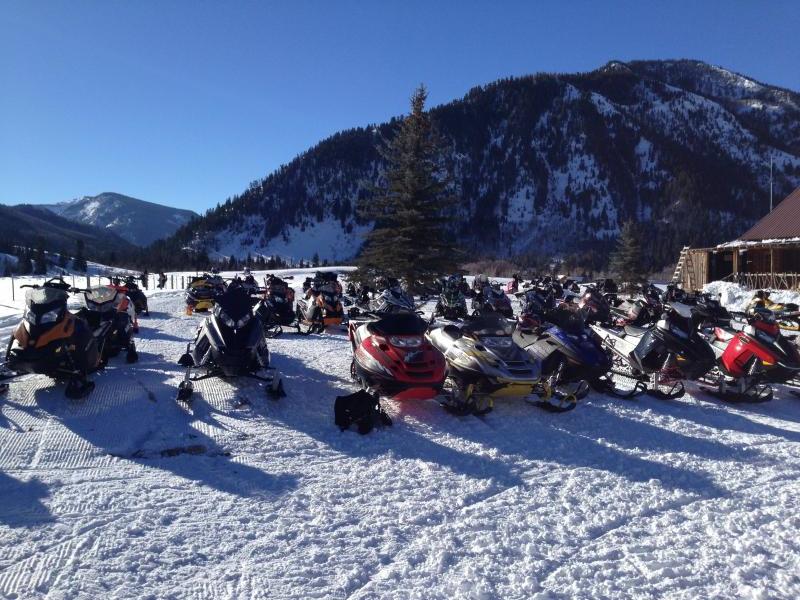
current conditions Head to the fresh air in the mountains where skies are clear, northerly winds are blowing 20-25 mph along the high peaks, and temperatures are a few degrees warmer along the ridges than in the gunk filled valleys. With a little snooping around, you'll find surprisingly good riding conditions on mid elevation wind sheltered slopes.
Click here for current winds, temperatures, and snowfall throughout the range. Click here for trip reports and avalanche observations.
|
 |
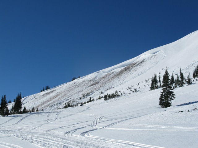
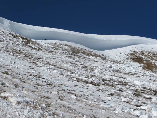
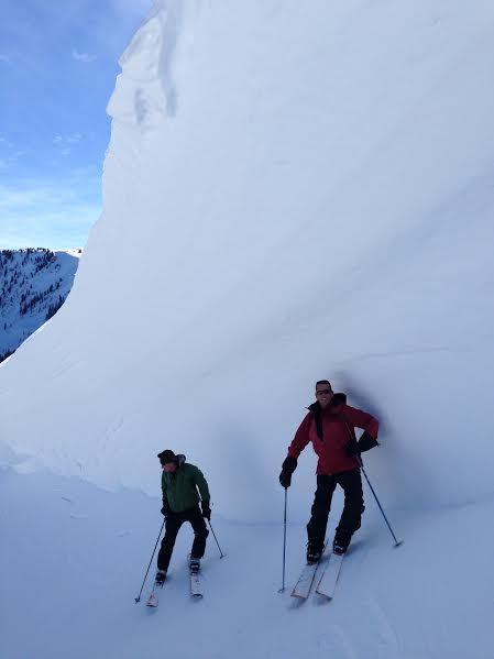
recent activity Many thanks to my partners Ted Scroggin and Trent Meisenheimer for taking time out of their busy lives to scope out this rather large slide on the eastern front... you guys are awesome! A brief viddy describing Uinta conditions can be seen here.
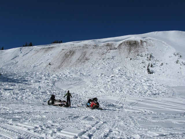
Very large sled triggered slide on Double Hill from earlier in the week.
Trent and his sled are dwarfed by the glacial sized blocks of bone crushing debris.
An overview from the amphitheater... our main man Ted Scroggin tries to digest the enormity of this truly epic slide. Ted knows the Uinta's better than anyone else and has never seen this slope slide this big before.
15'-20' deep and 500' wide, the avalanche ran 800' vertically.
Even the boyz at Mavericks would be impressed with the double overhead conditions in the western Uinta's. More recent avalanche activity is found here.
|
| type | aspect/elevation | characteristics |
|---|

|
|
LIKELIHOOD
 LIKELY
UNLIKELY
SIZE
 LARGE
SMALL
TREND
 INCREASING DANGER
SAME
DECREASING DANGER
|
|
description
Nothing has changed since yesterdays update and it's been two weeks since the big storm cycle rolled through the range. One is for sure... the upper Weber Canyon/Chalk Creek/Whitney Basin zone, experienced the largest avalanche cycle many of us have ever seen. What makes conditions super tricky right now is the fact that you can ride the vast majority of our terrain and not even have to deal with avalanches. Problem is, the snowpack will feel bomber under our skis, board, or sled. And just like a weekend in Vegas, we'll be feelin' pretty good about things and lured deeper into the intoxicating feeling of winning and going big. Unfortunately, all we need to do is a find a weakness (usually around a rock band we can't see under the snow), collapse the slope, and now we're staring down the barrel of a deadly slide. All the recent avalanches we've looked at have a common theme- they're upper elevation, east and northeast facing slopes, and they're fat and heavily windloaded. Best way to avoid the unpredictable is to avoid slopes with these characteristics. The best way to combat the unknown is to manage our terrain choices. Remember... just like Vegas, in an instant we can lose it all and there's no more free buffet. Yeah, it's a roll of the dice and there's a reason the house always wins.
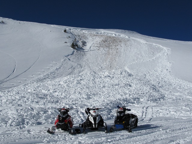
The UAC fleet in front of yet another sled triggered slide in Super Bowl from earlier in the week.
|
 |
weather High pressure remains in place today, giving us yet another beautiful day in the mountains with temperatures rising into the mid 30's. North and northwest winds blow in the 20's and 30's along the high ridges and diminish somewhat overnight. A weak, moisture starved system grazes northeast Utah tonight and tomorrow bringing cooler temperatures, but not much in the way of snow. Looks like a more substantial pattern shift is slated for the middle to latter part of the upcoming week.
|
| general announcements Remember your information can save lives. If you see anything we should know about, please participate in the creation of our own community avalanche advisory by submitting snow and avalanche conditions. You can call me directly at 801-231-2170, email [email protected], or email by clicking HERE This is a great time of year to schedule a free avalanche awareness presentation for your group or club. You can contact me at 801-231-2170 or email [email protected] Donate to your favorite non-profit –The Utah Avalanche Center. The UAC depends on contributions from users like you to support our work. Benefit the Utah Avalanche Center when you buy or sell on ebay - set the Utah Avalanche Center as a favorite non-profit in your ebay account here and click on ebay gives when you buy or sell. You can choose to have your seller fees donated to the UAC, which doesn't cost you a penny. Utah Avalanche Center mobile app - Get your advisory on your iPhone along with great navigation and rescue tools. The information in this advisory is from the US Forest Service which is solely responsible for its content. This advisory describes general avalanche conditions and local variations always occur. I will update this advisory by 7:00 AM on Wednesday Jan. 29, 2014 |


_0.jpg)


 .
.