| During the month of April, Mark Miller will donate $75 to the charity of your choice (5 to chose from, including the Utah Avalanche Center!) Mark Miller Subaru has raised over $300k in the previous 6 Do Good Feel Good events. More Info here |  |
| During the month of April, Mark Miller will donate $75 to the charity of your choice (5 to chose from, including the Utah Avalanche Center!) Mark Miller Subaru has raised over $300k in the previous 6 Do Good Feel Good events. More Info here | |
| Advisory: Uintas Area Mountains | Issued by Craig Gordon for Wednesday - November 27, 2013 - 6:51am |
|---|


|
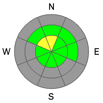
bottom line A MODERATE avalanche danger makes up a very small percentage of our terrain today, but human triggered avalanches are possible. The most likely place to trigger a slide will be in steep, upper elevation terrain, especially on slopes facing north and northwest.. Wind sheltered terrain offers a LOW avalanche danger.
|
 |
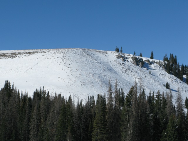
current conditions High pressure over the region is giving us clear skies with light and variable winds along the ridges. Cold air pooled in the usual low laying locations like Mirror Lake where it's in the low teens. Once you climb out of the deep freeze it's quite balmy... in the upper 20's and low 30's. It's pretty grim out there, but patches of soft snow can be found on very wind sheltered. north facing, rock free meadows. Click here for current winds, temperatures, and snowfall throughout the range.
Recent winds have worked what little snow there is in upper elevation exposed terrain, leaving it thin and scoured.
Wind sheltered terrain does offer patches of soft settled snow.
|
 |
recent activity No new avalanche activity to report. |
| type | aspect/elevation | characteristics |
|---|

|
|
LIKELIHOOD
 LIKELY
UNLIKELY
SIZE
 LARGE
SMALL
TREND
 INCREASING DANGER
SAME
DECREASING DANGER
|
|
description
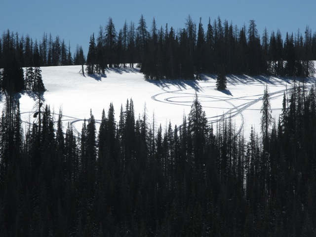
For nearly four days, east and northeast winds punished the western Uinta's, creating unevenly distributed slabs on the leeward side of mid and upper elevation ridgelines. Yesterday, Ted and I found these slabs to be generally unreactive to our additional weight, but they are resting on very weak snow near the ground. Given the consequences of triggering a slide with the early season snow cover, we decided not to pull on the dogs tail too much. While not widespread, today you'll want to continue avoiding any fat or rounded looking piece of snow, especially if it sounds hollow like a drum. Remember- even a small avalanche could take you for a nasty ride through rocks and stumps barely hidden under our shallow snowpack.
|
 |
weather A southerly flow develops today, allowing high clouds to drift into the region late in the day and again tomorrow. Winds remain light and temperatures climb into the low 40's with overnight lows dipping into the mid 20's. Not much change through the early part of the weekend, but a major pattern shift is slated for early next week as we see a deep tough develop over the region. I will keep you posted as details develop. |
| general announcements Remember your information can save lives. If you see anything we should know about, please participate in the creation of our own community avalanche advisory by submitting snow and avalanche conditions. You can call me directly at 801-231-2170, email [email protected], or email by clicking HERE This is a great time of year to schedule a free avalanche awareness presentation for your group or club. You can contact me at 801-231-2170 or email [email protected] Donate to your favorite non-profit –The Friends of the Utah Avalanche Center. The UAC depends on contributions from users like you to support our work. The information in this advisory is from the US Forest Service which is solely responsible for its content. This advisory describes general avalanche conditions and local variations always occur. I will update this advisory by 7:00 AM on Thursday Nov. 28, 2013 |


_0.jpg)