| During the month of April, Mark Miller will donate $75 to the charity of your choice (5 to chose from, including the Utah Avalanche Center!) Mark Miller Subaru has raised over $300k in the previous 6 Do Good Feel Good events. More Info here |  |
| During the month of April, Mark Miller will donate $75 to the charity of your choice (5 to chose from, including the Utah Avalanche Center!) Mark Miller Subaru has raised over $300k in the previous 6 Do Good Feel Good events. More Info here | |
| Advisory: Uintas Area Mountains | Issued by Craig Gordon for Sunday - November 24, 2013 - 5:49am |
|---|

|
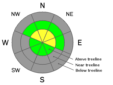
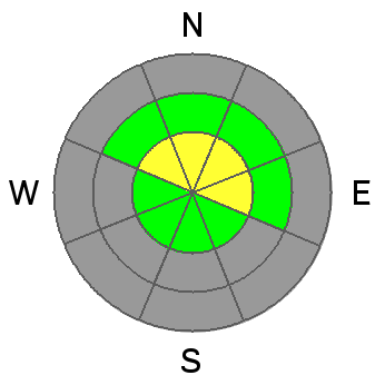
bottom line The avalanche danger is MODERATE today and human triggered avalanches are possible, especially on steep, upper elevation, shady slopes. In terrain with these characteristics, once triggered, todays avalanches have the possibility of breaking to the ground, creating an unmanageable and possibly season ending situation. Wind sheltered terrain offers a LOW avalanche danger.
|
 |
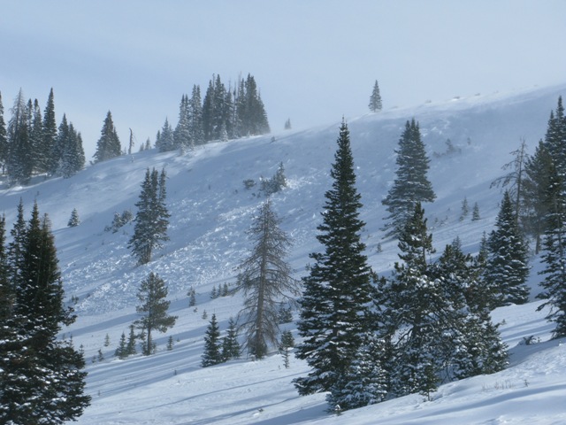
current conditions A flurry or two from last night helped lay down an inch of new snow, but the more welcome news is the winds have finally backed off. Even along the high ridges they're light and variable, blowing 5-10 mph. Temperatures are in the low to mid 20's and skies are mostly cloudy. Riding and turning options remain limited to grassy meadows and rock free roads. Ted was near Gold Hill yesterday and JG near Wolf Creek Pass. You can find their excellent trip reports here. Click here for current winds, temperatures, and snowfall throughout the range.
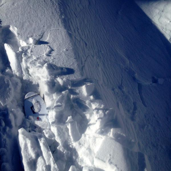
Winds have raked the ridges clean....
forming fat drifts like this...
which will be sensitive to the additional weight of a rider today.
|
 |
recent activity
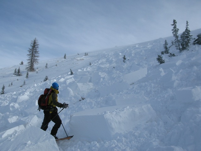
On Friday, Cody and I noticed this slide which broke 3' deep and 300' wide on a steep, heavily wind loaded, northwest facing slope in Wolf Creek Bowl. The avalanche occurred naturally on Friday morning as a result of the strong east winds.
As we approached the ridge the investigate the natural avalanche, we triggered this slide from about 100' away. Same characteristics, both breaking to the ground on weak October snow. More details can be found here.
|
| type | aspect/elevation | characteristics |
|---|

|
|
LIKELIHOOD
 LIKELY
UNLIKELY
SIZE
 LARGE
SMALL
TREND
 INCREASING DANGER
SAME
DECREASING DANGER
|
|
description
Winds are always the big game changer for the western Uintas, but Friday's east winds are a bit odd for us, forming sensitive drifts in unusual locations. Some of the weakest snow in the range is found on upper elevation shady slopes, and this is exactly the kind of terrain that now has a thick, cohesive slab resting on top of the weak, sugary junk show near the ground. The sketchiest conditions are found on upper elevation, northerly facing terrain which retained snow since October. Once triggered, today's avalanches will break deeper and wider than you might expect given the early season conditions, and they'll be packing heat... easily knocking you off your skis, board, or sled and taking you for a nasty ride through rocks and stumps barely hidden under our shallow snowpack. The big ticket for today is heading to a rock free meadow where all the old snow from October melted off.
|
 |
weather Skies should clear as the day progresses, but in the meantime we can expect a few flakes, light winds, and temperatures climbing into the low 30's. Under clear skies, overnight lows dip into the upper teens. High pressure builds for the first half of the week and there are no big pattern changing storms in sight. |
| general announcements Remember your information can save lives. If you see anything we should know about, please participate in the creation of our own community avalanche advisory by submitting snow and avalanche conditions. You can call me directly at 801-231-2170, email [email protected], or email by clicking HERE This is a great time of year to schedule a free avalanche awareness presentation for your group or club. You can contact me at 801-231-2170 or email [email protected] Donate to your favorite non-profit –The Friends of the Utah Avalanche Center. The UAC depends on contributions from users like you to support our work. The information in this advisory is from the US Forest Service which is solely responsible for its content. This advisory describes general avalanche conditions and local variations always occur. I will update this advisory by 7:00 AM on Wednesday Nov. 27, 2013 |


_0.jpg)