

Avalanche Advisory
| Advisory: Uintas Area Mountains | Issued by Craig Gordon for November 18, 2012 - 6:05am |
|---|


Above treeline
Near treeline
Below treeline
|
bottom line Terrain to avoid- steep, upper elevation, north facing slopes above treeline where there's an isolated possibility of human triggered avalanches breaking to the ground. Remember - it's early season - consequences are often severe for someone getting caught and dragged through rocks and stumps in the thin coverage. LOW avalanche danger exists on South facing terrain and slopes that were bare prior to the early November storm.
|

 |
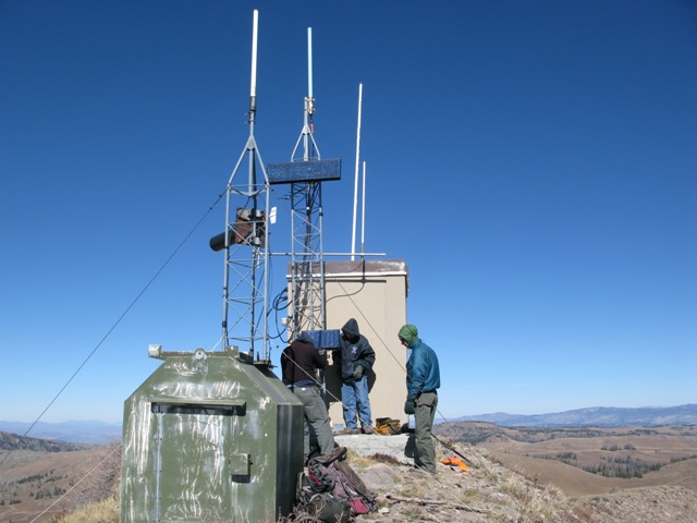
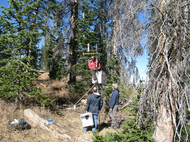
special announcement Welcome to the new look of the avalanche advisory. This past summer we had a series of meetings and negotiated a unified look-and-feel of the avalanche advisories and web pages for other avalanche centers in this region including Jackson, Wyoming, Sun Valley and the Sierra Avalanche Center. Eventually all these sites should look very similar and the plan is for Colorado to join the look next winter. In another week or two we expect to have two viewing choices for the advisory page--this basic view and the "advanced" view most are familiar with from last season with colored danger ratings in the aspect-elevation diagram. We are still in the process of transferring the pages and content from our old website to the new site, so be patient. We are also tweaking the look and design so you may notice some changes. When everything is finished, it should all be pretty cool. In addition, we've expanded our Uinta weather station network adding two more sites near Currant Creek Peak. We're still working on some communication logistics, but expect the data to be flowing through cyberspace by weeks end. I'll provide links on the advisory page when we're up and running.
In partnership with the National Weather Service this season we will have wind and temperature data from Currant Creek Peak.
And real-time snow info for the southern half of the range! This is one of the examples of where your fundraising dollars go to.
|
 |
current conditions Skies are mostly cloudy this morning and temperatures mild. Even the high elevation stations are reporting 30 degrees. The good news... yesterday's little system treated the western Uinta's right, especially the Mirror Lake Highway where 6" of dense, spongy snow stacked up. Outside of the Mirror Lake corridor just 2-4" of snow fell. Southwest winds remain a nuisance blowing 20-30 mph along the ridges and gusting into the mid 40's along the high peaks. The overnight storm is a welcome sight in our hood, however it’s thin out there so go lightly to avoid gear, machine, or bodily damage. Recent observations can be found here. Both Mirror Lake Highway and Wolf Creek Pass remain open, but don't let the easy access to nearby terrain lull you into a false sense of security. Be prepared for your own self rescue. Wear and know how to use a beacon, shovel, and probe. Wondering why last winter was so crazy? Click here to watch the 2011-12 Utah Winter Review... an excellent recap of last years conditions.
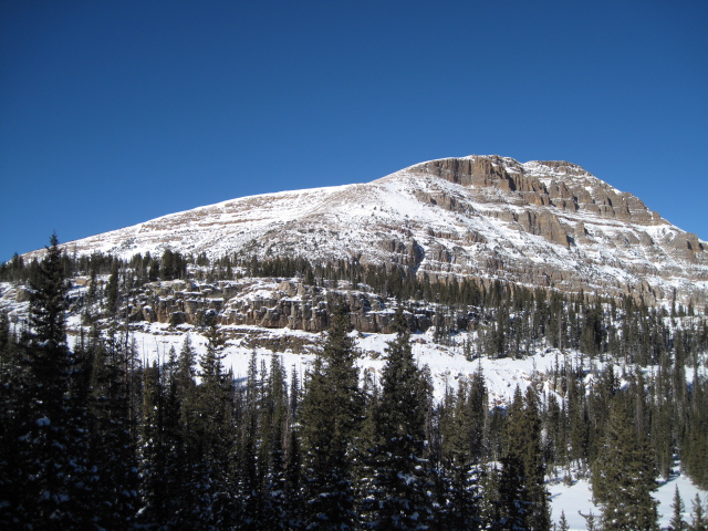
White from far... but far from white. Snow cover remains super thin on the Eastern front. |
 |
recent activity No recent avalanche activity to report.
|
Avalanche Problem 1over the next 24 hours
| type | aspect/elevation | characteristics |
|---|
 |
Above treeline
Near treeline
Below treeline
|
|
|
description
Winds ramped up around midnight and have continued gusting into the 40's through the early morning hours. While shallow and isolated to high elevation north facing terrain, there may be a few fresh wind drifts sensitive to the additional weight of a rider. Given the thin snow cover and all the obstacles barely hidden under this thin facade of snow, triggering even a small slide could have body beating consequences. Best to avoid any steep, wind loaded slope facing the north half of the compass. |

Avalanche Problem 2over the next 24 hours
| type | aspect/elevation | characteristics |
|---|
 |
Above treeline
Near treeline
Below treeline
|
|
|
description
Late October snow never melted off the high north facing slopes. As a matter of fact it has grown weak and sugary overtime and now a denser, cohesive slab rests above this persistent weak layer. Given the overall structure of the snowpack human triggered slides breaking into old snow are possible. I'd be suspicious of steep, rocky, upper elevation north facing terrain where triggering a slide could result in a season ending injury. |
 |
weather A series of moist systems rolls through northern Utah, producing unsettled weather today and tonight. The strongest impulse may hold together enough to deliver 4"-8" of snow overnight before high pressure builds for the early half of the week. Southwest winds will blow 15-25 mph at most locations, gusting into the 30's along the ridges. Temperatures will remain mild with highs in the low to mid 30's. |
| general annoucements Remember your information can save lives. If you see anything we should know about, please participate in the creation of our own community avalanche advisory by submitting snow and avalanche conditions. You can call me directly at 801-231-2170, email [email protected], or email by clicking HERE This is a great time of year to schedule a free avalanche awareness presentation for your group or club. You can contact me at 801-231-2170 or email [email protected] Donate to your favorite non-profit –The Friends of the Utah Avalanche Center. The UAC depends on contributions from users like you to support our work. The information in this advisory expires 24 hours after the date and time posted, but will be updated by 7:00 AM Wednesday November 21st. |