SPECIAL ANNOUNCEMENT |
 |
Sunday, April 15th will be the last of our regularly scheduled advisories for the western Uinta's. |
|
|
BOTTOM LINE
Danger by aspect and elevation on slopes approaching 35° or steeper.
(click HERE for tomorrow's danger rating)
|
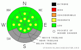
Danger Rose Tutorial
|
Above treeline we're dealing with dry snow issues and fresh wind drifts. Pockets of MODERATE avalanche danger will be found on steep, upper elevation leeward slopes and human triggered avalanches are possible
In addition, wet avalanches will become a concern with daytime heating. While the danger is generally LOW this morning, it will be rising to MODERATE on all steep slopes. Human triggered avalanches will be possible as the snowpack soaks in intense springtime sun. As the snow heats up, simply get off of and out from under steep slopes. |
|
|
CURRENT CONDITIONS |

|
A band of high, thin clouds moved over the region late yesterday, helping to keep temperatures rather mild overnight with lows in the high 20’s. In addition, southwest winds picked up around 9:00 and blew in the 30’s and 40’s along the high ridges. Winds backed off late last night and are currently blowing 15-25 mph. While most low elevation terrain got baked yesterday, up high you’ll still find creamy powder on a supportable, go anywhere base.
|
|
|
RECENT ACTIVITY |

|
No new avalanche activity to report.
Click here to view recent observations. |
|
|
THREAT #1 |

|
| WHERE |
PROBABILITY |
SIZE |
TREND |

|
|
|
|
| |
|
|
Over the next
24 hours.
|
|
|
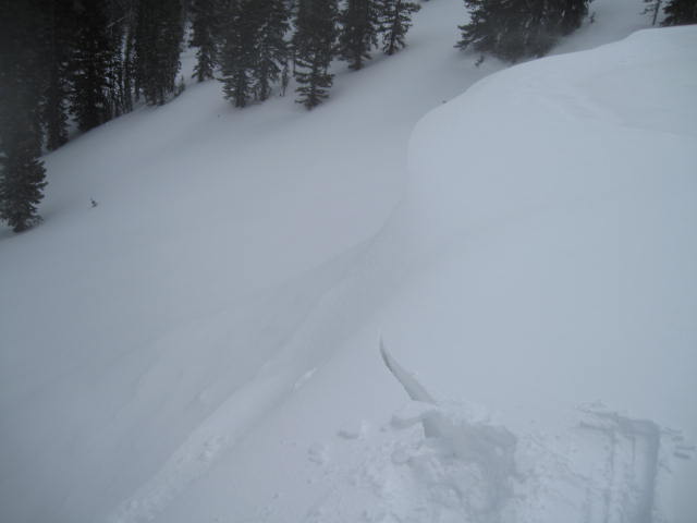
The bump in high elevation winds last night created a few fresh wind drifts which will be sensitive to the weight of a rider this morning. However, these are limited to steep, upper elevation slopes in the wind zone and easy to detect by their rounded appearance. While shallow and predictably breaking at or below your skis, board, or sled, today’s soft slabs are resting on some slick crusts which could trip you up. Perhaps more of a danger is an uncontrolled slide on the ice skating rink surface left behind. |
|
|
THREAT #2 |

|
| WHERE |
PROBABILITY |
SIZE |
TREND |

|
|
|
|
| |
|
|
Over the next
24 hours.
|
|
|

The winter that wasn't. Usually these high elevation south facing slopes in the Whitney Basin hold plenty of late season snow. Not so much the case this spring.
The new snow will take on some heat today, becoming damp and reactive on sustained, steep slopes. These are manageable avalanche conditions which can be avoided by getting off of steep slopes as the day heats up and the snow gets wet and manky. |
|
|
MOUNTAIN WEATHER |

|
Sunny skies, light wind, and warming temperatures are on tap the next few days. High temperatures reach into the upper 40’s with overnight lows in the upper 20’s. A warm southerly flow develops late Tuesday, helping to usher in several days of unsettled weather from Wednesday through next weekend. This could be a good, cold spring storm. |
|
|
GENERAL ANNOUNCEMENTS |
The information in this advisory expires 24 hours after the date and time posted, but will be updated by 7:00 AM Wednesday, April 11th.
If you’re getting out and about and trigger an avalanche or see anything interesting please drop me an email at
craig@utahavalanchecenter.org
or call 801-231-2170 |
|
|
This information does not apply to developed ski areas or highways where avalanche control is normally done. This advisory is from the U.S.D.A. Forest Service, which is solely responsible for its content. This advisory describes general avalanche conditions and local variations always occur. |
|
This advisory provided by the USDA Forest Service, in partnership with:
The Friends of the Utah Avalanche Center, Utah Division of State Parks and Recreation, Utah Division of Emergency Management, Salt Lake County, Salt Lake Unified Fire Authority and the friends of the La Sal Avalanche Center. See our Sponsors Page for a complete list. |
