BOTTOM LINE
Danger by aspect and elevation on slopes approaching 35° or steeper.
(click HERE for tomorrow's danger rating)
|

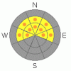
Danger Rose Tutorial
|
The avalanche danger on all steep slopes will rise from Level 1 (LOW) this morning to Level 2 (MODERATE) with daytime heating. Both human triggered wet slabs and sluffs are possible, especially during the heat of the day. While not widespread, pockets of Level 3 (CONSIDERABLE) danger exist, particularly on steep, rocky, north facing slopes with a shallow weak snowpack. |
|
|
CURRENT CONDITIONS |

|
This week’s heat has taken its toll on lower elevation terrain.
Skies are overcast and temperatures are in the low to mid 40’s. A few of the upper elevation weather stations are reporting temperatures near freezing. Southwesterly winds continue to be a nuisance, blowing 20-30 mph at most locations and into the mid 40’s along the high peaks. While most slopes are crusted and hard, you can still find patches of soft settled powder on upper elevation north facing slopes.
|
|
|
RECENT ACTIVITY |

|
No new avalanche activity to report.
Click here to view recent observations. |
|
|
THREAT #1 |

|
| WHERE |
PROBABILITY |
SIZE |
TREND |
|
|
|
|
| |
|
|
Over the next
24 hours.
|
|
|
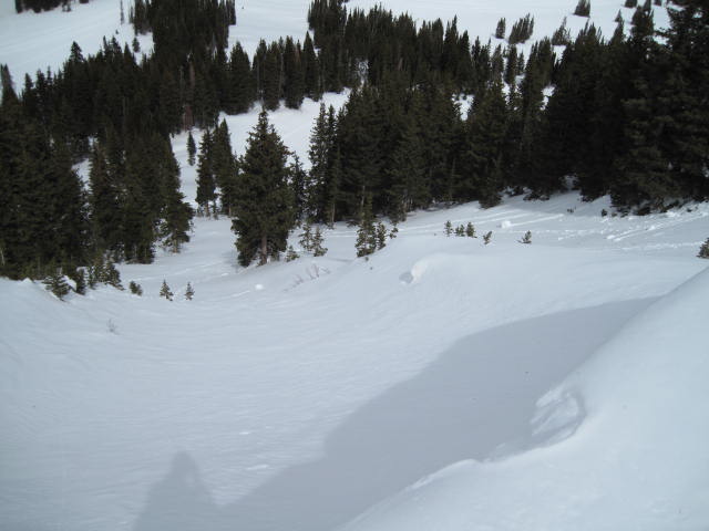
From Ted's excellent observation near the Super Bowl Friday- this would be a likely location where a lingering persistent slab could be triggered. This is a steep north facing slope with a very thin snow pack that has avalanched earlier this season. You can see vegetation sticking up through the snow.
Several nights of above freezing temperatures may help to irritate some of our snowpacks, deeper, weak layer issues. While we haven’t seen or heard of any avalanches breaking to weak layers of snow near the ground, the basic structure of our snowpack remains suspect. Steep, rocky terrain, facing the north half of the compass and slopes that avalanched early in the season are prime examples of the kind of terrain where you could trigger a deep, dangerous avalanche today. |
|
|
THREAT #2 |

|
| WHERE |
PROBABILITY |
SIZE |
TREND |

|
|
|
|
| |
|
|
Over the next
24 hours.
|
|
|
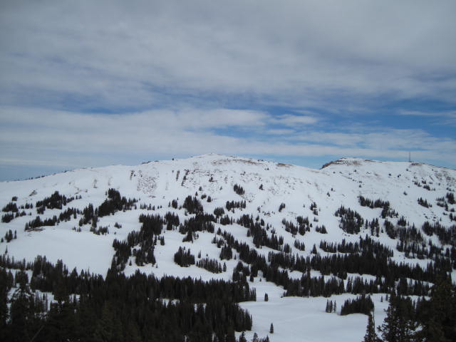
The winter that wasn't... bare ground is seen even in our high terrain where the snowpack is usually deep and fat this time of year.
The combination of strong winds and cloud cover may help to keep the wet avalanche activity at bay. However, if the sun comes out and you feel like an ant under a magnifying glass, simply get off of and out from under steep slopes. In addition, carefully plan your exit strategy so you're not at the bottom of a gully or terrain trap where huge piles of bone crushing debris can bury you very deeply. |
|
|
THREAT #3 |

|
| WHERE |
PROBABILITY |
SIZE |
TREND |

|
|
|
|
| |
|
|
Over the next
24 hours.
|
|
|
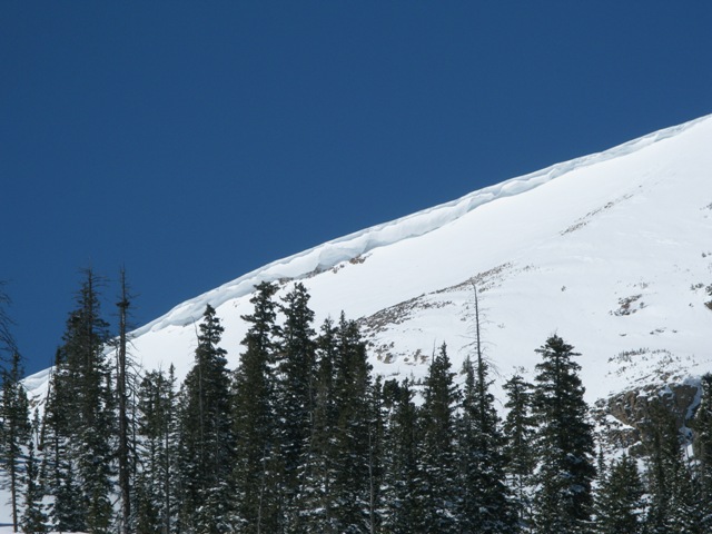
Cornices are large and may break back much further than you might expect. |
|
|
MOUNTAIN WEATHER |

|
High clouds, warm temperatures, and increasingly strong southerly winds are on tap for today. Temperatures climb into the mid 50's and winds should blow 30-40 mph with a few higher gusts along the most exposed ridgelines. A cold front crosses the region late Monday morning and we should see a short-lived burst of heavy snow with accumulations in the 2"-4" range. Look for cloudy and warm weather on Tuesday with another weak storm moving through the region Wednesday night. |
|
|
GENERAL ANNOUNCEMENTS |
The information in this advisory expires 24 hours after the date and time posted, but will be updated by 7:00 AM Wednesday, March 28th.
If you’re getting out and about and trigger an avalanche or see anything interesting please drop me an email at
craig@utahavalanchecenter.org
or call 801-231-2170 |
|
|
This information does not apply to developed ski areas or highways where avalanche control is normally done. This advisory is from the U.S.D.A. Forest Service, which is solely responsible for its content. This advisory describes general avalanche conditions and local variations always occur. |
|
This advisory provided by the USDA Forest Service, in partnership with:
The Friends of the Utah Avalanche Center, Utah Division of State Parks and Recreation, Utah Division of Emergency Management, Salt Lake County, Salt Lake Unified Fire Authority and the friends of the La Sal Avalanche Center. See our Sponsors Page for a complete list. |
