SPECIAL ANNOUNCEMENT |
 |
Many thanks to all who participated in yesterday’s very successful Avy Essentials class. In particular huge thanks to Dan and Nick from Boondockers for all their generous support and to Trent, Reid, and Andy for sharing their expertise with the group… rock on! |
|
|
BOTTOM LINE
Danger by aspect and elevation on slopes approaching 35° or steeper.
(click HERE for tomorrow's danger rating)
|
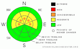
Danger Rose Tutorial
|
If the weather forecast verifies, the avalanche danger will rise from Level 2 (MODERATE) to Level 3 (CONSIDERABLE) on steep, upper elevation, northerly facing terrain at and above treeline. By day’s end human triggered avalanches will be probable on steep wind drifted slopes.
In wind sheltered terrain at lower elevations the avalanche danger will start as Level 1 (LOW) this morning and increase to Level 2 (MODERATE) as the storm evolves. Human triggered avalanches will be possible on steep slopes by late in the day. |
|
|
CURRENT CONDITIONS |

|
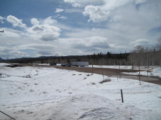
The winter that wasn't. Riding and turning conditions are less than ideal and the snowpack has taken a hard hit this week.
Snow is starting to develop from the south, but is a little late to get going. Just an inch fell overnight and southeast winds are still blowing 30-40 mph along the ridges. Temperatures are in the upper 20’s and low 30’s. It’s a bit burly out there, and until the storm gets underway it might be better to grab a second or third cup of coffee and wait ‘til more snow stacks up. With the long days of spring upon us, a dusk patrol could be in order. |
|
|
RECENT ACTIVITY |

|
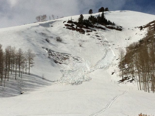
A few wet slabs from late in the week were reported on steep rocky slopes with a thin weak snowpack. Today's temperatures should squelch any wet activity.
Click here to view recent observations. |
|
|
THREAT #1 |

|
| WHERE |
PROBABILITY |
SIZE |
TREND |

|
|
|
|
| |
|
|
Over the next
24 hours.
|
|
|
Once the storm arrives avalanche conditions will be changing, especially during periods of heavy snowfall coupled with strong winds. The new snow is falling on a variety of slick sun and heat crusts which formed during the recent warm spell. The crusts aren’t just isolated to sunny slopes, yesterday we found them on all aspects expect for high north facing slopes where a little soft snow still exists. As the new snow stacks up and winds continue to blow, drifting will become more widespread and shallow soft slabs will become more sensitive to the additional weight of a rider. Most of today’s avalanche issues are going to be found on steep, upper elevation, leeward slopes facing the north half of the compass. |
|
|
MOUNTAIN WEATHER |

|
A cold front moving through the region this morning brings a quick hitting shot of snow, with 6”-8” expected by the end of the day. South and southwest winds blow 20-30 mph along the ridges today, before switching to the west and northwest by around midnight. Temperatures will be dropping throughout the day and overnight lows dive into the mid teens. Light snow continues Monday before tapering off during the night. High pressure builds over the area Tuesday, giving us warm and dry conditions through the week. |
|
|
GENERAL ANNOUNCEMENTS |
The information in this advisory expires 24 hours after the date and time posted, but will be updated by 7:00 AM Wednesday, March 21st.
If you’re getting out and about and trigger an avalanche or see anything interesting please drop me an email at
craig@utahavalanchecenter.org
or call 801-231-2170 |
|
|
This information does not apply to developed ski areas or highways where avalanche control is normally done. This advisory is from the U.S.D.A. Forest Service, which is solely responsible for its content. This advisory describes general avalanche conditions and local variations always occur. |
|
This advisory provided by the USDA Forest Service, in partnership with:
The Friends of the Utah Avalanche Center, Utah Division of State Parks and Recreation, Utah Division of Emergency Management, Salt Lake County, Salt Lake Unified Fire Authority and the friends of the La Sal Avalanche Center. See our Sponsors Page for a complete list. |
