SPECIAL ANNOUNCEMENT |
 |
Through a generous donation by Backcountry.com to our partners the Friends of the Utah Avalanche Center we will continue forecasting until April 24th. I will issue weekend updates for the Uintas through next Sunday. Thanks for all the great support! |
|
|
BOTTOM LINE
Danger by aspect and elevation on slopes approaching 35° or steeper.
(click HERE for tomorrow's danger rating)
|
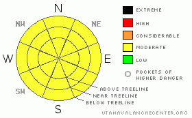
Danger Rose Tutorial
|
A Level 2 (MODERATE) danger for human triggered wet avalanches exists on all steep slopes, particularly at mid and low elevations. Should we experience any significant rainfall, the danger will rapidly rise. In addition, cornices may become more tender, so be sure to steer clear of these huge overhanging boxcars.
While isolated and hard to trigger, a Level 2 (MODERATE) danger exists for human triggered avalanches breaking to the January raincrust. Upper elevation, steep, rocky terrain facing the north half of the compass, should still be considered suspect. |
|
|
CURRENT CONDITIONS |

|
A moist westerly flow continues to camp out over the region. Currently, skies are overcast, temperatures in the mid to upper 30’s, and southwest winds are blowing 30-40 mph along the high ridges. Riding and turning conditions have taken a hard hit in the past few days, but there may be a few patches of soft settled snow in the high country and of course, any day in the mountains is better than a day of chores around the house! |
|
|
RECENT ACTIVITY |

|
No new avalanche activity to report.
Click here for recent observations from around the range. |
|
|
THREAT #1 |

|
| WHERE |
PROBABILITY |
SIZE |
TREND |

|
|
|
|
| |
|
|
Over the next
24 hours.
|
|
|
With a marginal refreeze overnight and rain showers expected for all but the highest elevations, the snow surface will rapidly transform into damp, manky, mashed potatoes. If the sun comes out for any length of time or if you find yourself getting drenched with rain, the avalanche danger will increase accordingly. You may be able to trigger small wet avalanches when side-hilling on steep, mid and lower elevation slopes and those shallow slides may break deeper into the snowpack once things get rolling.. You’ll definitely want to avoid terrain traps like gullies and creek bottoms where the heavy, wet, bone snapping debris will pile up deeply. |
|
|
THREAT #2 |

|
| WHERE |
PROBABILITY |
SIZE |
TREND |

|
|
|
|
| |
|
|
Over the next
24 hours.
|
|
|
I haven’t heard of any avalanches breaking deep into the January raincrust for several weeks now and I’d like to think we’ve finally turned a corner and can put this nemesis to bed. However, this is the time of year we start exploring, getting into steep, crazy terrain we only visit in the spring and my gut tells me steep, rocky, upper elevation terrain facing the north half of the compass should still be considered suspect. While isolated, if you're getting into terrain that has these characteristics, carefully analyze the slope, your escape routes, and think of the consequences of triggering a deep, scary slide. |
|
|
MOUNTAIN WEATHER |

|
Skies will be mostly cloudy with a chance for rain showers at the trailheads and an inch or so of damp, heavy snow along the ridges. West and southwest winds will blow 25-35 mph with gusts in the 50’s especially late this afternoon and evening. High temperatures reach to nearly 50 degrees before dipping into the upper 20’s overnight. Warm and wet weather is on tap for Monday with snow levels rising to about 9,000’. Cold air finally reaches the region Monday night and snow levels should drop to the valley floor. Storm totals will vary greatly with elevation, but the high peaks should see about a foot of new snow. A midweek break is followed by an active pattern late in the week. |
|
|
GENERAL ANNOUNCEMENTS |
The information in this advisory expires 24 hours after the date and time posted, but will be updated by 7:00 AM Saturday, Apr.23rd, 2011.
If you’re getting out and about and trigger an avalanche or see anything interesting please let us know here. Or drop Craig an email : craig@utahavalanchecenter.org or call 801-231-2170 |
|
|
This information does not apply to developed ski areas or highways where avalanche control is normally done. This advisory is from the U.S.D.A. Forest Service, which is solely responsible for its content. This advisory describes general avalanche conditions and local variations always occur. |
|
This advisory provided by the USDA Forest Service, in partnership with:
The Friends of the Utah Avalanche Center, Utah Division of State Parks and Recreation, Utah Division of Emergency Management, Salt Lake County, Salt Lake Unified Fire Authority and the friends of the La Sal Avalanche Center. See our Sponsors Page for a complete list. |
