SPECIAL ANNOUNCEMENT |
 |
April showers… bring spring powder! With a big storm on tap, we’ll open the avalanche center doors and continue issuing advisories through the weekend. |
|
|
BOTTOM LINE
Danger by aspect and elevation on slopes approaching 35° or steeper.
(click HERE for tomorrow's danger rating)
|

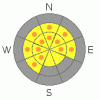
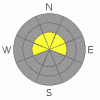
Danger Rose Tutorial
|
At and above treeline the avalanche danger is a Level 2 (MODERATE) and human triggered avalanches are possible on steep wind drifted slopes. As you gain elevation the avalanche danger increases. In the wind zone, along the leeward side of high elevation ridges, pockets of Level 3 (CONSIDERABLE) danger exist and human triggered avalanches are probable.
The danger for wet avalanches on steep, mid and low elevation sun exposed slopes will increase from Level 1 (LOW) this morning to Level 2 (MODERATE) with daytime heating. Human triggered avalanches will be possible, especially during the heat of the day. With heating, cornices may become more tender, so be sure to steer clear of these huge overhanging boxcars.
Isolated to steep, rocky terrain facing the north half of the compass, a Level 2 (MODERATE) avalanche danger exists for human triggered avalanches which break deeply, near or below the January raincrust. |
|
|
CURRENT CONDITIONS |

|
A series of cold Pacific storms is the gift that keeps giving and snow totals in the high terrain throughout the range are nearing two feet. Temperatures are in the low 20’s and winds are blowing 15-30 mph out of the east and southeast. At lower elevations the snow has settled rapidly and got slightly green-housed yesterday, but up high, riding and turning conditions are bordering on epic and the coverage is simply amazing. |
|
|
RECENT ACTIVITY |

|
Shallow soft slabs within the new storm snow have been reported on steep wind drifted slopes. Click here for a great observation Ted captured near Gold Hill.
Click here for recent observations from around the range. |
|
|
THREAT #1 |

|
| WHERE |
PROBABILITY |
SIZE |
TREND |
|
|
|
|
| |
|
|
Over the next
24 hours.
|
|
|
It’s a tale of two snowpacks and up high it’s full on winter conditions. While the snow is settling rather quickly, there’s still plenty of new snow available to blow around and form drifts sensitive to the weight of a rider. Throughout the storm winds have been pretty well behaved, though midday Friday, south and southeasterly winds blew 30-50 mph with gusts in the low 70’s for about five hours. Strong winds created slabs lower downslope than you might expect and loaded slopes that have a westerly component to their aspect…. which is unusual for us. Today, look for and avoid, fat rounded pillows of snow on the leeward side of ridges and around terrain features like chutes and gullies. While most of today’s wind drifts are manageable in size, carefully evaluate each slope on an individual basis, especially when you’re getting into steep wind drifted terrain or riding from one drainage to another.Along the leeward side of high elevation ridges, avalanches triggered within the new snow can break wider and deeper than you might expect and will pack a punch once they get moving. Slope cuts on small test slopes are a great way to gather information and see what kind of avalanche dragon you’re dealing with. |
|
|
THREAT #2 |

|
| WHERE |
PROBABILITY |
SIZE |
TREND |

|
|
|
|
| |
|
|
Over the next
24 hours.
|
|
|
At lower elevations, warmer temperatures and brief glimpses of strong spring sunshine rapidly change the new snow into damp, manky, mashed potatoes. If the sun comes out for any length of time or if we experience a rapid warm up, the avalanche danger will increase accordingly. When you’re seeing roller balls cascading down the slope it means the snow is starting to heat up and it’s time to move to a cooler aspect. In addition, you may be able to trigger small wet avalanches when side-hilling on steep, lower elevation slopes. You’ll definately want to avoid terrain traps like gullies and creek bottoms where the heavy, wet, bone snapping debris will pile up deeply. |
|
|
THREAT #3 |

|
| WHERE |
PROBABILITY |
SIZE |
TREND |
|
|
|
|
| |
|
|
Over the next
24 hours.
|
|
|
While isolated to steep, rocky, upper elevation terrain there's still a possibility you could trigger a deep avalanche that breaks below the January raincrust. If you're getting into terrain that has these characteristics carefully analyze the slope, your escape routes, and think of the consequences. |
|
|
MOUNTAIN WEATHER |

|
After a brief break this morning, snowfall should increase and we’re looking at another good shot by late in the day. An additional foot by morning seems to be a good bet. Winds should begin to switch to the west and northwest and mellow out into the 10-20 mph range, before picking back up late in the day and gusting into the 30’s. Highs temperatures reach into the low 30’s with overnight lows dipping into the teens. Light snow continues Sunday morning before high pressure takes hold late in the day through Monday. A series of smaller storms is on tap for midweek. |
|
|
GENERAL ANNOUNCEMENTS |
The information in this advisory expires 24 hours after the date and time posted, but will be updated by 7:00 AM Sunday, Apr.10th, 2011.
If you’re getting out and about and trigger an avalanche or see anything interesting please let us know here. Or drop Craig an email : craig@utahavalanchecenter.org or call 801-231-2170
The western Uinta advisory program is going full tilt and forecasts will be issued by 7:00 AM on Wednesday, Saturday, Sunday and all holidays. |
|
|
This information does not apply to developed ski areas or highways where avalanche control is normally done. This advisory is from the U.S.D.A. Forest Service, which is solely responsible for its content. This advisory describes general avalanche conditions and local variations always occur. |
|
This advisory provided by the USDA Forest Service, in partnership with:
The Friends of the Utah Avalanche Center, Utah Division of State Parks and Recreation, Utah Division of Emergency Management, Salt Lake County, Salt Lake Unified Fire Authority and the friends of the La Sal Avalanche Center. See our Sponsors Page for a complete list. |
