SPECIAL ANNOUNCEMENT |
 |
Sunday April 4th will be the last of our regularly scheduled Uinta advisories for the season. |
|
|
BOTTOM LINE
Danger by aspect and elevation on slopes approaching 35° or steeper.
(click HERE for tomorrow's danger rating)
|

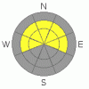
Danger Rose Tutorial
|
The danger of wet avalanches is generally LOW this morning, but will rapidly rise to MODERATE with daytime heating and human triggered avalanches are possible. Be aware- the danger may increase to CONSIDERABLE at lower elevations, especially in steep north facing terrain with a weak shallow snowpack.
In addition, at mid and upper elevations there’s still an isolated possibility of triggering a slide that breaks into weak snow near the ground, especially in steep, rocky terrain facing the north half of the compass. A MODERATE avalanche danger still exists on slopes with these characteristics. |
|
|
CURRENT CONDITIONS |

|
High pressure over the region allowed skies to remain clear overnight and the snowpack received a bomber refreeze. Currently it’s in the low to mid teens and southwesterly winds are generally light, blowing 10-20 mph along the high ridges. Shallow powder can still be found in high, north facing terrain and a bountiful, morning corn harvest waits for early risers on south facing slopes.
|
|
|
RECENT ACTIVITY |

|
A couple of shallow soft slabs were reported yesterday, all occurring just off the ridges in high elevation, steep, wind loaded, north and east facing terrain. |
|
|
THREAT #1 |

|
| WHERE |
PROBABILITY |
SIZE |
TREND |

|
|
|
|
| |
|
|
Over the next
24 hours.
|
|
|
Temperatures rise rapidly today and the danger of wet avalanches will increase as the day wares on. Remember- the sun is high in the sky, beating down on nearly every aspect including due north. At lower elevations some of our weakest snow is found on north facing slopes. As the snow heats up and gets damp and manky it’ll be easy to get the surface snow to sluff and even a shallow wet slide has the potential to gouge into weaker layers of snow as it descends the slope. Fortunately for us, this time of year the avalanche game is pretty straight forward- get off of and out from under steep, sun exposed slopes, especially during the heat of the day. Also, avoid terrain traps like gullies and road cuts where even a small slide can pile up tons of cement-like debris.
|
|
|
THREAT #2 |

|
| WHERE |
PROBABILITY |
SIZE |
TREND |
|
|
|
|
| |
|
|
Over the next
24 hours.
|
|
|
Of course this forecast wouldn’t be complete without the mention of at least an isolated possibility of triggering a slide that breaks on weak, sugary snow near the ground. Remember- our snowpack is only 60-70% of where we should be for this time of year and you know that shallow snow means weak snow. The terrain we normally head to in the spring and “ride it if it’s white” isn’t good to go. In fact, many steep, mid and upper elevation slopes remain thin and weak. If you’re travels take you into big, committing terrain, avoid likely trigger points like steep breakovers or shallow, rocky looking slopes. Above all- think about the consequences of triggering a slide. |
|
|
MOUNTAIN WEATHER |

|
High pressure centered over Utah today, gradually shifts east Monday as a broad Pacific trough noses in from the west. Today we can expect mostly sunny skies, light westerly winds and warming temperatures. Highs at 8,000’ reach into the mid to upper 40’s and at 10,000’ in the upper 30’s. Overnight lows dip into the low 20’s. Winds will increase rapidly late Monday through Tuesday. Anticipate strong and gusty southwest winds at all elevations Tuesday. A vigorous cold front is expected Tuesday night into Wednesday morning with the potential for heavy snow.
|
|
|
GENERAL ANNOUNCEMENTS |
The information in this advisory expires 24 hours after the date and time posted, but will be updated by 7:00 AM Wednesday March 31, 2010.
Sunday April 4th will be the last of our regularly scheduled Uinta advisories for the season.
If you’re getting out and about and trigger an avalanche or see anything interesting please drop us an email at craig@utahavalanchecenter.org or call 801-231-2170
Also, we've installed two beacon checkers exclusively for snowmobiler's- one at the Noblett's Trailhead, the other at the Bear River Trailhead. Thanks to Backcountry Access, the Bear River Lodge for donating one of the units and the great folks at the National Weather Service for their partnership, support and hard work making this project happen. Click here for a brief tutorial. |
|
|
This information does not apply to developed ski areas or highways where avalanche control is normally done. This advisory is from the U.S.D.A. Forest Service, which is solely responsible for its content. This advisory describes general avalanche conditions and local variations always occur. |
|
This advisory provided by the USDA Forest Service, in partnership with:
The Friends of the Utah Avalanche Center, Utah Division of State Parks and Recreation, Utah Division of Emergency Management, Salt Lake County, Salt Lake Unified Fire Authority and the friends of the La Sal Avalanche Center. See our Sponsors Page for a complete list. |
