25th Annual Black Diamond Fall Fundraising Party
Thursday, September 13; 6:00-10:00 PM; Black Diamond Parking Lot
25th Annual Black Diamond Fall Fundraising Party
Thursday, September 13; 6:00-10:00 PM; Black Diamond Parking Lot
| Advisory: Skyline Area Mountains | Issued by Brett Kobernik for Monday - April 9, 2018 - 9:30am |
|---|
 |
special announcement AVALANCHE FORECASTING FOR THE SKYLINE IS FINISHED FOR THE 2017-18 WINTER SEASON WE'LL CONTINUE POSTING AVALANCHES AND OBSERVATIONS WHICH YOU CAN VIEW HERE |
 |
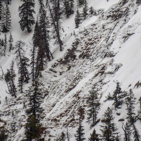
current conditions Thank you to all of our supporters and everyone who helped out by providing me with information about avalanches up in our mountains! Springtime avalanche danger is generally not as dangerous as it is earlier in the winter. However, people still do get caught in avalanches occasionally in the Spring. Here are some typical springtime conditions to watch out for. NEW SNOW: RAPID WARMING AND RAIN: PHOTO BELOW: Example of a wet avalanche that broke to the ground in Ephraim Canyon on April 7 after rain and warm temps
DON'T LET YOUR GUARD DOWN!! Good luck and I'll see you next season! |