25th Annual Black Diamond Fall Fundraising Party
Thursday, September 13; 6:00-10:00 PM; Black Diamond Parking Lot
25th Annual Black Diamond Fall Fundraising Party
Thursday, September 13; 6:00-10:00 PM; Black Diamond Parking Lot
| Advisory: Skyline Area Mountains | Issued by Brett Kobernik for Saturday - March 11, 2017 - 7:03am |
|---|

|
bottom line We have a generally LOW avalanche danger today. It is possible the danger may rise to MODERATE if daytime heating makes the snow overly wet. Move off of and stay out from under slopes that become really wet and sloppy.
|
 |
current conditions A fairly solid "refreeze" of the snow surface happened on Friday night. The snow was locked up and frozen in the morning and then became soft and wet during the daytime heating. With another night with mountain temperatures just below freezing, we should see similar conditions today. |
 |
recent activity During my time out in the backcountry on Saturday, I did not experience any really dangerous avalanche conditions. At one point around noon, we did come upon a short but very steep east facing slope where I was able to easily initiate some wet point release avalanches. Again, they were very small only running about 50 feet in length. However, if the slope had been a larger slope of say 600 to 1000 feet vertical, the avalanches would have entrained quite a bit of snow and would have packed a big enough punch to be considered dangerousl |
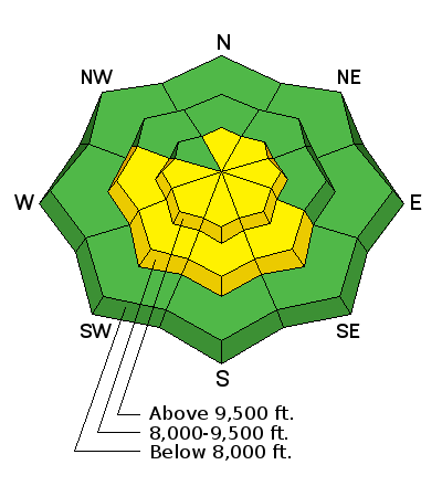
| type | aspect/elevation | characteristics |
|---|

|
|
LIKELIHOOD
 LIKELY
UNLIKELY
SIZE
 LARGE
SMALL
TREND
 INCREASING DANGER
SAME
DECREASING DANGER
|
|
description
Wet avalanche activity is your biggest concern today. Things will be quite stable and safe this morning then potentially become unstable and maybe dangerous as the daytime heating occurs. East facing slopes heat up first, then south then west. Avoid being on very steep terrain especially being in steep walled gullies when the snow starting to rollerball or pinwheel. |
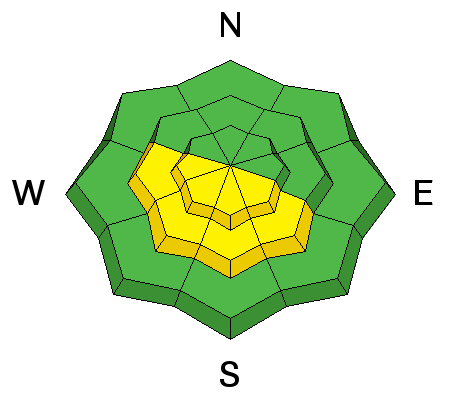
| type | aspect/elevation | characteristics |
|---|

|

|
LIKELIHOOD
 LIKELY
UNLIKELY
SIZE
 LARGE
SMALL
TREND
INCREASING DANGER
SAME
DECREASING DANGER
|
|
description
This is the time of the year when we really need to start giving cornices a lot of respect. We don't know exactly when they decide they want to release and tumble down the mountain. What we do know is that it often starts to occur in the Spring during prolonged heating events. This is what we are looking at now. Avoid being on OR BELOW large cornices right now. |
 |
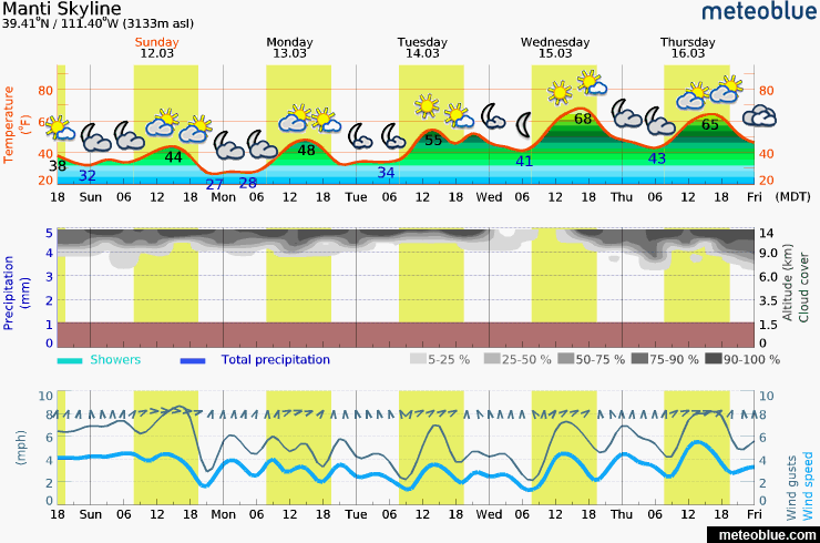
weather We'll see plenty of sun today but there may be some high clouds moving through. Ridgetop temperatures are going to be a few degrees cooler than on Friday with highs in the low 40s. Wind should remain fairly light from the northwest. Conditions look similar on Sunday, perhaps a little warmer. It'll be warmer still into the middle of the week. The weather pattern looks quiet for the next week. Weather models indicate the possibility for some storms around the 23rd.
|
| general announcements We will publish full detailed advisories Saturday and Sunday mornings by 7am. We will also be publishing basic avalanche danger ratings & info during the week. If you are getting out into the mountains, we love to hear from you! You can SUBMIT OBSERVATIONS ONLINE or EMAIL US If you would like to have avalanche advisories emailed to you, SIGN UP HERE We can provide basic avalanche awareness presentations for your school, group or club. To enquire, CLICK HERE |