25th Annual Black Diamond Fall Fundraising Party
Thursday, September 13; 6:00-10:00 PM; Black Diamond Parking Lot
25th Annual Black Diamond Fall Fundraising Party
Thursday, September 13; 6:00-10:00 PM; Black Diamond Parking Lot
| Advisory: Skyline Area Mountains | Issued by Brett Kobernik for Tuesday - February 28, 2017 - 6:56am |
|---|


|
bottom line The avalanche danger is CONSIDERABLE in the higher terrain where we've seen the most new snow and wind. Human triggered avalanches are likely in wind effected terrain above 9500 feet. Wind speeds will increase later today which will increase the avalanche danger. Out of the wind effected terrain and below 9500 feet the avalanche danger is MODERATE. You will greatly reduce the chance of triggering an avalanche if you avoid wind effected terrain today.
|
 |
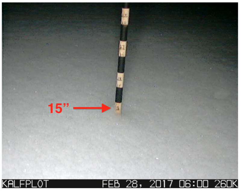
current conditions Strong southwest wind Monday morning no doubt drifted a lot of the low density powder from our previous storm. The wind switched more west mid day and slowed down. New snow totals across the Skyline on Monday varied from 5 to 15 inches. Below is a picture of the storm board in Spring City Canyon which was cleared on Sunday:
Poor visibility on Monday did not allow for very good snow and avalanche assessment of the upper elevations. I did note that in sheltered areas the new snow was somewhat sensitive. My guess is that there probably was some natural avalanche activity along the higher ridges. Considering the recent wind and all of the new powder from the last two storms that was getting blown around yesterday morning, the wise backcountry traveler will let the snowpack settle and stabilize for a day or so before "stepping out" into bigger steeper terrain. "Sidehill" or "ski cut" small steep test slopes with no consequences today to get a feel if the new snow is sensitive. |
 |
weather
|
| general announcements We will publish full detailed advisories Saturday and Sunday mornings by 7am. We will also be publishing basic avalanche danger ratings & info during the week. If you are getting out into the mountains, we love to hear from you! You can SUBMIT OBSERVATIONS ONLINE or EMAIL US If you would like to have avalanche advisories emailed to you, SIGN UP HERE We can provide basic avalanche awareness presentations for your school, group or club. To enquire, CLICK HERE |