| Please join us at the 23rd annual Black Diamond Fall Fundraiser Party Thursday Sept 15. Tickets are on sale now here, at the Black Diamond store & at REI. Special bonus raffle for online ticket purchasers! |
| Please join us at the 23rd annual Black Diamond Fall Fundraiser Party Thursday Sept 15. Tickets are on sale now here, at the Black Diamond store & at REI. Special bonus raffle for online ticket purchasers! |
| Advisory: Skyline Area Mountains | Issued by Brett Kobernik for Saturday - December 5, 2015 - 6:44am |
|---|


|
bottom line The majority of the mountain terrain has a LOW avalanche danger. There is an isolated MODERATE avalanche danger along the highest more east facing slopes where the recent wind has formed fresh drifts which might release if provoked.
|
 |
current conditions Ridgetop temperatures are in the mid teens to low 20s this morning. The wind is the most notable weather feature. After a very calm week, southwest winds finally picked up into the moderate speed range late Thrusday and into Friday. They have switched around to the northwest and have slowed slightly. |
 |
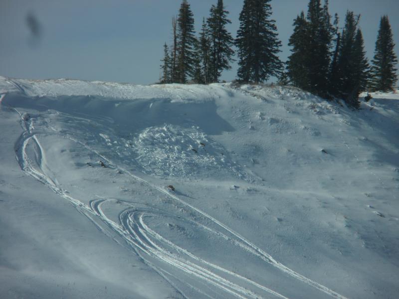
recent activity There were a couple of small cornice falls or small wind drifts that released naturally during the slight bump in wind. It is possible that one of these little pockets was triggered by a snowmobile.
Small avalanche on The Big Drift near Skyline Summit, SR31.
|
| type | aspect/elevation | characteristics |
|---|

|

|
LIKELIHOOD
 LIKELY
UNLIKELY
SIZE
 LARGE
SMALL
TREND
 INCREASING DANGER
SAME
DECREASING DANGER
|
|
description
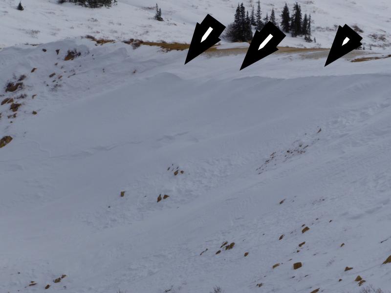
The small fresh drifts seem somewhat sensitive. The wind has drifted snow on top of faceted weak snow on the ground. That weak snow will collapse if the drift is provoked by a person. I stopped on a drift in a flat location yesterday and when my partner pulled up on his machine, the drift collapsed and I felt it settle a few inches under me. These sensitive drifts are only right along the more east facing ridgelines. They are generally in areas where people wouldn't be traveling right now due to the very shallow snowpack.
Example of recent drifts along the higher east facing ridges.
|
 |
weather We'll see a few clouds this morning but mostly clear skies today. Northwest winds will be in the moderate speed category and high temperatures along the upper ridges will be near 30. Winds shift around to the southwest and increase in speed slightly on Sunday with high temperatures a bit warmer than today. There will be some weather disturbances clipping northern Utah through the mid portion of the week. This probably won't do much more than produce clouds along the Skyline. Weather models are hinting at a more significant storm for late in the week. |
| general announcements We will publish full detailed advisories Saturday and Sunday mornings by 7am. We will also be publishing basic avalanche danger ratings & info during the week. If you are getting out into the mountains, we love to hear from you! You can SUBMIT OBSERVATIONS ONLINE or EMAIL US If you would like to have avalanche advisories emailed to you, SIGN UP HERE We can provide basic avalanche awareness presentations for your school, group or club. To enquire, CLICK HERE |