| During the month of April, Mark Miller will donate $75 to the charity of your choice (5 to chose from, including the Utah Avalanche Center!) Mark Miller Subaru has raised over $300k in the previous 6 Do Good Feel Good events. More Info here |  |
| During the month of April, Mark Miller will donate $75 to the charity of your choice (5 to chose from, including the Utah Avalanche Center!) Mark Miller Subaru has raised over $300k in the previous 6 Do Good Feel Good events. More Info here | |
| Advisory: Skyline Area Mountains | Issued by Craig Gordon for Saturday - December 20, 2014 - 6:57am |
|---|

|
bottom line Pockets of MODERATE avalanche danger exist on steep wind drifted slopes and human triggered avalanches are possible. Out of the wind zone the avalanche danger is generally LOW.
|
 |
avalanche watch THIS AVALANCHE WATCH IS FOR THE WASATCH...BEAR RIVER AND WESTERN UINTA MOUNTAIN RANGES AND FOR THE NORTHWESTERN PORTIONS OF THE WASATCH PLATEAU. A WARM WINTER STORM WITH HEAVY SNOW AND STRONG WINDS WILL RAPIDLY INCREASE THE AVALANCHE DANGER BEGINNING TONIGHT AND CONTINUING THROUGH MONDAY. |
 |
special announcement We just released an exciting, new avy safety video designed specifically for snowmobilers - Knowledge is Powder. https://vimeo.com/113677686 NEW THIS YEAR: You can now receive advisories by email for each region in the state. Go here for details.
|
 |
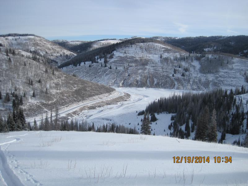
current conditions Skies are mostly cloudy, winds are light and variable, and temperatures are in the upper 20's and low 30's. With average snow depths only in the 18" range, it's still relatively shallow on the Skyline.
Until we get more snow, low angle, rock free meadows and road rides are your best bet right now. |
 |
recent activity No avalanche activity to report.
|
| type | aspect/elevation | characteristics |
|---|

|

|
LIKELIHOOD
 LIKELY
UNLIKELY
SIZE
 LARGE
SMALL
TREND
 INCREASING DANGER
SAME
DECREASING DANGER
|
|
description
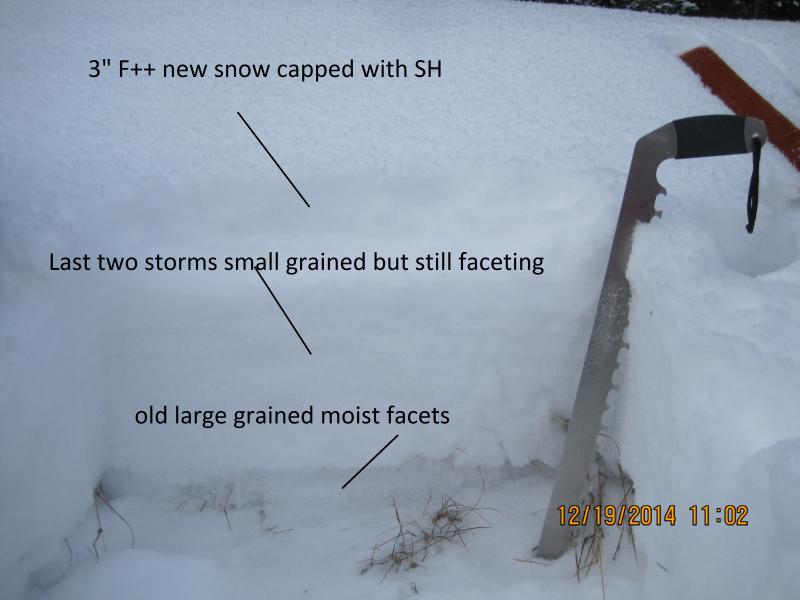
Storms have been splitting around us and we've been getting skunked on the Skyline this season. As a result, it's been a relatively benign avalanche year. However, the snow that is on the ground is losing it's strength, we've got a tricky setup, and it looks like winter is deciding to return from its hiatus. With a warm, wet, and windy storm on tap for tonight and Sunday the avalanche danger will be on the rise. There's plenty of light density snow to blow around and winds are expected to increase later today. As the storm develops and winds begin to ramp up, I suspect fresh drifts will break wider and deeper than you might expect. While mostly manageable this morning, by days end these fresh slabs could be packing a punch and you'll want to avoid any steep slope with recent deposits of wind drifted snow.
The weak and sugary surface snow will be no match for the dense, heavy snow and strong winds expected tonight and tomorrow. Steve, Darce, and Cody were out stomping around yesterday and their great insight on the conditions can be found here. |
 |
weather Today we can expect increasing clouds, light snow, and temperatures climbing into the 30's. Southwest winds ramp up tonight, and Sunday will be warm and wet. As the storm settles in over the region Southwest winds will be cranking into the 40's and 50's along the high peaks. Hard to say if this storm will dive far enough south to slam the Skyline with a huge dump... we might just be on the southern edge. I'm cautiously optimistic for 6"-12" by the time the storm winds down on Monday.
|
| general announcements We're still interested in snow and avalanche information. If you see anything we should know about, please participate in the creation of our own community avalanche advisory by submitting snow and avalanche conditions. You can call me directly at 801-231-2170, email [email protected], or email by clicking HERE Donate to your favorite non-profit –The Utah Avalanche Center. The UAC depends on contributions from users like you to support our work. Benefit the Utah Avalanche Center when you buy or sell on ebay - set the Utah Avalanche Center as a favorite non-profit in your ebay account here and click on ebay gives when you buy or sell. You can choose to have your seller fees donated to the UAC, which doesn't cost you a penny. Utah Avalanche Center mobile app - Get your advisory on your iPhone along with great navigation and rescue tools. The information in this advisory is from the US Forest Service which is solely responsible for its content. This advisory describes general avalanche conditions and local variations always occur. I will update this advisory by 7:00 AM Sunday Dec. 21, 2014. |


.jpg)