
| During the month of April, Mark Miller will donate $75 to the charity of your choice (5 to chose from, including the Utah Avalanche Center!) Mark Miller Subaru has raised over $300k in the previous 6 Do Good Feel Good events. More Info here |  |
| During the month of April, Mark Miller will donate $75 to the charity of your choice (5 to chose from, including the Utah Avalanche Center!) Mark Miller Subaru has raised over $300k in the previous 6 Do Good Feel Good events. More Info here | |
| Advisory: Skyline Area Mountains | Issued by Craig Gordon for Saturday - March 22, 2014 - 6:18am |
|---|


|
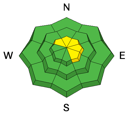
bottom line Overall, the avalanche danger is MODERATE this weekend and human triggered avalanches are possible on steep, wind drifted slopes. While not widespread, avalanches still have the possibility to break deep and wide, especially on steep, rocky, upper elevation terrain facing the north half of the compass. As the sun bakes the snow surface, the danger of wet avalanches will rise to MODERATE. Human triggered avalanches are possible on steep, sunny slopes with daytime heating.
|
 |
special announcement Saturday March 29th will be the last of our regularly scheduled advisories for the 2013-14 season. |
 |
current conditions Skies are overcast, temperatures in the mid to upper 20's, and west-northwest winds are blowing 10-20 mph along the high ridges surrounding the Skyline. Snow surface conditions are a mixed bag and a lot of our terrain got jacked from Tuesday's hurricane force wind event. Damaging snow at nearly every elevation, winds were strong enough to blow bark off the trees. Could be a good day to get the taxes done and wait for the mid week storm to freshen things up. Darce and Steve were in Seeley Canyon yesterday. Their trip report can be found here.
|
 |
recent activity No new avalanche activity to report.
|
| type | aspect/elevation | characteristics |
|---|

|
|
LIKELIHOOD
 LIKELY
UNLIKELY
SIZE
 LARGE
SMALL
TREND
 INCREASING DANGER
SAME
DECREASING DANGER
|
|
description
While not widespread, there could be a few tired old wind slabs that'll be reactive to the additional weight of a rider today. Lurking on the leeward side of upper elevation ridges and around terrain features like chutes and gullies, these will appear fat and rounded and sound hollow like a drum. Mostly predictable in depth and width, take care that a stiff wind slab doesn't knock you off your feet, especially in steep, unforgiving, high consequence terrain. |
| type | aspect/elevation | characteristics |
|---|

|

|
LIKELIHOOD
 LIKELY
UNLIKELY
SIZE
 LARGE
SMALL
TREND
 INCREASING DANGER
SAME
DECREASING DANGER
|
|
description
The good news is, the old weak snow from early in the season has gained some strength, especially where the snowpack is deep. However, where the pack remains shallow, like around bushes and rocks barely hidden under the snow, there are still places where a person may still be able to trigger a large avalanche that breaks to the ground. Steep, rocky slopes facing the north half of the compass remain suspect and should be approached with caution. Chances for triggering a deep scary avalanche this weekend are low but consequences are high. |
| type | aspect/elevation | characteristics |
|---|

|

|
LIKELIHOOD
LIKELY
UNLIKELY
SIZE
LARGE
SMALL
TREND
 INCREASING DANGER
SAME
DECREASING DANGER
|
|
description
The sun is high in the sky and it's intense this time of year, rapidly heating the snow surface. Make sure you have an exit strategy planned when slopes become wet during the heat of the day. Avoid being below steep slopes and in confined terrain such as gullies where wet, cement-like snow can pile up very deeply.. |
 |
weather Overcast skies and a few flurries are on tap this morning as weak storm system slides through the region. West and northwest winds gust into the 20's and 30's along the summit and temperatures climb into the mid 30's. Skies should clear later today and overnight lows dip into the upper teens. Warm, dry weather is on tap for Sunday through midweek. A quick hitting storm moves into the area for Wednesday before high pressure returns for next weekend. |
| general announcements Donate to your favorite non-profit –The Utah Avalanche Center. The UAC depends on contributions from users like you to support our work.
Benefit the Utah Avalanche Center when you buy or sell on ebay - set the Utah Avalanche Center as a favorite non-profit in your ebay account here and click on ebay gives when you buy or sell. You can choose to have your seller fees donated to the UAC, which doesn't cost you a penny.
Utah Avalanche Center mobile app - Get your advisory on your iPhone along with great navigation and rescue tools. The information in this advisory is from the US Forest Service which is solely responsible for its content. This advisory describes general avalanche conditions and local variations always occur. This advisory will be updated by 7:00 AM Saturday, March 29th, 2014 or sooner if conditions warrant. |


.jpg)