| During the month of April, Mark Miller will donate $75 to the charity of your choice (5 to chose from, including the Utah Avalanche Center!) Mark Miller Subaru has raised over $300k in the previous 6 Do Good Feel Good events. More Info here |  |
| During the month of April, Mark Miller will donate $75 to the charity of your choice (5 to chose from, including the Utah Avalanche Center!) Mark Miller Subaru has raised over $300k in the previous 6 Do Good Feel Good events. More Info here | |
| Advisory: Skyline Area Mountains | Issued by Craig Gordon for Sunday - December 8, 2013 - 6:10am |
|---|

|
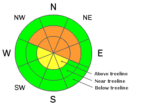
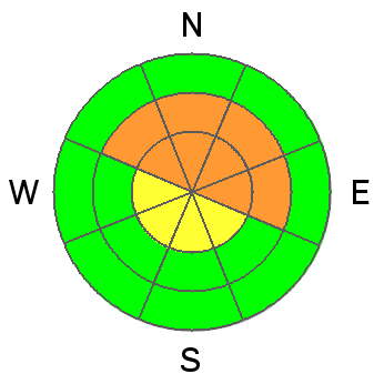
bottom line A CONSIDERABLE avalanche danger will be found on steep, wind drifted, mid and upper elevation slopes and human triggered avalanches are likely. Terrain to avoid is steep, rocky, leeward slopes, especially where solid feeling slabs overlay weak sugary snow near the ground. In terrain with these characteristics avalanches have the possibility to break wide and deep, creating an unmanageably large and dangerous slide. Upper elevation south facing terrain offers MODERATE avalanche danger and human triggered slides are possible on steep wind drifted slopes. Low elevation terrain and slopes that were bare prior to yesterday's big storm offer a LOW avalanche danger.
|
 |
current conditions Wow.... what a great storm for the Skyline! Yesterday's system parked over the region dumping 12"-15" of light density, in your face snow. Under mostly cloudy skies temperatures are in the low single digits and winds are generally out of the west, blowing 10-15 mph. On Friday, our intrepid observers, Darce Trotter and Steve Cote, were out there braving the brutally cold temps and in general, just killin' it with awesome observations like this.
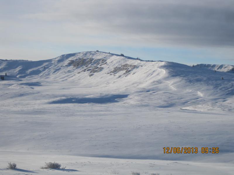
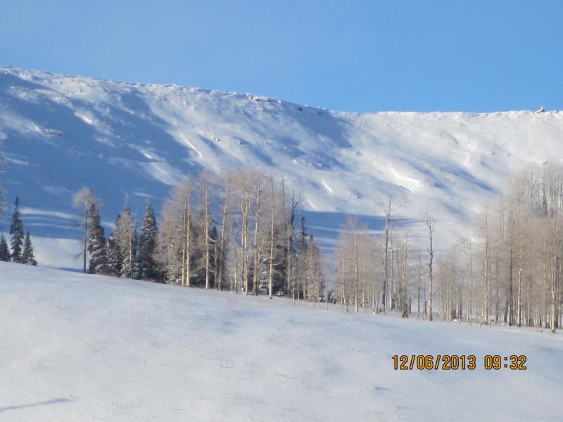
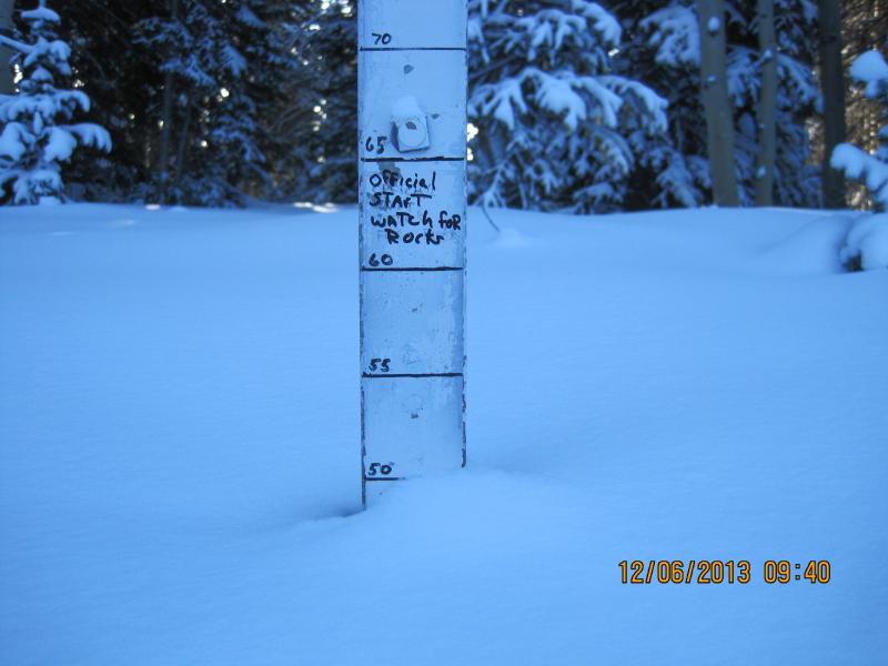
Images of the Skyline prior to yesterday's storm
|
 |
recent activity Visibility was poor yesterday and we didn't hear about any recent avalanche activity. |
| type | aspect/elevation | characteristics |
|---|

|
|
LIKELIHOOD
 LIKELY
UNLIKELY
SIZE
 LARGE
SMALL
TREND
 INCREASING DANGER
SAME
DECREASING DANGER
|
|
description
Wind slabs will be sensitive to the additional weight of a rider today, but they're manageable because they break at or below our skis, board, or sled and we can avoid them by steering clear of fat, round pillows of snow. Not so manageable are slides that break to old snow near the ground. Remember- the early season snowpack is shallow... and a shallow snowpack is a weak snowpack. Overnight we virtually doubled our snowpack and one thing is for sure... snow doesn't like rapid change. The weakest snow we've found is on mid and upper elevation, north facing terrain, especially steep, rocky slopes. Once triggered, today's avalanches have the possibility of breaking deeper and wider than you might expect, easily producing a season ending injury or possibly worse. In either case, look for natures red flags like shooting cracks, whoomphing sounds, and of course the hugest clue... recent avalanches. Wanna avoid avalanche danger altogether? The ticket for the next few days is to head to slopes that were bare prior to yesterday's storm.
|
 |
weather Skies will become partly cloudy with scattered snow showers likely throughout the day. Temperatures climb into the single digits with northwesterly winds blowing 10-15 mph along the ridges. Clear and cold for the first part of the week with a slow warming trend slated for midweek. After that there's much uncertainty as the computer models struggle for a common consensus. |
| general announcements Remember your information can save lives. Please let us and the rest of the community know what your are seeing out there by submitting snow and avalanche conditions. This is a great time of year to schedule a free avalanche awareness presentation for your group or club. Contact either Craig Gordon or Brett Kobernik by emailing us: Donate to your favorite non-profit –The Friends of the Utah Avalanche Center. The UAC depends on contributions from users like you to support our work. The information in this advisory is from the US Forest Service which is solely responsible for its content. This advisory describes general avalanche conditions and local variations always occur. This advisory will be updated by 8:00 PM Friday December 13th or sooner if conditions warrant. |


.jpg)