AVALANCHE WARNING »
Dangerous avalanche conditions are occuring or are imminent.
Backcountry travel in avalanche terrain is not recommended.
|
 |
Notice: THIS AVALANCHE WARNING IS FOR THE MOUNTAINS OF NORTHERN AND CENTRAL UTAH, TO INCLUDE THE BEAR RIVER RANGE, THE WESTERN UINTAS AND THE WASATCH PLATEAU. RAPID WARMING AND DIRECT SUN WILL CREATE DANGEROUS AND UNSTABLE AVALANCHE CONDITIONS. NATURAL AND HUMAN TRIGGERED AVALANCHES ARE LIKELY. BACKCOUNTRY TRAVEL ON OR BELOW STEEP MOUNTAIN SLOPES IS NOT RECOMMENDED OVER THE NEXT FEW DAYS. |
|
|
SPECIAL ANNOUNCEMENT |
 |
Yesterday, a group of snowmobilers triggered a large avalanche in Beaver Basin, in the La Sal Mountains near Moab. One member of the group is still missing and a search to find the buried sledder will resume today. We’ll have more details as they unfold. our thoughts and prayers go out tp the friends and family of the missing sledder. |
|
|
BOTTOM LINE
Danger by aspect and elevation on slopes approaching 35° or steeper.
(click HERE for tomorrow's danger rating)
|

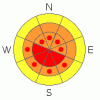
Danger Rose Tutorial
|
The avalanche danger on steep sunny slopes will rise to Level 4 (HIGH) and both human triggered and natural avalanches are likely during the heat of the day.
On shady slopes a Level 3 (CONSIDERABLE) danger exists and human triggered avalanches breaking on a variety of buried weak layers are probable.
The danger of wet avalanches at lower elevations will rise from Level 1 (LOW) this morning to Level 2 (MODERATE) and human triggered avalanches will be possible with daytime heating. |
|
|
CURRENT CONDITIONS |

|
A few rogue clouds are drifting through the region as high pressure begins to build. Temperatures are balmy, in the mid 20’s to low 30's, and winds are light and variable blowing 5-15 mph. South facing slopes took on a bit of heat yesterday, but shady slopes remain soft and creamy. |
|
|
RECENT ACTIVITY |

|
Visibility has been limited to say the least and we haven’t been able to visit any of the big terrain surrounding the Skyline. However, given the big winds and plenty of new snow I’d have to think the region has experienced a pretty significant natural avalanche cycle.
Click here for recent observations from the region. |
|
|
THREAT #1 |

|
| WHERE |
PROBABILITY |
SIZE |
TREND |

|
|
|
|
| |
|
|
Over the next
24 hours.
|
|
|
Recent winds and heavy snowfall have overloaded a variety of weak layers and many slopes wait for a human trigger to come along and knock the legs out from underneath them. Today the storm snow will get its first taste of strong spring sunshine and rapidly warming temperatures. Don't get fooled into thinking we're just dealing with fresh wind drifts. Today, avalanches can break 2’-3’ deep on a layer of weak surface snow formed in early February. They’ll pack a punch, quickly ruining a great day of powder riding. |
|
|
THREAT #2 |

|
| WHERE |
PROBABILITY |
SIZE |
TREND |
|
|
|
|
| |
|
|
Over the next
24 hours.
|
|
|
In addition to steep south facing slopes, mid and lower elevation shady terrain will get baked by the sun today. Remember- wet avalanches can channel tremendous amounts of snow into terrain traps like gullies and road cuts, stacking up huge piles of bone snapping debris. Carefully plan your route back to the rig so you won’t have to deal with any questionable slopes above or adjacent to your exit. |
|
|
THREAT #3 |

|
| WHERE |
PROBABILITY |
SIZE |
TREND |

|
|
|
|
| |
|
|
Over the next
24 hours.
|
|
|
Cornices are ginormous along the leeward side of mid and upper elevation ridges, breaking back further than you might think. |
|
|
MOUNTAIN WEATHER |

|
Warm and dry conditions develop today and Monday. Light winds, sunny skies, and high temperatures slated to soar in to the upper 30’s are a good bet. Lows dip into the upper teens. The next storm system should arrive Tuesday afternoon. |
|
|
GENERAL ANNOUNCEMENTS |
The information in this advisory expires 24 hours after the date and time posted, but will be updated by 7:00 AM Saturday, March 9th. If you’re getting out and about and trigger an avalanche or see anything interesting please drop me an email at craig@utahavalanchecenter.org or call 801-231-2170 Also, now is a great time to schedule one of our free avalanche awareness presentations for your group or club. Email or call me and we’ll get you booked before things get too crazy. |
|
|
This information does not apply to developed ski areas or highways where avalanche control is normally done. This advisory is from the U.S.D.A. Forest Service, which is solely responsible for its content. This advisory describes general avalanche conditions and local variations always occur. |
|
This advisory provided by the USDA Forest Service, in partnership with:
The Friends of the Utah Avalanche Center, Utah Division of State Parks and Recreation, Utah Division of Emergency Management, Salt Lake County, Salt Lake Unified Fire Authority and the friends of the La Sal Avalanche Center. See our Sponsors Page for a complete list. |
