25th Annual Black Diamond Fall Fundraising Party
Thursday, September 13; 6:00-10:00 PM; Black Diamond Parking Lot
25th Annual Black Diamond Fall Fundraising Party
Thursday, September 13; 6:00-10:00 PM; Black Diamond Parking Lot
| Advisory: Salt Lake Area Mountains | Issued by Mark Staples for Saturday - April 1, 2017 - 5:47am |
|---|

|
bottom line The main issue today will be loose wet avalanches that will occur as the day warms. For this reason, the avalanche danger will be MODERATE. At the upper elevations, watch for any fresh wind slabs formed by strong NE winds.
|
 |
special announcement Thanks for everyone that donated to organizations that make living in Utah a better place during yesterday's Love Utah Give Utah. We here at the Utah Avalanche Center gratefully appreciate the support we receive from this amazing community. |
 |
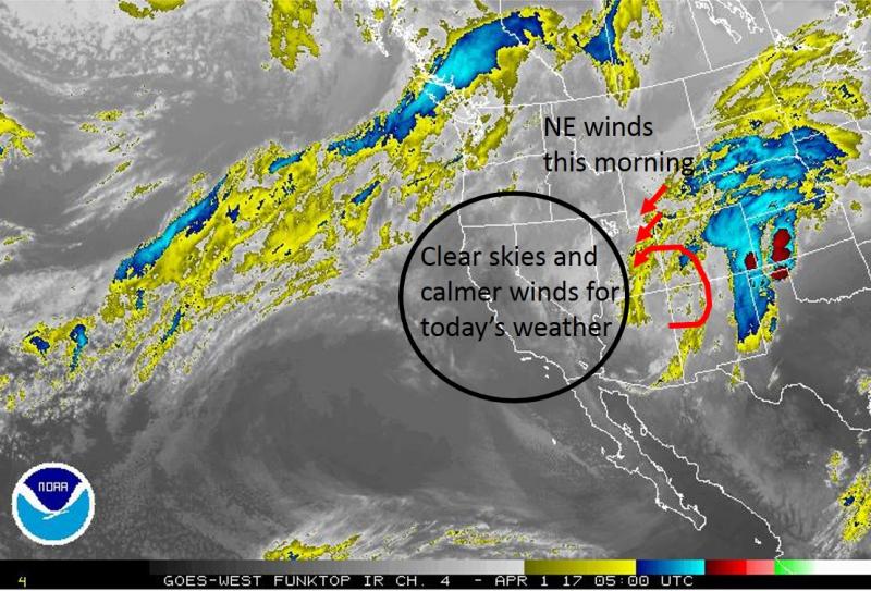
current conditions Yesterday around noon, warming temperatures and low clouds (acting as a greenhouse) made the new snow wet on most slopes up to 10,000 feet. These slopes should have a breakable ice crust this morning. Only a trace of wet snow fell yesterday during the day and none overnight as skies cleared. This morning the freezing line is near 7000 feet and above that elevation temperatures are generally in the mid 20's F. However, the main weather story is strong NE winds which are averaging 20-30 mph at ridgetops and gusting 40-60 mph. These winds are a little crazy blowing strong in one place while much calmer in other places. Even in the wide open terrain of the SLC airport, there has been a huge difference in winds from once side to the other. Week in Review [Detailed Version] This past week has been highlighted by the see-sawing of storm and bluebird days, with avalanche activity ranging from storm and wind slabs during stormy periods, to predictable wet activity on sunny days.
|
 |
recent activity Yesterday afternoon as the snow became wet, there were many loose wet avalanches. Skiers triggered one notable loose wet slide around 3 p.m. in upper Little Cottonwood that ran 600 feet and created debris 4-5 feet deep. Other loose wet slides occurred on Little Superior, Big Cottonwood Canyon and the Park City Ridgeline. |
| type | aspect/elevation | characteristics |
|---|

|
|
LIKELIHOOD
 LIKELY
UNLIKELY
SIZE
 LARGE
SMALL
TREND
 INCREASING DANGER
SAME
DECREASING DANGER
|
|
description
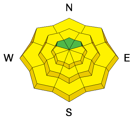
Most slopes should have an ice crust on them this morning which will melt quickly this morning. After this happens, loose wet avalanches should start occurring. |
| type | aspect/elevation | characteristics |
|---|

|
|
LIKELIHOOD
LIKELY
UNLIKELY
SIZE
 LARGE
SMALL
TREND
 INCREASING DANGER
SAME
DECREASING DANGER
|
|
description
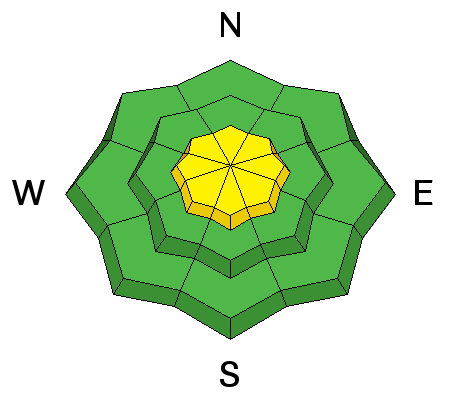
There isn't much snow for this morning's strong NE winds to transport, but they will likely form a few fresh wind slabs worth watching for today at the highest elevations. |
 |
weather Today will have sunny skies and temperatures rising into the upper 30's and low 40's F. By mid morning winds should ease and turn more northerly averaging 5-15 mph. More clouds should arrive Sunday afternoon bringing cooler temperatures and a chance for more snow but no major accumulations.
|
general announcements
|