| Please join us at the 23rd annual Black Diamond Fall Fundraiser Party Thursday Sept 15. Tickets are on sale now here, at the Black Diamond store & at REI. Special bonus raffle for online ticket purchasers! |
| Please join us at the 23rd annual Black Diamond Fall Fundraiser Party Thursday Sept 15. Tickets are on sale now here, at the Black Diamond store & at REI. Special bonus raffle for online ticket purchasers! |
| Advisory: Salt Lake Area Mountains | Issued by Mark Staples for Tuesday - March 15, 2016 - 7:18am |
|---|

|
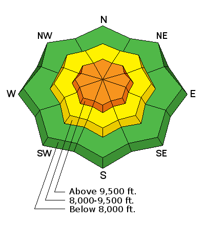
bottom line On upper elevation slopes the avalanche danger is CONSIDERABLE where you will find many fresh wind slabs that will be easy to trigger. At mid elevations the avalanche danger is MODERATE where you can still find some wind slabs. Additionally, triggering an avalanche within the new snow is possible even on non wind loaded slopes.
|
 |
special announcement PLEASE HELP guide our discussions of website maintenance, upgrades or possible changes in coming years. Take this brief survey. As a way of saying thanks we'll be raffling a free avalanche class and other free stuff like hats, beanies, water bottles, etc. Do you need lift tickets to Snowbird, Snowbasin, Sundance, or Nordic Valley? Purchase them HERE at reduced prices. Every penny on these donated tickets benefits the Utah Avalanche Center. Check out our Garage Sale! Chock full of sweet backcountry gear - you can find the goods on our Facebook page here. |
 |
current conditions It's great to see winter come back for a visit even though it felt more like May or June yesterday with heavy rain and lightning yesterday especially in the Ogden area.
|
| type | aspect/elevation | characteristics |
|---|

|

|
LIKELIHOOD
 LIKELY
UNLIKELY
SIZE
 LARGE
SMALL
TREND
 INCREASING DANGER
SAME
DECREASING DANGER
|
|
description
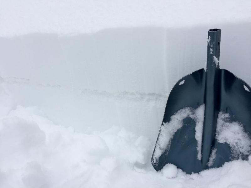
It's a pretty easy formula - when it snows and the wind blows, we get wind slabs that make avalanches. Winds yesterday blew strong from the SW and this morning they are blowing generally from the WNW. A harder question to answer is how much time they need to stablize. As long as snow is falling and the wind is blowing, they should remain sensitive, and for today, it will be easy to trigger fresh wind slabs. |
| type | aspect/elevation | characteristics |
|---|

|
|
LIKELIHOOD
 LIKELY
UNLIKELY
SIZE
LARGE
SMALL
TREND
INCREASING DANGER
SAME
DECREASING DANGER
|
|
description
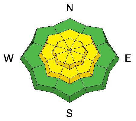
Even in places without any wind loading, I would assess the bond between the new snow and the old snow. The good news is that this is easy to do by jumping on small, steep test slopes. Also, walk or ride above your partner's tracks and see if the snow cracks or slides easily into their tracks.
|
 |
weather Today, snowfall may linger through the morning but increase a bit this afternoon and evening and deliver another 3-5 inches of snow by tomorrow morning. Temperatures will climb a few degrees today but should remain in the teens F above 9000 feet. Winds should blow 10-20 mph generally from the west before shifting to the NW this evening. |
| general announcements Remember your information can save lives. If you see anything we should know about, please help us out by submitting snow and avalanche conditions. You can also call us at 801-524-5304, email by clicking HERE, or include #utavy in your tweet or Instagram. To get help in an emergency (to request a rescue) in the Wasatch, call 911. Be prepared to give your GPS coordinates or the run name. Dispatchers have a copy of the Wasatch Backcountry Ski map. Backcountry Emergencies. It outlines your step-by-step method in the event of a winter backcountry incident. If you trigger an avalanche in the backcountry, but no one is hurt and you do not need assistance, please notify the nearest ski area dispatch to avoid a needless response by rescue teams. Thanks.
EMAIL ADVISORY If you would like to get the daily advisory by email you will need to subscribe here. DAWN PATROL Hotline updated daily by 5-530am - 888-999-4019 option 8. TWITTER Updates for your mobile phone - DETAILS UDOT canyon closures: LINK TO UDOT, or on Twitter, follow @UDOTavy, @CanyonAlerts or @AltaCentral Utah Avalanche Center mobile app - Get your advisory on your iPhone along with great navigation and rescue tools. Powderbird Helicopter Skiing - Blog/itinerary for the day Lost or Found something in the backcountry? - http://nolofo.com/ To those skinning uphill at resorts: it is critical to know the resort policy on uphill travel. You can see the uphill travel policy for each resort here. Benefit the Utah Avalanche Center when you shop from Backcountry.com or REI: Click this link for Backcountry.com or this link to REI, shop, and they will donate a percent of your purchase price to the UAC. Both offer free shipping (with some conditions) so this costs you nothing! Benefit the Utah Avalanche Center when you buy or sell on ebay - set the Utah Avalanche Center as a favorite non-profit in your ebay account here and click on ebay gives when you buy or sell. You can choose to have your seller fees donated to the UAC, which doesn't cost you a penny. This information does not apply to developed ski areas or highways where avalanche control is normally done. This advisory is from the U.S.D.A. Forest Service, which is solely responsible for its content. This advisory describes general avalanche conditions and local variations always exist. |