SPECIAL ANNOUNCEMENT |
 |
The Hellgate-Superior portion of Little Cottonwood road will be closed from 10 am to 11:30 am for a rescue drill. The by-pass road to Alta will be open.
Support the Utah Avalanche Center and get some runs by picking up some discount lift tickets. Donated by Ski Utah and the Utah resorts and all the money goes to the UAC to keep the forecasts and education going. Details and purchase info here.
There are still openings in the Logan area Women’s Backcountry 101, this Thursday night and all day Saturday. For more information, go to the Education page HERE. |
|
|
BOTTOM LINE
Danger by aspect and elevation on slopes approaching 35° or steeper.
(click HERE for tomorrow's danger rating)
|

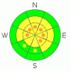
Danger Rose Tutorial
|
Pockets of CONSIDERABLE avalanche danger exist on the steep upper elevation (above about 9,500’) slopes facing westerly to northerly to easterly, for avalanches failing on the facets near the ground. While they may be hard to trigger and can only be triggered in isolated places, any slide breaking near the ground could be unsurvivable. The same weak layer exists on the mid elevation slopes, where once again it is possible to trigger a large avalanche, but only in very isolated areas. Human triggered slides may still be triggered remotely from below.
Lower angle slopes, not locally connected to steeper terrain, remain the safest choice for travel. |
|
|
CURRENT CONDITIONS |

|
Under clear skies, temperatures have cooled once again into the single digits and low teens. The winds are from the south to southeast and have increased slightly in the past few hours, though the even the windiest spots still only have speeds in the 10-15 mph range, with gusts to 20. Enjoyable riding and turning can be had in fast, recrystallized snow on shady slopes, over a mostly supportable base. |
|
|
RECENT ACTIVITY |

|
Sadly, Utah’s third avalanche fatality of the season occurred late Sunday afternoon, near Lost Creek Reservoir, south of I-70, when a group of snowmobilers triggered a large slide from below (photo below), failing on weak facets near the ground. In an insanely long day, Brett put out a forecast, drove south and visited the accident site with two of our observers, and posted a complete accident report HERE.
No reports of activity from the northern part of the state, and explosive testing in the Sessions was negative, with no results. |
|
|
THREAT #1 |

|
| WHERE |
PROBABILITY |
SIZE |
TREND |
|
|
|
|
| |
|
|
Over the next
24 hours.
|
|
|
Checking out the accident report, the avalanche and snowpack characteristics are chillingly similar to those in the northern mountains – a deep hard slab over very weak facets near the ground - in obvious as you travel over it, hard to release in snow pit tests, but with frightening consequences if you do trigger a slide. It is turning into a winter of patience, with no end in sight – we appear to be locked in to an unstable snow pack, and need to continue to look at familiar terrain with new eyes. Keeping travel to low angle terrain, slopes less steep than about 30 degrees, and out from under steep slopes, will help you avoid triggering one of these deadly slides.
The combination of a little snow, wind and settlement is erasing the obvious avalanche history from view, making it even harder to evaluate which slopes have slid and how recently. |
|
|
THREAT #2 |

|
| WHERE |
PROBABILITY |
SIZE |
TREND |

|
|
|
|
| |
|
|
Over the next
24 hours.
|
|
|
There are also a handful of other minor avalanche concerns to keep on your radar -
• It is now easy to trigger small sluffs in the weak surface snow on steep, shady slopes – don’t let one knock you off balance and send you into a tree or off a cliff. This sluffing indicates to me that we now have another well established weak layer, and I’m about ready to place my bet that that the current surface snow will be the most active weak layer with our next storm cycle.
• Wet sluffs – some of the steeper, sunny slopes may heat up enough that it will be possible to initiate wet loose sluffs with a push. And if we get just the right thickness of high thin clouds, snow on shady slopes will heat, too, at low to mid elevations.
• And finally, there are a few lingering old hard wind slabs out there from last week’s easterly winds that are still cracking, but becoming less and less excited about moving. |
|
|
MOUNTAIN WEATHER |

|
After clear skies this morning, there will be increasing high thin clouds this afternoon ahead of a very weak disturbance that could give us a few snow flurries on Wednesday. Temperatures today will warm to near 30 at 8,000’ and to near 20 at 10,000’. The southeasterly winds will remain light, averaging less than 15 mph. The dismal, but perhaps wildlife friendly, forecast for the near future – high pressure Thursday into the early weekend, with a chance for a few weak, splitting disturbances late in the weekend and into next week. |
|
|
GENERAL ANNOUNCEMENTS |
If you trigger an avalanche in the backcountry - especially if you are adjacent to a ski area – please call the following teams to alert them to the slide and whether anyone is missing or not. Rescue teams can be exposed to significant hazard when responding to avalanches, and do not want to do so when unneeded. Thanks.
Salt Lake – Alta Central (801-742-2033)
Ogden – Snowbasin Patrol Dispatch (801-620-1017)
Provo – Sundance Patrol Dispatch (801-223-4150)
Dawn Patrol Forecast Hotline, updated by 05:30: 888-999-4019 option 8.
Twitter Updates for your mobile phone http://utahavalanchecenter.org/twitter)
Daily observations are frequently posted by 10 pm each evening.
Subscribe to the daily avalanche advisory e-mail click HERE.
UDOT canyon closures UDOT at (801) 975-4838
Wasatch Powderbird Guides does daily updates about where they'll be operating on this blog http://powderbird.blogspot.com/ .
You have the opportunity to participate in the creation of our own community avalanche advisory by submitting avalanche and snow observations. You can also call us at 801-524-5304 or 800-662-4140, or email by clicking HERE
Donate to your favorite non-profit –The Friends of the Utah Avalanche Center. The UAC depends on contributions from users like you to support our work.
We will update this forecast tomorrow morning. Thanks for calling. |
|
|
This information does not apply to developed ski areas or highways where avalanche control is normally done. This advisory is from the U.S.D.A. Forest Service, which is solely responsible for its content. This advisory describes general avalanche conditions and local variations always occur. |
|
This advisory provided by the USDA Forest Service, in partnership with:
The Friends of the Utah Avalanche Center, Utah Division of State Parks and Recreation, Utah Division of Emergency Management, Salt Lake County, Salt Lake Unified Fire Authority and the friends of the La Sal Avalanche Center. See our Sponsors Page for a complete list. |
