SPECIAL ANNOUNCEMENT |
 |
Winter is on the doorstep! We will be issuing our first early morning forecast of the season starting tomorrow, Monday, November 7th, 2010, by 7:30 am. |
|
|
BOTTOM LINE
Danger by aspect and elevation on slopes approaching 35° or steeper.
(click HERE for tomorrow's danger rating)
|
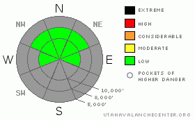
Danger Rose Tutorial
|
The snow pack is mostly stable today, with isolated wind drifts possible along the higher ridgelines. However, a rapid transition to full-on winter starting tomorrow will create an increasing avalanche danger this week, with new snow slides becoming the main concern, especially in wind drifted areas. |
|
|
CURRENT CONDITIONS |

|
The moderate, southerly winds have pushed mountain temperatures into the 30’s and 40’s today. This combination has been shrinking our snow pack all week, with less than 2 feet of snow remaining on most upper elevation northerly facing slopes and just patches of snow on the sunnier slopes. If you’re not getting out today, a quick snap shot of average snow cover is available using the NWS weather cameras, HERE. |
|
|
THREAT #1 |

|
| WHERE |
PROBABILITY |
SIZE |
TREND |

|
|
|
|
| |
|
|
Over the next
24 hours.
|
|
|
The week of warm weather has also been strengthening the pack, and most of the remaining snow at the upper elevation is warm, dense and strong. Generally stable conditions exist today, with a few cracky shallow winds slabs possible at the higher elevations. Starting tomorrow, we’ll be watching for all the standard concerns a storm brings: bonding of the new snow to the old snow surfaces, any instabilities within the new snow, and sensitive wind drifts. The new snow will be the most sensitive on the upper elevation, shaded, northerly facing slopes, where in isolated places the preexisting snow pack includes a thin layer of loose, weak snow at the surface. |
|
|
MOUNTAIN WEATHER |

|
A Winter Storm Watch is in effect from midnight Sunday through Tuesday afternoon. Today’s warm, dry, windy conditions will rapidly changeover to winter as a strong and cold storm system moves through the area late Sunday night through Tuesday, with the heaviest snowfall expected around frontal passage Monday morning. Storm totals of 18-30 inches are possible in the upper Cottonwoods through Tuesday. Colder and unsettled weather will continue through much of the week, with a second storm system expected to move into the area on Wednesday.
For more detailed weather information and links to all the remote weather stations, go the One Stop Weather Shopping at the National Weather Service’s Snow and Avalanche page, which includes the greatest hits web page – the Cottonwood Canyons forecast.
|
|
|
This information does not apply to developed ski areas or highways where avalanche control is normally done. This advisory is from the U.S.D.A. Forest Service, which is solely responsible for its content. This advisory describes general avalanche conditions and local variations always occur. |
|
This advisory provided by the USDA Forest Service, in partnership with:
The Friends of the Utah Avalanche Center, Utah Division of State Parks and Recreation, Utah Division of Emergency Management, Salt Lake County, Salt Lake Unified Fire Authority and the friends of the La Sal Avalanche Center. See our Sponsors Page for a complete list. |
