SPECIAL ANNOUNCEMENT |
 |
UDOT will have Little Cottonwood Canyon closed tomorrow (Thursday) morning from 6:30-8:30 AM in order to sight in their artillery. Targets there on the north side of the canyon may run from Maybird Chute to Grizzly Gulch. They request that those looking to access that terrain wait until after the operation. Early birds may want to try terrain out of the White Pine parking lot or routes in Big Cottonwood Canyon. Thanks. |
|
|
BOTTOM LINE
Danger by aspect and elevation on slopes approaching 35° or steeper.
(click HERE for tomorrow's danger rating)
|
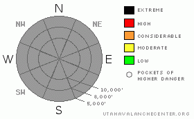
Danger Rose Tutorial
|
Just not much going on out there. Things are mostly stable. We'll wait upon our next set of storms.
UDOT will have Little Cottonwood Canyon closed tomorrow (Thursday) morning from 6:30-8:30 AM in order to sight in their artillery. Targets there on the north side of the canyon may run from Maybird Chute to Grizzly Gulch. They request that those looking to access that terrain wait until after the operation. Early birds may want to try terrain out of the White Pine parking lot or routes in Big Cottonwood Canyon. Thanks. |
|
|
CURRENT CONDITIONS |

|
Ah yes, the return to Indian Summer. Stable conditions in the atmosphere as well as the mountains. One only needs to get some elevation to see the velvet blanket of smog lapping at the mouths of the canyons. Those looking for numbers can find data from the instrumentation in the hills. Check here for a tabular format and here for a spatial display. Check here for our graphical display. Overnight lows have been in the mid to upper 30's above 10,000' and in the mid to upper 20's at 7000'. Winds are hardly a whisper. Settled snow sits at about 2' in shady upper Little Cottonwood and somewhat shy of that in Big Cottonwood and along the Park City Ridgeline. Sunny aspects are rock hard where not rocky, though softening somewhat in the heat of the day. Upper elevation northerlies are a mixed bag of recrystallized snow and wind damage. Rain/rime/melt freeze crusts abound. |
|
|
RECENT ACTIVITY |

|
No activity for a number of days, and even that was explosive-released in upper Little Cottonwood. |
|
|
THREAT #1 |
|
No problem identified.
|
| WHERE |
PROBABILITY |
SIZE |
TREND |

|
| No probability identified. |
|
|
|
|
|
Kobernik put together a nice gallery this afternoon. I'd agree that it's worth taking a look around to see what terrain holds snow and what may hold weakening, faceted snow. Don't let those warm temps fool you. The low sun angle, the clear skies and outgoing long wave radiation may be enough to square off and weaken some of the available surface snow on the shady side. Stay tuned. |
|
|
MOUNTAIN WEATHER |

|
A storm passing off to the north late Thursday will start to kick in a couple more clouds, stronger southwesterly winds and cooler weather. 10,000' temps will drop to the mid-20's by Friday. The southwesterly winds are likely to bump to 30mph or more by late Thursday. The front should be enough to push the blanket of smog out of the velleys. High pressure then builds for later in the weekend with what appears to be a major pattern change for next week. The weather models are not in great alignment currently, but they agree that a ridge will not be dominating the scene. |
|
|
GENERAL ANNOUNCEMENTS |
If you want to get this avalanche advisory e-mailed to you daily click HERE.
UDOT highway avalanche control work info can be found by calling (801) 975-4838.
Our statewide toll free line is 1-888-999-4019 (early morning, option 8).
The UAC depends on contributions from users like you to support our work. To find out more about how you can support our efforts to continue providing the avalanche forecasting and education that you expect please visitour Friends page.
If you’re getting out and see anything we should know about please let us know. You can leave a message at (801) 524-5304 or 1-800-662-4140, or email us at uac@utahavalanchecenter.org. (Fax 801-524-6301)
This advisory will only be updated as conditions change. |
|
|
This information does not apply to developed ski areas or highways where avalanche control is normally done. This advisory is from the U.S.D.A. Forest Service, which is solely responsible for its content. This advisory describes general avalanche conditions and local variations always occur. |
|
This advisory provided by the USDA Forest Service, in partnership with:
The Friends of the Utah Avalanche Center, Utah Division of State Parks and Recreation, Utah Division of Emergency Management, Salt Lake County, Salt Lake Unified Fire Authority and the friends of the La Sal Avalanche Center. See our Sponsors Page for a complete list. |
