BOTTOM LINE
Danger by aspect and elevation on slopes approaching 35° or steeper.
(click HERE for tomorrow's danger rating)
|
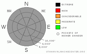
Danger Rose Tutorial
|
Be careful today about new snow instabilities, especially for recent wind slabs, which you can almost certainly find along the high elevation ridges. Many people assume that in the early season, there is just not enough snow to avalanche, which can be a dangerous mistake. Often the most dangerous conditions occur in the early season. Lucky for us, we don't seem to have much weak, suggary, faceted snow underlying this new snow with the exception of some of the steep, north through east facing slopes above about 10,000'. I would suspect you could find more sensitive snow in those areas but, like I say, we have not had the budget to get out yet to see for ourselves.
Probably the largest danger today will be hitting unseen rocks and stumps. Also, any ride you may take in an avalanche today will be especially hazardous because your will almost certainly hit rocks on the way down. The smart folks always wait until these first significant snowfall settles so you can more easily see the buried obstacles.
This is also a good time of year to make sure you have fresh batteries in your beacon, do a good beacon practice and make sure you have all the proper rescue equipment in your pack. |
|
|
CURRENT CONDITIONS |

|
Wow, winter has arrived along with a new President Elect. Our apologies for only intermittent updates this time of year. With significant budget cuts this season, our staff just barely came back to work and we are busy getting our new computers and web site up and running.
Brighton report a storm total of 32 inches with Alta around two feet and it's still snowing hard. Temperatures have dropped into the single digits to mid teens and the winds are moderate from the northwest.
|
|
|
RECENT ACTIVITY |

|
Lucky for us, the previous snow in this storm came in wetter and denser, so it helped to give us a good base and, in theory, it should help the more recent, drier snow, to bond. Because of our budget cuts, we still have not been able to get up in the mountains and the ski areas are not getting out yet for avalanche control. So we really don't have much information. |
|
|
MOUNTAIN WEATHER |

|
The National Weather Service is expecting continued heavy snow through the day with the possible accumulation of another 6-12 inches. Snow should taper off tonight.
The extended forecast calls for another storm for about Sunday and Monday. |
|
|
This information does not apply to developed ski areas or highways where avalanche control is normally done. This advisory is from the U.S.D.A. Forest Service, which is solely responsible for its content. This advisory describes general avalanche conditions and local variations always occur. |
|
This advisory provided by the USDA Forest Service, in partnership with:
The Friends of the Utah Avalanche Center, Utah Division of State Parks and Recreation, Utah Division of Emergency Management, Salt Lake County, Salt Lake Unified Fire Authority and the friends of the La Sal Avalanche Center. See our Sponsors Page for a complete list. |
