
In partnership with: Utah Division of State
Parks and Recreation, The Friends of the Utah Avalanche Center, Utah Department
of Emergency Services and Homeland Security and
AVALANCHE ADVISORY
Monday,
February 20, 2006 7:30am
Good morning, this is Bruce Tremper with
the
A long time fundraiser for the
Current Conditions:
The winter of 06 continues its march into the
history book of legendary winters.
Backcountry riding conditions are excellent, once again, with up to a
foot of cold, light powder on a mostly stable foundation. To be fair, there are some niggling
complaints about feeling the various crusts underneath but nothing that a month
in
Avalanche Conditions:
Although the snow remains mostly stable in
all areas, yesterday a couple skiers were able to pop out some relatively small
wind slabs on steep slopes about a foot deep and 30 feet wide. One was on Miller Hill, south of Snowbird on
a steep, shallow, rocky, north-facing slope.
There were two others that a skier was able to intentionally ski cut on
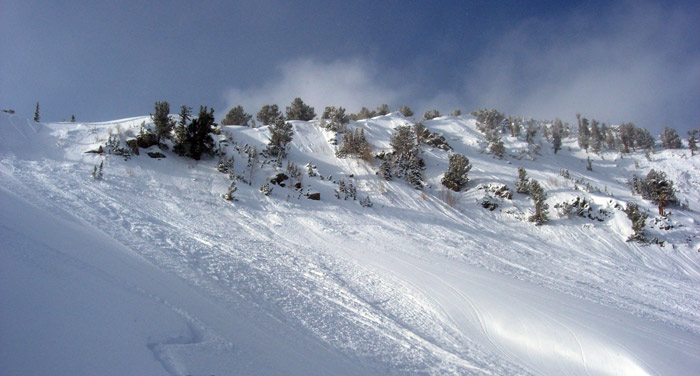
Bottom Line:
The avalanche danger is mostly LOW with pockets of MODERATE danger,
mostly on slopes steeper then 35 degrees with recent deposits of wind drifted
snow.
Mountain Weather:
We will
have very cold temperatures today, starting out around zero and rising to about
8 degrees on the ridge tops and into the mid teens down at 8,000’. Ridge top winds will remain fairly light,
around 10 mph from the west and northwest.
There’s a still lot of low level moisture with just enough westerly
winds to stack it up against the mountains.
This should produce very light snow showers and variable low-level
clouds through much of the day but you will also see the sun poke through quite
a bit as well, especially at higher elevations.
The
extended forecast calls for continued cold with light winds for the next couple
days and slowly warming by mid week. We
don’t see any significant snow for the next week or so.
Announcements:
Click here to check out our new online avalanche
encyclopedia.
Early birds and snow
geeks can catch our 6AM report at 364-1591.
Click HERE for a text only version of the avalanche advisory.
To
have this advisory automatically e-mailed to you each day, click HERE.
UDOT also has a highway avalanche control work
hotline for Big Cottonwood, Little Cottonwood, and
Wasatch
Powderbirds did not get out yesterday and if they can fly today, they will be
in American Fork, White Pine and the Sessions.
For more info, call 742-2800.
Please
report any backcountry snow and avalanche conditions. Call (801) 524-5304 or 1-800-662-4140, email [email protected] or fax 801-524-6301. The information in this advisory is from the
U.S. Forest Service, which is solely responsible for its content. This advisory describes general avalanche
conditions and local variations always occur.
Drew Hardesty will update this advisory by 7:30 Tuesday morning. Thanks for calling.