
In partnership with: Utah Division of State
Parks and Recreation, The Friends of the Utah Avalanche Center, Utah Department
of Emergency Services and Homeland Security and
AVALANCHE ADVISORY
Thursday, December 08, 2005 7:30am
Good morning,
this is Bruce Tremper with the
UDOT has a highway avalanche control work hotline
for Little Cottonwood road, which is updated as needed. 801-975-4838.
Up coming avalanche awareness talks by the UAC
staff include:
Dec 13 7 pm REI, 3285 E, 3300 S, SLC
Dec 14 6:30 pm Mtn.
High Motorsports, 8262 S Redwood Rd, West Jordan
Dec 14 7 pm South Valley Unitarian,
6876 S Highland Dr.
Current Conditions:
Yesterday was nearly cold enough to remind me of my native
Avalanche Conditions:
The new snow had
time to settle and the cold seemed to put the avalanches into the deep freeze
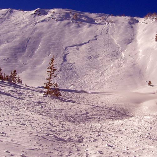
yesterday and we had no significant avalanches reported from the backcountry. Ski area explosive control work, however,
produced localized avalanches breaking deep into old, faceted snow near the
ground. One was triggered by a ski cut
in a steep, rocky, shallow area on the
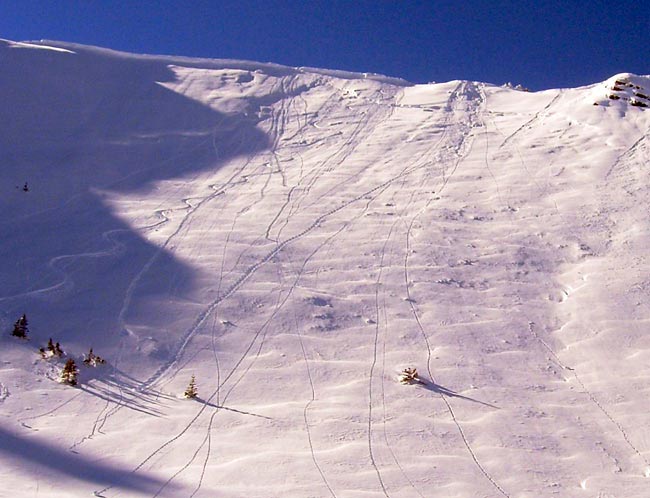
In addition today, you should watch for some
localized, lingering wind drifts http://www.avalanche.org/~uac/AdvisoryPhotos05-06/Seth-Roller-Superior-12-07-
and also, as temperatures warm up today, watch for a few localized damp sluffs
on steep, south facing slopes.
Bottom Line:
The avalanche
danger is MODERATE
on slopes steeper than 35 degrees with recent drifts of wind blown snow and
also MODERATE
danger on any slope approaching 35 degrees or steeper above 9,000’ that faces
the north half of the compass as well as east facing slopes, especially in
shallow snowpack areas. This means that
there are localized areas where you can still trigger and avalanche and some of
those avalanches may be large and deep.
Mountain Weather:
Ridge top
temperatures will continue to warm today into the lower 20’s—much more
reasonable than the -10 degree temperatures yesterday. Skies should be mostly clear with occasional
high clouds. Ridge top winds will
continue light from the southwest. Down
at 8,000’, temperatures should rise to a balmy 30 degrees today with an overnight
low near 20.
For the extended forecast, we don’t see any significant snow for at least the
next 10 days but we may get a few clouds after the weekend.
Seasonal Weather History Charts.
Please
report any backcountry snow and avalanche conditions you observe. We appreciate all information. You can call (801) 524-5304 or
1-800-662-4140, or email to [email protected]
or fax to 801-524-6301. The information
in this advisory is from the U.S. Forest Service, which is solely responsible
for its content. This advisory describes
general avalanche conditions and local variations always occur.
To
have this advisory automatically e-mailed to you each day, click HERE. (You must re-sign up this season even if you
were on the list last season.)
The annual report for 2004-05 is now on the web.
(Click HERE,
8mb)
We
will update this advisory by 7:30 Friday morning. Thanks for calling.