
In partnership with: Utah Division of State Parks
and Recreation, The Friends of the Utah Avalanche Center, Utah Department of
Emergency Services and Homeland Security and
AVALANCHE ADVISORY
Thursday, December 01, 2005 7:30am
Good morning,
this is Drew Hardesty with the
There will be
two showings of the new TGR film “Tangerine Dream” at Brewvies tonight night,
December 1st, at 7 and 9 pm. This is a
fundraiser for the UAC, sponsored by our partner, The Friends of the
Our staff
will be giving two free avalanche awareness talks tonight. One will be at the Sandy REI at 7 pm, the
other at Hanson Mountaineering in
Current Conditions:
The current storm moving through the Wasatch should pretty well ring the bell
of our snowpack over the next 24-36 hours and has all the red flags for a good
avalanche cycle. Most of the action will
occur with the warm front where we’ll have rising temperatures, heavy wet
snowfall, and strong southwesterly winds.
Mountain temperatures are about 15 degrees warmer than yesterday morning
and are in the upper teens to mid-twenties.
The winds are 25-30mph with gusts to 50 along the highest ridgelines,
and as of 5am, we’ve just seen the first couple of inches of a storm that is
likely to dump two feet or more in the high country by tomorrow afternoon.
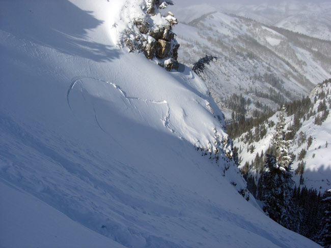
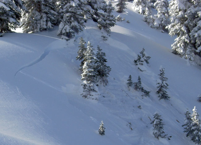
Avalanche Conditions:
While the skier
triggered avalanches in the central Wasatch were spotty
and pockety
at best, the
It’s clear that in the absence of a knock-out blow,
the weak basal snowpack has slowly been able to adjust to added weight over the
past week. With this forecasted storm, I
feel sure that the current teeter-totter holding pattern chapter will come to a
close. The danger
will rapidly rise by this afternoon and overnight and we are likely to see our
first major natural avalanche cycle of the year. With increasing snowfall and strong winds, backcountry
travelers should watch for avalanches to become more sensitive and widespread. Remain alert to the collapsing of the snow on
the weak basal snow, and move through suspect terrain one-at-a-time, if at
all.
Bottom Line:
The avalanche
danger is MODERATE
this morning and will rise to CONSIDERABLE with today’s expected snow
and winds. This danger rating most
applies to freshly wind drifted slopes and northwest through north through
easterly aspects at the mid and upper elevations. As they will be favored by this type of
storm, the
Mountain Weather:
Areas favored by a
southwest flow may see up to and over 2’ of snow by tomorrow afternoon. Rain/snow lines are expected to hover around
7500’. Mountain temps will be in the
upper twenties at 10,000’ and near freezing at 8000’. Ridgetop winds will increase to 40-50mph out
of the southwest through tomorrow morning.
A cold front follows for noon tomorrow, producing more snowfall and plunging
temps again to the low teens and single digits.
The next storm moves through on Saturday.
Seasonal Weather History Charts. (NOTE: USE INTERNET EXPLORER FOR BEST VIEWING)
Please
report any backcountry snow and avalanche conditions you observe. We appreciate all information. You can call (801) 524-5304 or
1-800-662-4140, or email to [email protected]
or fax to 801-524-6301. The information
in this advisory is from the U.S. Forest Service, which is solely responsible
for its content. This advisory describes
general avalanche conditions and local variations always occur.
To
have this advisory automatically e-mailed to you each day, click HERE. (You must re-sign up this season even if you
were on the list last season.)
The annual report for 2004-05 is now on the web.
(Click HERE,
8mb)
We
will update this advisory Friday morning.
Thanks for calling.