
In partnership with: Utah Division of State
Parks and Recreation, The Friends of the Utah Avalanche Center, Utah Department
of Emergency Services and Homeland Security and
AVALANCHE ADVISORY
Tuesday, November 29, 2005 7:00am
Good morning,
this is Brett Kobernik with the
There will be two showings of the new TGR film
“Tangerine Dream” at Brewvies Thursday, December 1, at 7 and 9 pm. This is a fundraiser for the UAC, sponsored
by our partner, The Friends of the
This week our staff will be
giving three free avalanche awareness talks. The first is Tuesday, November 29th
at the Salt Lake REI. The second is
Thursday, December 1st at the Sandy REI. Both are at 7pm. The third is at Hanson Mountaineering in
For a quick glance at avalanche classes in the
Current Conditions:
Mountain temperatures climbed into the teens overnight. Ridgetop winds also increased a bit are
averaging 15 to 20 mph with gusts to 35 at the highest locations.
Avalanche Conditions:
Observations from
Monday were pretty mundane with most people finding light density snow on the
surface and weak faceted snow under the Thanksgiving storm layer. No avalanching was reported however one group
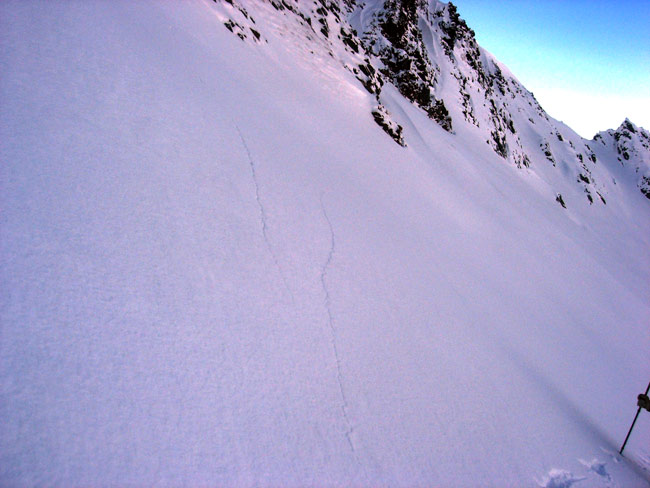
in Cardiac Bowl experienced a significant collapse of the snowpack which sent shooting
cracks out to cover an area about 60 feet wide. Cardiac bowl is in the highest area of Mill D
South in
We will also need to pay attention to the upcoming
interface between the new snow and the old snow as there is plenty of loose
light density snow on the current surface to act as a weak layer.
Take a look at the current SNOW
PROFILE. The snowpack may look like this
by tomorrow.
Hand pits and shovel tilt tests are good for revealing
instabilities at the new snow/old snow interface while cracking and collapsing are a sure sign that the deeper buried facets are failing.
Bottom Line:
An isolated MODERATE danger
remains this morning on northerly upper elevation slopes steeper then 35
degrees that were wind effected from the last storm. Most other slopes have a LOW danger.
Mountain Weather:
For today we
should see scattered snow showers.
Ridgetop temperatures will be in the low 20s and ridgetop winds will be
from the west southwest at around 15 mph.
Snow should start falling in earnest late this afternoon with wind
speeds increasing. Cold air moves in
late tonight while winds shift to the west northwest and will be in the 25 to
30 mph range. Up to a foot of snow is
expected by Wednesday morning.
Light snow showers should continue through Wednesday with a couple of
additional inches possible. Ridgetop
temperatures will be in the teens and blustery ridgetop winds will be from the west
in the 20mph range.
The rest of the week looks unsettled with a few more chances for snow.
Seasonal Weather History Charts. (NOTE: USE INTERNET EXPLORER FOR BEST VIEWING)
Please
report any backcountry snow and avalanche conditions you observe. We need all the information we can get. You can call (801) 524-5304 or 1-800-662-4140,
or email to [email protected] or fax to
801-524-6301. The information in this
advisory is from the U.S. Forest Service, which is solely responsible for its
content. This advisory describes general
avalanche conditions and local variations always occur.
To
have this advisory automatically e-mailed to you each day, click HERE. (You must re-sign up this season even if you
were on the list last season.)
The annual report for 2004-05 is now on the web.
(Click HERE,
8mb)
Evelyn
Lees will update this advisory Tuesday morning.
Thanks for calling.