
In partnership with: Utah Division of State
Parks and Recreation, The Friends of the Utah Avalanche Center, Utah Department
of Emergency Services and Homeland Security and
AVALANCHE BULLETIN
Sunday, November 27, 2005 5pm
Good morning,
this is
There will be two showings of the new TGR film
“Tangerine Dream” at Brewvies Thursday, December 1, at 7 and 9 pm. This is a fundraiser for the UAC, sponsored
by our partner, The Friends of the
Next week our staff will be giving two free
avalanche awareness talks. The first is
Tuesday, November 29th at the Salt Lake REI. The second is Thursday, December 1st
at the Sandy REI. Both are at 7pm. These talks are great for all ages and all
types of recreation.
For a quick glance at avalanche classes in the
Current Conditions:
Snow continued overnight with a few lake effect snow bands drifting into the
Avalanche Conditions:
At least on the
north facing slopes, it’s what I call a “foof on top
of foof” situation.
SNOW
PROFILE In other words, the old snow
surface on the shady slopes is nothing but deep, weak, sugary faceted
snow. And now we have new, soft, foofy snow on top of old, deep foofy
snow. Normally, when we get a couple
feet of new snow on top of all this weak, faceted snow we have much more
avalanche activity, but in this case, the new snow is not creating much of a
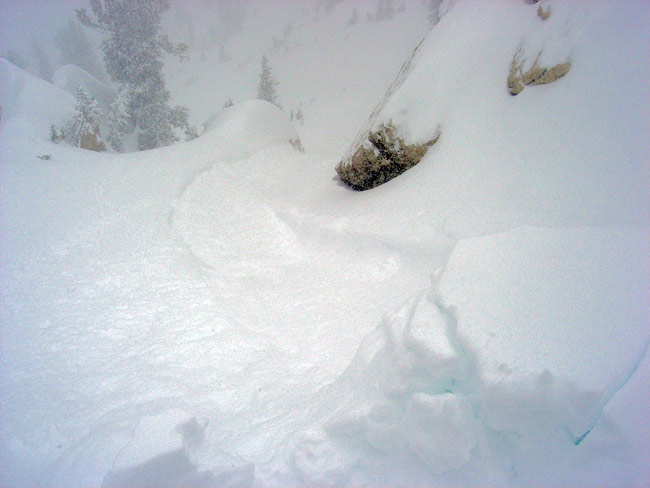
slab except in wind drifted areas. PHOTO.
So today you will need to watch out
for two kinds of avalanche problems:
First, the northwest winds created localized, soft wind slabs mostly along the
upper elevation ridges, and as always, you should avoid all slopes steeper than
35 degrees with recent wind deposits.
Second, very weak facted snow underlies all
the new snow on all slopes that face the north and east quadrants of the
compass above about 9,000’, especially in wind sheltered areas. So you should avoid slopes approaching 35
degrees and steeper on shady slopes.
Yesterday one skier was able to trigger a soft slab on a 33 degree,
north facing slope but it was not steep enough to slide. The avalanche danger will likely rise later
in the week when warmer, denser snow creates more of a slab on top of all of
our very weak buried layers.
Finally, watch out for lots of buried rocks and stumps under the light density
new snow, especially on slopes that face the south half of the compass.
Bottom Line:
The avalanche
danger will remain MODERATE
on any slope steeper than 35 degrees with recent wind deposits and also MODERATE on any slope
facing the northwest, north through east above 9,000’ approaching 35 degrees or
steeper. If heavy snow continues to fall
through the day, the danger will likely rise to Considerable.
Mountain Weather:
Cold, unstable airmass continues to dominate the
weather of northern
Temperatures today will remain mighty chilly. 8,000’ temperatures will hover around 10
degrees with zero overnight. 10,000’
temperatures are near zero this morning and will rise to around 5 degrees today
and be zero again tonight. Ridge top winds
should remain around 15 mph from the north-northwest this morning and turn northwest
later in the morning
Extended
Forecast:
We are in a snowy pattern for the next week. We have a bit of a break in the action tonight and Monday morning, but clouds should return again Monday night with snow on a southwesterly flow starting Tuesday morning through Wednesday morning and another pulse Thursday through Saturday. Temperatures for the next storms are much warmer—20-25 degrees—which should put heavier, denser snow on top of our very light snow.
Seasonal
Weather History Charts. (NOTE: USE INTERNET EXPLORER FOR BEST VIEWING)
Please
report any backcountry snow and avalanche conditions you observe. We need all the information we can get. You can call (801) 524-5304 or
1-800-662-4140, or email to [email protected]
or fax to 801-524-6301. The information
in this advisory is from the U.S. Forest Service, which is solely responsible
for its content. This advisory describes
general avalanche conditions and local variations always occur.
To
have this advisory automatically e-mailed to you each day, click HERE. (You must re-sign up this season even if you
were on the list last season.)
The annual report for 2004-05 is now on the web.
(Click HERE,
8mb)
Drew
Hardesty will update this advisory Monday morning. Thanks for calling.