
In partnership with:
The
Friends of the Utah Avalanche Center Home page is: http://www.utahavalanchecenter.com
Please click here and
fill out our user’s survey
Avalanche Information
Saturday, April 30,
2005 8 pm
Good evening, this is Drew Hardesty with the
Current Conditions:
Another inch or two fell Friday night above 8000’ with little more than a few
flurries during the day today. At least
in the
Avalanche
Information:
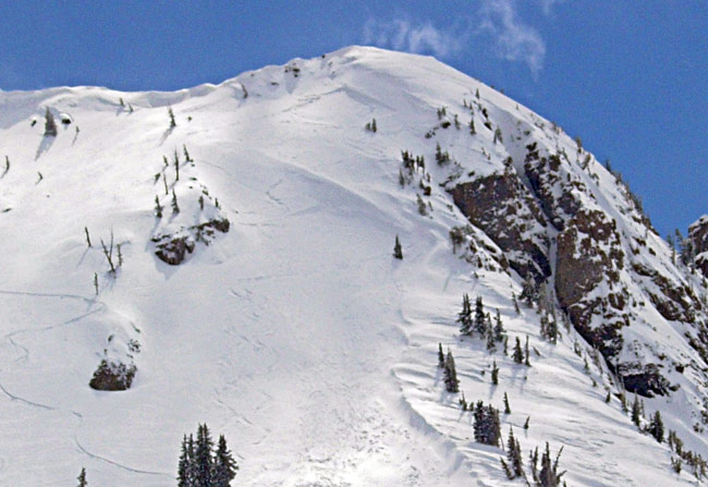
It’s a good news/bad news sort of thing. The relatively warm temperatures and a
day of settlement in the high density snow helped to seal off the wind drift problems
from yesterday, but today’s stronger northwesterly winds created some new isolated
wind drifts in exposed upper elevation terrain.
It’s likely that most of these will have settled out by Sunday, but if
you’re touring in the higher elevations, keep an eye out for these new drifts
and take some precautions in determining how well they’re glued in. Often if you don’t like the weather in
spring, wait five minutes. If and when the
sun is finally able to poke through, the danger of wet sluffs and slabs will
rise dramatically on the sun-exposed slopes.
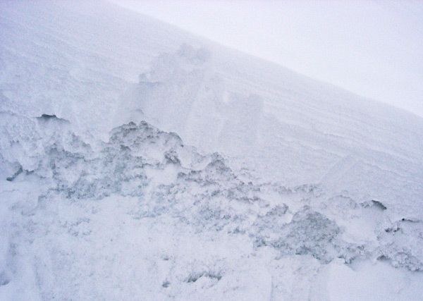
Of
significant interest is the recent activity pulling out into damp,
unconsolidated melt-freeze grains 10-30” beneath the recent dry snow. This type of layering can be found at most elevations
and on all aspects but true north. These
unconsolidated grains, capped by a crust of varying thickness, failed to lock
up due to poor refreezes and are now insulated by the new snow. At
least three slides have pulled out into this layering in the last three days,
triggered either by another avalanche from above (East Castle at
Alta – northeast
aspect at 10,700’) or from possibly increased warming (below
Kessler Peak in Cardiff Fork southeast aspects at around 9500’). These types of avalanches will be more
pronounced with a spike in temperature and solar radiation and may still be
triggered by other slides coming down from above.
Mountain Weather:
We’ll have continued showers tonight and tomorrow with accumulations of a trace
to three inches by the afternoon. Winds
will be light and easterly tonight and tomorrow. Ridgetop temps will be in the mid-twenties
tonight and tomorrow with 8000’ highs in the low to mid-thirties. The mid-range outlook keeps us in a cool
unsettled pattern for the next week or so.
We might get a bit of a break mid-week with a weak storm lined up for
the weekend.
Since we are operating on a reduced staff and there’s not much
information coming in this time of year, we won’t issue any avalanche danger
ratings.
Finally, remember that with the exception of Snowbird, all the ski resorts are
closed for the season and they are not doing any avalanche control. So you need to treat them like the
backcountry and follow the usual safe-travel ritual, like one-at-a-time, don’t
travel above other people and get out of the way at the bottom.
If you run across anything we should know
about, please call and leave a message at 524-5304 or 1-800-662-4140, or e-mail
us at [email protected]. Fax is 524-6301.
The information in this
advisory is from the U.S. Forest Service, which is solely responsible for its
content. This advisory describes general avalanche conditions and local
variations always occur.
Thanks for calling.