
In partnership with:
The
Friends of the Utah Avalanche Center Home page is: http://www.utahavalanchecenter.com
To receive automated e-mails of
this advisory click HERE.
Avalanche advisory
Friday, March 25, 2005
Good morning, this is
In
Weekend Warrior Update:
This past week we have
been hit with our fifth large snowstorm of the winter with up to 70 inches of
new snow and nearly 7 inches of water weight since last Saturday. The new snow fell on top of a very hard,
solid base, so most of the avalanches have been running on the old snow surface
or as soft slabs or wind slabs within the new snow. Before the storm, there was some weak faceted
snow on the steep, north facing, wind sheltered slopes, and people have experienced
collapses on these slopes and occasional slides breaking on this layer. Heads up for the weekend: we expect dramatic warming with sun and we
should have a rapidly rising danger of wet avalanches this weekend.
Current Conditions:
Overnight, almost no snow fell because the ridge top winds are too weak to push
the moist air up the mountains.
Yesterday about five inches fell during the day. Ridge top winds are very light from the south
with ridge top temperatures in the mid teens. The powder is good, but a bit dense above
9,500’ but it’s pretty manky
at lower elevations and there is a thin sun crust on sun exposed slopes.
Avalanche Conditions:
Yesterday there was a couple close calls.
In a very active avalanche day in the
Without any snow or wind overnight, I suspect that many of the instabilities
within the new snow will have settled out but there has been a huge amount of
weight added to the snowpack this past week and I just don’t trust the deeper
weak layers, especially on north facing slopes.
Also, the winds should pick up from the northwest this afternoon with
perhaps another 6 inches of snow and more tonight, so it will probably keep
things interesting. When you are out
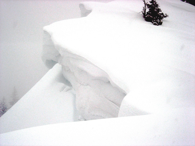
today, be sure to jump on test slopes, kick cornices (See
photos of a cornice kicking lesson) and dig down with your hand to see how
well the new snow is bonded to underlying layers. Also, continue to follow all your safe travel
practices like one at a time and doing slope cuts.
Heads up for the weekend: We should have a
strong warming with sun this weekend and this will almost certainly create
widespread areas of wet avalanches with dramatically
rising avalanche danger. This
weekend, you definitely need to stay off of and out from underneath steep
slopes, especially when they get wet and soggy.
Bottom Line
(Salt Lake and Park City, Ogden and Provo mountains)
The
avalanche danger remains CONSIDERABLE on slopes approaching 35 degrees
or steeper, especially with recent deposits of wind drifted snow, especially
those shady slopes facing northwest through east. Other steep slopes have a MODERATE danger. Any steep slope receiving direct sun today the
danger will rise to CONSIDERABLE.
This weekend, the avalanche danger will likely rise to HIGH.
Danger Scale: http://www.avalanche.org/~uac/ed-scale.htm
Mountain Weather: (You can find the afternoon
Weather Update here.)
Moist air should keep clouds around the mountains today and ridge top winds
should pick up by afternoon from the northwest, which should give us 6 inches
of snow this afternoon and tonight. At
8,000’ it should get into the upper 20’s.
Ridge top temperatures will cool to around 10 degrees by Saturday
morning. On Saturday ridge top
temperatures will rapidly rise from 10 degrees in the morning to near freezing
by Sunday. Combined with clear skies and
sunshine, it will create widespread wet avalanche activity. On Sunday and Monday, temperatures will
continue to rise with some high clouds.
Then we will have yet another snow storm Monday night through about
Thursday.
The
Powderbird guides did not get out yesterday, and probably will not get out
today, but if they do will be in
If you are getting out, we
appreciate your snowpack and avalanche observations. Please call and leave a message at 524-5304
or 1-800-662-4140, or e-mail us at [email protected]. Fax is 524-6301.
The information in this
advisory is from the U.S. Forest Service, which is solely responsible for its
content. This advisory describes general avalanche conditions and local
variations always occur.
Brett Kobernik will update our
early morning avalanche activity report by around 5:30 am on Saturday morning
at 364-1591, and this advisory by 7:30.
Thanks for calling.