
In partnership with:
The
NEW AND IMPROVED Friends of the Utah Avalanche
Center Home page is: http://www.utahavalanchecenter.com
To receive automated e-mails
of this advisory click HERE.
Avalanche advisory
Friday, February 18,
2005
Good morning, this is Brett Kobernik with the
The Friends of
the
Current Conditions:
Thin clouds are over the mountains and temperatures are in the mid 20’s along
the ridges. Ridgetop winds are from the
south at less then 10 mph at most stations.
Avalanche Conditions:
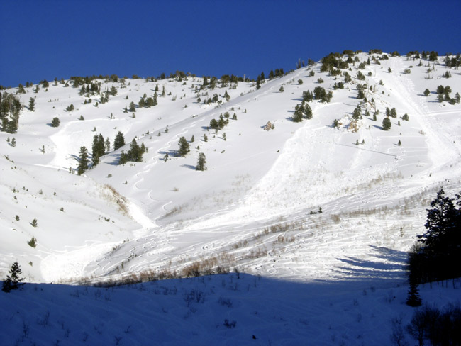
Yesterday was the most active day out
of the last week for human triggered avalanches. There were also some results from helicopter test explosives as well. Areas that had activity included Gobblers
Knob, Butler
Fork, Days
Fork, Silver
Fork, and possibly Dutches Draw but this avalanche
may have been triggered on Wednesday.
Some of the avalanches were triggered from a distance or otherwise known
as “remotely triggered”. Most of these
ran on a weak layer of faceted snow that formed in late January. For more details on these call 364 1591.
It’s apparent that we have a
slab sitting on a persistent weak layer of facets. There is a crust associated with this weak
layer in some areas as well. The
weakness varies from place to place making hazard evaluation “tricky” as one of
our observers puts it. This is a perfect
“booby trap” type snowpack as you will find mostly stable snow in many areas,
then, just around the corner you may trigger a slab avalanche. The weakness is buried deep enough to make
the size of these avalanches quite dangerous.
With snow and wind in the
forecast, the danger will rise over the next few days and I’m sure we haven’t
seen the last of our current weak layer, however “spotty” it may be. On the other hand, this weakness just may not
have received enough weight from the last few storms to become a widespread
problem. Time will tell but one thing is
for sure, we do have weakness within the snowpack.
Bottom Line (
The
avalanche danger remains MODERATE on slopes
steeper than about 35 degrees, with both loose sluff and slab avalanches
possible. In my opinion, this type of
moderate danger makes for some of the most difficult hazard evaluation. These are conditions that often catch even
the most experienced backcountry travelers.
Mountain Weather:
Cloud cover will
increase with a slight chance snow during the day. Temperatures will be near 35 degrees at 8000
feet and in the mid 20’s at 10,000’.
Winds will be around 10 mph from the south.
Late this afternoon is when we should see more significant snowfall start. Accumulations of 4-8” are possible by
Saturday morning. Strong winds are
forecasted on Saturday with more snow expected during the day.
Yesterday, Wasatch Powderbirds were in
Mineral,
Thanks again to everyone who
is sending in observations! This
advisory is for you and it’s great to hear from people who use it. Please keep calling us at 524-5304 or
1-800-662-4140, or e-mailing us at [email protected]. Fax is 524-6301.
The information in this
advisory is from the U.S. Forest Service, which is solely responsible for its
content. This advisory describes general avalanche conditions and local
variations always occur.
Drew Hardesty will update this
advisory by 7:30 on Saturday morning.
Thanks for calling.
For an explanation of avalanche danger ratings:
http://www.avalanche.org/~uac/ed-scale.htm