25th Annual Black Diamond Fall Fundraising Party
Thursday, September 13; 6:00-10:00 PM; Black Diamond Parking Lot

25th Annual Black Diamond Fall Fundraising Party
Thursday, September 13; 6:00-10:00 PM; Black Diamond Parking Lot
| Advisory: Provo Area Mountains | Issued by Drew Hardesty for Wednesday - April 11, 2018 - 7:14am |
|---|
 |
special announcement The last regular early morning forecast will be Sunday, April 17th. We will issue updates for the Salt Lake zone with every snowfall through the rest of April. The Wilderness Medicine Program at the University of Utah is surveying the knowledge of both regular and occasional backcountry users. Please provide your input through this survey. https://www.surveymonkey.com/r/AvalancheSafetySkillsSurvey |
 |
current conditions Skies are mostly cloudy trending clear. Winds are generally light now from the northwest. Mountain temperatures are in the upper 30s to mid 40s. Sadly, the trails heads in the Provo area mountains melted out long ago. It was a tough winter for low elevations snow. Icy, slide for life conditions exist on many steep slopes at the mid and upper elevations. |
 |
recent activity Mark Staples and Mark White joined Woody from UDOT and headed down to Timp on Monday and provided some much needed new information. Check out their full observation HERE. Recent activity noted:
|
| type | aspect/elevation | characteristics |
|---|


|


|

LIKELIHOOD
 LIKELY
UNLIKELY
SIZE
 LARGE
SMALL
TREND
 INCREASING DANGER
SAME
DECREASING DANGER
|
|
description
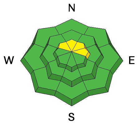
Remember that Risk is inherent in mountain travel. Wet Loose sluffs. With direct sun and warming temperatures, the surface snow will soften and move with provocation on all aspects at the mid and upper elevations. We call these 'push-a-lanches' for obvious reasons as one can scrape and push these damp pieces of snow in steeper terrain. |
| type | aspect/elevation | characteristics |
|---|


|


|

LIKELIHOOD
 LIKELY
UNLIKELY
SIZE
 LARGE
SMALL
TREND
 INCREASING DANGER
SAME
DECREASING DANGER
|
|
description
Wet slabs occurred during the rain on Saturday. The issue and the weak layers near the ground in the Provo area mountains are not gone, rather they are moslty dormant - hidden beneath a strong frozen crust. Avalanching on these deeper weak layers is unlikely. However, if you are finding wet snow beneath the crusts or as the day heats and the crusts are getting punchy, avoid steep slopes. Danger for this problem would be above 9500 at upper elevations mainly on northerlies. Wind slabs: there may be a few wind drifts along the highest ridge lines near the summits of the peaks. Cornices are increasingly sensitive with direct sun and warming temperatues. Avoid being on or beneath them. |
 |
weather Skies are mostly-trending partly cloudy with now west to northwesterly winds blowing 10-15mph. Mountain temps will rise to the low 50s at the mid-elevations and near 40 at 10,000'. We'll have just a window of fair weather before we see increasing southwest winds and high level clouds racing ahead of tomorrow's cold Pacific storm. Frontal passage looks to be during the morning commute and orographically favored areas by a northwest flow may see 4-8" by Friday. Moderate to strong post-frontal north to northwest winds are expected at this time. High pressure builds for the weekend with another storm on tap for Monday. |
| general announcements CLICK HERE FOR MORE GENERAL INFO AND FAQ The UAC has new support programs with Outdoor Research and Darn Tough. Support the UAC through your daily shopping. When you shop at Smith's, or online at Outdoor Research, REI, Backcountry.com, Darn Tough, Patagonia, NRS, Amazon, eBay a portion of your purchase will be donated to the FUAC. See our Donate Page for more details on how you can support the UAC when you shop. Benefit the Utah Avalanche Center when you buy or sell on eBay - set the Utah Avalanche Center as a favorite non-profit in your eBay account here and click on eBay gives when you buy or sell. You can choose to have your seller fees donated to the UAC, which doesn't cost you a penny This information does not apply to developed ski areas or highways where avalanche control is normally done. This advisory is from the U.S.D.A. Forest Service, which is solely responsible for its content. This advisory describes general avalanche conditions and local variations always occur. |