25th Annual Black Diamond Fall Fundraising Party
Thursday, September 13; 6:00-10:00 PM; Black Diamond Parking Lot

25th Annual Black Diamond Fall Fundraising Party
Thursday, September 13; 6:00-10:00 PM; Black Diamond Parking Lot
| Advisory: Provo Area Mountains | Issued by Drew Hardesty for Wednesday - March 21, 2018 - 7:31am |
|---|
 |
special announcement We have lift tickets for Snowbasin, Snowbird, Solitude, and Powder Mountain remaining. The tickets are discounted an additional 20%. Details and order information here. All proceeds from these go towards paying for avalanche forecasting and education! The UAC Marketplace is still open. Our online marketplace still has deals on skis, packs, airbag packs, beacons, snowshoes, soft goods and much more. |
 |
current conditions Warm and windy before the storm. Hint: grab the Gore-Tex - no, make that PVC - and fish around in the garage for the XTra Tuffs or ditch boots... Skies are overcast and we'll see some light rain transitioning to snow in the mid-elevations. Mountain temperatures are already in the mid to upper 30s as warm air aloft has kept ridgeline temps nearly on par with yesterday's highs. The winds backed to the southwest and south overnight and are 20-25mph with gusts to 40. Sun, warm temps, and wind have taken their toll on the snow surface conditions and - sad to say - things are gonna get worse before they get better. See Mtn Weather below. |
 |
recent activity
This is a stunning natural avalanche on Timpanogos photographed by the talented photographer and skier Matt Turley (report).With good visibility, it can be viewed from the Heber Valley. It's conjectured to have been triggered Monday by a large natural cornice fall that pried out the deep slab avalanche to the ground, which, in turn, pulled out other avalanches into old snow as it barrelled nearly 3000' down the Giant Staircase toward Timpooneke (or north side of the mountain). |
| type | aspect/elevation | characteristics |
|---|


|


|

LIKELIHOOD
 LIKELY
UNLIKELY
SIZE
 LARGE
SMALL
TREND
 INCREASING DANGER
SAME
DECREASING DANGER
|
|
description
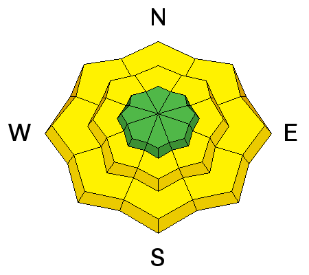
It is still possible to trigger a deep avalanche breaking on a mid-pack or basal facet layer to the ground. Suspect areas include slopes that have avalanched one or more times this year and steep, complex, rocky terrain with sharp break overs. These may be pried out with any heavy loading events: explosives, large cornices, other avalanches cascading down from above, or significant wind and/or precipitation events. Rapid warming and intense direct solar radiation are known secondary contributors as well. |
| type | aspect/elevation | characteristics |
|---|


|


|

LIKELIHOOD
 LIKELY
UNLIKELY
SIZE
 LARGE
SMALL
TREND
 INCREASING DANGER
SAME
DECREASING DANGER
|
|
description
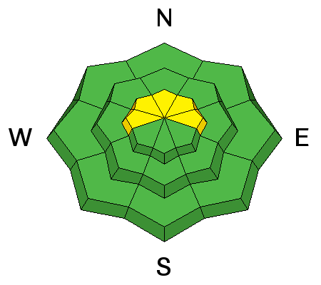
Wet loose sluffs in the low to mid-elevations, particularly in damp and soggy northerly terrain. Take care to avoid being in or above terrain traps such as creekbeds and in steep-walled gullies over the next several days. |
| type | aspect/elevation | characteristics |
|---|


|


|

LIKELIHOOD
 LIKELY
UNLIKELY
SIZE
 LARGE
SMALL
TREND
 INCREASING DANGER
SAME
DECREASING DANGER
|
|
description
Wind drifts will start to develop today along the ridgelines and become more widespread and developed over the next 24-48 hours. Drifts will be more prevalent on the west to north to east sides of the compass and should respond well to ski cuts and cornice drops. |
 |
weather We'll see an initial and perhaps secondary wave of light snow and rain today though it's just a hint of things to come. Sky cover will oscillate from overcast to mostly cloudy with mountain temperatures rising to the upper 20s to low 30s along the higher ridgelines. Mid-elevation temps will rise to the mid-40s. The models, I think, are underdone with their projection of the southerly winds for today and I expect to see winds approaching 25-30mph by the early afternoon. In any event, we're looking at a warm, wet, and windy event over the next couple of days. Ferocious well describes the southwesterlies tonight, tomorrow, and into early Friday morning. Guidance suggests gusts to 80-90 mph+ along the highest peaks. Heaviest precipitation later Thursday into Friday morning. A rain/snowline of 9-9500' seems (un)reasonable to start before lowering to 6000' or so Friday morning. Some uncertainty with these sub-trop moisture taps, but 1-1.5" snow-water-equivalent seems fair if not underdone. Stay tuned. |
| general announcements CLICK HERE FOR MORE GENERAL INFO AND FAQ The UAC has new support programs with Outdoor Research and Darn Tough. Support the UAC through your daily shopping. When you shop at Smith's, or online at Outdoor Research, REI, Backcountry.com, Darn Tough, Patagonia, NRS, Amazon, eBay a portion of your purchase will be donated to the FUAC. See our Donate Page for more details on how you can support the UAC when you shop. Benefit the Utah Avalanche Center when you buy or sell on eBay - set the Utah Avalanche Center as a favorite non-profit in your eBay account here and click on eBay gives when you buy or sell. You can choose to have your seller fees donated to the UAC, which doesn't cost you a penny This information does not apply to developed ski areas or highways where avalanche control is normally done. This advisory is from the U.S.D.A. Forest Service, which is solely responsible for its content. This advisory describes general avalanche conditions and local variations always occur. |